Holly Springs, Georgia
| Holly Springs, Georgia | |
|---|---|
| City | |
|
Holly Springs train depot | |
 Location in Cherokee County and the state of Georgia | |
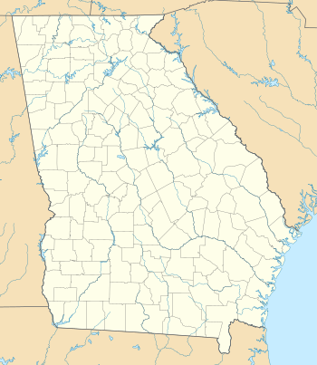 Holly Springs, Georgia  Holly Springs, Georgia  Holly Springs, Georgia Location in Cherokee County and the state of Georgia | |
| Coordinates: 34°9′59″N 84°30′4″W / 34.16639°N 84.50111°WCoordinates: 34°9′59″N 84°30′4″W / 34.16639°N 84.50111°W | |
| Country | United States |
| State | Georgia |
| County | Cherokee |
| Area | |
| • Total | 6.7 sq mi (17.3 km2) |
| • Land | 6.6 sq mi (17.0 km2) |
| • Water | 0.1 sq mi (0.3 km2) |
| Elevation | 1,109 ft (338 m) |
| Population (2010) | |
| • Total | 9,189 |
| • Density | 1,399/sq mi (540.1/km2) |
| Time zone | Eastern (EST) (UTC-5) |
| • Summer (DST) | EDT (UTC-4) |
| ZIP code | 30142 |
| Area code(s) | 770/678/470 |
| FIPS code | 13-39524[1] |
| GNIS feature ID | 0315567[2] |
| Website |
www |

Holly Springs is a city in Cherokee County, Georgia, United States. The population was 9,189 as of the 2010 census,[3] up from 3,195 at the 2000 census.
Geography
Holly Springs is located south of the center of Cherokee County at 34°9′59″N 84°30′4″W / 34.16639°N 84.50111°W (34.166478, -84.501016).[4] It is bordered by Canton, the county seat, to the north, and by Woodstock to the south. Interstate 575 passes through the city, with access from exits 11 and 14. Downtown Atlanta is 36 miles (58 km) to the south.
According to the United States Census Bureau, Holly Springs has a total area of 6.7 square miles (17.3 km2), of which 6.6 square miles (17.0 km2) is land and 0.12 square miles (0.3 km2), or 1.57%, is water.[3]
Neighboring unincorporated communities
- Hickory Flat (east)
- Toonigh (southeast)
- Lebanon (south)
- Sixes (west) - home to Fort Sixes, an 1830s Indian removal fort
Demographics
| Historical population | |||
|---|---|---|---|
| Census | Pop. | %± | |
| 1910 | 251 | — | |
| 1920 | 216 | −13.9% | |
| 1930 | 273 | 26.4% | |
| 1940 | 256 | −6.2% | |
| 1950 | 386 | 50.8% | |
| 1960 | 475 | 23.1% | |
| 1970 | 575 | 21.1% | |
| 1980 | 687 | 19.5% | |
| 1990 | 2,406 | 250.2% | |
| 2000 | 3,195 | 32.8% | |
| 2010 | 9,189 | 187.6% | |
| Est. 2015 | 10,719 | [5] | 16.7% |
As of the census[1] of 2000, there were 3,195 people, 1,136 households, and 892 families residing in the city. The population density was 1,008.5 people per square mile (389.1/km²). There were 1,173 housing units at an average density of 370.3 per square mile (142.9/km²). The racial makeup of the city was 94.80% White, 1.16% African American, 0.66% Native American, 0.75% Asian, 0.03% Pacific Islander, 1.44% from other races, and 1.16% from two or more races. Hispanic or Latino of any race were 4.82% of the population.
There were 1,136 households out of which 45.6% had children under the age of 18 living with them, 66.9% were married couples living together, 7.7% had a female householder with no husband present, and 21.4% were non-families. 16.3% of all households were made up of individuals and 3.3% had someone living alone who was 65 years of age or older. The average household size was 2.81 and the average family size was 2.16.
In the city the population was spread out with 30.1% under the age of 18, 7.3% from 18 to 24, 40.8% from 25 to 44, 16.7% from 45 to 64, and 5.0% who were 65 years of age or older. The median age was 31 years. For every 100 females there were 103.1 males. For every 100 females age 18 and over, there were 111.2 males.
The median income for a household in the city was $57,019, and the median income for a family was $61,651. Males had a median income of $40,717 versus $26,823 for females. The per capita income for the city was $22,992. About 0.8% of families and 1.3% of the population were below the poverty line, including 1.6% of those under age 18 and none of those age 65 or over.
References
- 1 2 "American FactFinder". United States Census Bureau. Retrieved 2008-01-31.
- ↑ "US Board on Geographic Names". United States Geological Survey. 2007-10-25. Retrieved 2008-01-31.
- 1 2 "Geographic Identifiers: 2010 Demographic Profile Data (G001): Holly Springs city, Georgia". U.S. Census Bureau, American Factfinder. Retrieved July 24, 2014.
- ↑ "US Gazetteer files: 2010, 2000, and 1990". United States Census Bureau. 2011-02-12. Retrieved 2011-04-23.
- ↑ "Annual Estimates of the Resident Population for Incorporated Places: April 1, 2010 to July 1, 2015". Retrieved July 2, 2016.
- ↑ "Census of Population and Housing". Census.gov. Retrieved June 4, 2015.
External links
Municipalities and communities of Cherokee County, Georgia, United States | ||
|---|---|---|
| Cities |  | |
| Unincorporated communities | ||
| Footnotes | ‡This populated place also has portions in an adjacent county or counties | |