Hodge, Louisiana
| Village of Hodge | |
| Village | |
 Hodge welcome sign | |
| Country | United States |
|---|---|
| State | Louisiana |
| Parish | Jackson |
| Elevation | 190 ft (57.9 m) |
| Coordinates | 32°16′19″N 92°43′36″W / 32.27194°N 92.72667°WCoordinates: 32°16′19″N 92°43′36″W / 32.27194°N 92.72667°W |
| Area | 1.4 sq mi (3.6 km2) |
| - land | 1.0 sq mi (3 km2) |
| - water | 0.4 sq mi (1 km2), 28.57% |
| Population | 492 (2000) |
| Density | 513.6/sq mi (198.3/km2) |
| Timezone | CST (UTC-6) |
| - summer (DST) | CDT (UTC-5) |
| Area code | 318 |
 Location of Hodge in Louisiana | |
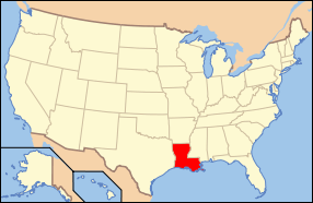 Location of Louisiana in the United States | |


Hodge is a village in Jackson Parish, Louisiana, United States. The population was 492 at the 2000 census. It is part of the Ruston Micropolitan Statistical Area.
Geography
Hodge is located at 32°16′19″N 92°43′36″W / 32.27194°N 92.72667°W (32.272082, -92.726557).[1] According to the United States Census Bureau, the village has a total area of 1.4 square miles (3.6 km2). 1.0 square mile (2.6 km2) of it is land and 0.4 square miles (1.0 km2) of it (29.93%) is water.
Roads
It is on U.S. Highway 167, about two miles north of Jonesboro, the parish seat, and immediately adjacent to two other small villages: North Hodge and East Hodge. SR 147 intersects Highway 167 immediately north of Hodge.
Demographics
| Historical population | |||
|---|---|---|---|
| Census | Pop. | %± | |
| 1930 | 1,367 | — | |
| 1940 | 1,445 | 5.7% | |
| 1950 | 1,386 | −4.1% | |
| 1960 | 878 | −36.7% | |
| 1970 | 818 | −6.8% | |
| 1980 | 708 | −13.4% | |
| 1990 | 562 | −20.6% | |
| 2000 | 492 | −12.5% | |
| 2010 | 470 | −4.5% | |
| Est. 2015 | 452 | [2] | −3.8% |
As of the census[4] of 2000, there were 492 people, 238 households, and 135 families residing in the village. The population density was 513.6 inhabitants per square mile (197.9/km²). There were 273 housing units at an average density of 285.0 per square mile (109.8/km²). The racial makeup of the village was 76.83% White, 22.15% African American, 0.20% Asian, 0.41% from other races, and 0.41% from two or more races.
There were 238 households out of which 21.8% had children under the age of 18 living with them, 43.3% were married couples living together, 10.5% had a female householder with no husband present, and 42.9% were non-families. 41.6% of all households were made up of individuals and 21.8% had someone living alone who was 65 years of age or older. The average household size was 2.07 and the average family size was 2.83.
In the village the population was spread out with 20.5% under the age of 18, 6.9% from 18 to 24, 27.4% from 25 to 44, 23.4% from 45 to 64, and 21.7% who were 65 years of age or older. The median age was 41 years. For every 100 females there were 89.2 males. For every 100 females age 18 and over, there were 89.8 males.
The median income for a household in the village was $22,237, and the median income for a family was $32,750. Males had a median income of $26,953 versus $15,893 for females. The per capita income for the village was $14,192. About 9.9% of families and 17.9% of the population were below the poverty line, including 17.0% of those under age 18 and 18.4% of those age 65 or over.
Education
Jackson Parish School Board serves the village.
Zoned schools include:
- Southside Elementary School
- Jonesboro-Hodge Middle School
- Jonesboro-Hodge High School
References
- ↑ "US Gazetteer files: 2010, 2000, and 1990". United States Census Bureau. 2011-02-12. Retrieved 2011-04-23.
- ↑ "Annual Estimates of the Resident Population for Incorporated Places: April 1, 2010 to July 1, 2015". Retrieved July 2, 2016.
- ↑ "Census of Population and Housing". Census.gov. Retrieved June 4, 2015.
- ↑ "American FactFinder". United States Census Bureau. Retrieved 2008-01-31.
Municipalities and communities of Jackson Parish, Louisiana, United States | ||
|---|---|---|
| Towns |  | |
| Villages | ||
| Unincorporated communities | ||