Innere Stadt
| Innere Stadt | ||
|---|---|---|
| 1st District of Vienna | ||
| ||
 Location of the district within Vienna | ||
| Country | Austria | |
| City | Vienna | |
| Government | ||
| • District Director | Markus Figl (ÖVP) | |
| • First Deputy | Isabelle Jungnickel (ÖVP) | |
| • Second Deputy | Daniela Ecker-Stepp (SPÖ) | |
| • Representation (40 Members) |
ÖVP 10, SPÖ 10, Greens 6, FPÖ 8, WIR 2, NEOS 4 | |
| Area | ||
| • Total | 2.88 km2 (1.11 sq mi) | |
| Population (2016-01-01)[1] | ||
| • Total | 16,409 | |
| • Density | 5,700/km2 (15,000/sq mi) | |
| Postal code | A-1010 | |
| Address of District Office |
Wipplingerstraße 8 A-1011 Wien | |
| Website |
www.wien.gv.at /bezirke/innerestadt/ | |

The Innere Stadt (German pronunciation: [ˈɪnəʀə ʃtat]) is the 1st municipal District of Vienna (German: 1. Bezirk). The Innere Stadt is the Old Town of Vienna. Until the city boundaries were expanded in 1850, the Innere Stadt was congruent with the city of Vienna. Traditionally it was divided into four quarters, which were designated after important town gates:
- Stubenviertel (northeast),
- Kärntner Viertel (southeast),
- Widmerviertel (southwest),
- Schottenviertel (northwest).[2]
The Ringstraße circles the Innere Stadt along the route of the former city walls.
The first district is, with a workforce of 100,745, the largest employment locale in Vienna. This is partially due to tourism, as well as the presence of many corporate headquarters due to the district's central location.
Geography
Innere Stadt is the central district of Vienna. It borders on Leopoldstadt in the northeast, on Landstraße in the east, on Wieden and Mariahilf in the south, on Neubau and Josefstadt in the west, and on Alsergrund in the north. The district border, starting at Urania, follows Wienfluss, Lothringerstraße, Karlsplatz, Gedreidemarkt, Museumsplatz, Museumstraße, Auerspergstraße, Landesgerichtsstraße, Universitätsstraße, Maria-Theresien-Straße and the Donaukanal.
History
- Main article: History of Vienna
Before 1850, Innere Stadt was physically equivalent with the city of Vienna. See History of Vienna for details about the history of Vindobona and Vienna, as well as historical significance after 1850.
Places of interest
| Historic Centre of Vienna | |
|---|---|
| Name as inscribed on the World Heritage List | |
 | |
| Type | Cultural |
| Criteria | ii, iv, vi |
| Reference | 1033 |
| UNESCO region | Europe |
| Inscription history | |
| Inscription | 2001 (25th Session) |
|
|
- Albertina
- Burgtheater
- Graben
- Hofburg Imperial Palace
- Kapuzinergruft
- Kärntner Straße
- Lutheran City Church
- Museum of Natural History
- Museum of Art History
- Maria am Gestade Church
- Palais Ephrussi
- Peterskirche
- Ruprechtskirche
- Schottenstift
- Stephansdom
- Rathaus, Vienna
- Pestsäule (a plague column)
- Virgilkapelle
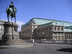
- Vienna State Opera
- Stadtpark, Vienna
Population
Over time
Population has been declining ever since its peak of 73,000 in 1880, until it hit the lowest recorded value of 17,000 in 2001. Although population has been increasing slightly since then, Innere Stadt continues to remain the least populated district in Vienna.
Structural
In 2001, 28.1% of the district's population was over 60 years of age, above the city average of 22.2%. The percentage of people under 15 years of age was 9.8%. The female population of 53.3% was also above city average.[4]
Origin and language
At 15.5%, the percentage of foreign residents in Innere Stadt was 2% under city average for the year 2001. 2.8% of the population had EU Citizenship (Germany excluded), 2.7% were citizens of Serbia and Montenegro, and 2.2% were German citizens. In total, 25.6% of the population were born in a foreign country. 79% of residents listed German as their language of choice. 4.0% spoke primarily Serbian, 1.8% Hungarian, and 1.4% Croatian. 14.3% spoke other languages.[4]
Religion
Roman catholics made up 51.3% of the Innere Stadt population in 2001, followed by 6.6% Protestants, 5.1% Orthodox Christians, 3.3% Jews. 22.7% were listed as non-confessional.[4]
Politics
The Bezirksvorsteher (District Director) has been a member of the conservative ÖVP party since 1946. Former Bezirksvorsteher Ursula Stenzel has spoken out against holding events in the inner city, citing concerns regarding noise pollution. Her comments have drawn criticism from other parties, especially the social democratic SPÖ.
| District Directors from 1945 | |
|---|---|
| Theodor Köpl (KPÖ) | April 1945–August 1945 |
| Fritz Schuckeld (SPÖ) | August 1945–October 1945 |
| Adolf Planek (SPÖ) | October 1945–1946 |
| August Altmutter (ÖVP) | 1946–1948 |
| Franz Eichberger (ÖVP) | 1948–1951 |
| Otto Friesinger (ÖVP) | 1951–1968 |
| Heinrich Anton Heinz (ÖVP) | 1968–1987 |
| Richard Schmitz (ÖVP) | 1987–2001 |
| Franz Grundwalt (ÖVP) | 2001–2005 |
| Ursula Stenzel (ÖVP) | 2005–2015 |
| Markus Figl (ÖVP) | 2015– |
Coat of arms
The first district's coat of arms is a white cross on a red background. It is also the coat of arms for the City of Vienna and the State of Vienna. The current coat of arms dates back to around 1270, when it first appeared on the minted "Wiener Pfennige" coins. It may have been based on the flag of the King of the Romans' forces during the Middle Ages, as the combat flag of Rudolph I of Germany featured a similar design.
Notes
References
- [Parts of this article were translated from German Wikipedia.]
- "Wien - 1. Bezirk - Innere Stadt", Wien.gv.at, 2008, webpage (15 subpages): Wien.gv.at-innerestadt (in German).
- Grabovszki, Ernst: Innere Stadt, Wien, 1. Bezirk. Verlag Sutton, Erfurt 2002, ISBN 3-89702-467-5
External links
| Wikivoyage has a travel guide for Vienna/Innere_Stadt. |
![]() Media related to Innere Stadt at Wikimedia Commons
Media related to Innere Stadt at Wikimedia Commons
- (German) History of Innere Stadt at the City of Vienna homepage.
- (English) (French) UNESCO rationale for inclusion of Vienna inner district into world cultural heritage list.
- (German) General information about Innere Stadt from the Green party.
- (German) Historical core of Vienna
| |||
| Districts by Number |
|  |
|---|---|---|
Coordinates: 48°12′35″N 16°22′12″E / 48.20972°N 16.37000°E