Hinesville, Georgia
| Hinesville, Georgia | |
|---|---|
| City | |
| Motto: "Home for a day or a lifetime." | |
 Location in Liberty County and the state of Georgia | |
 Hinesville, Georgia Location in the United States | |
| Coordinates: 31°49′57″N 81°36′42″W / 31.83250°N 81.61167°WCoordinates: 31°49′57″N 81°36′42″W / 31.83250°N 81.61167°W | |
| Country | United States |
| State | Georgia |
| County | Liberty |
| Government | |
| • Mayor | Allen Brown |
| • City Manager | Billy Edwards |
| Area | |
| • Total | 16.3 sq mi (42.3 km2) |
| • Land | 16.2 sq mi (42 km2) |
| • Water | 0.1 sq mi (0.3 km2) |
| Elevation | 75 ft (23 m) |
| Population (2010) | |
| • Total | 33,437 |
| • Density | 1,864.5/sq mi (718.5/km2) |
| Time zone | Eastern (EST) (UTC-5) |
| • Summer (DST) | EDT (UTC-4) |
| Area code(s) | 912 |
| FIPS code | 13-38964[1] |
| GNIS feature ID | 0331992[2] |
| Website | City of Hinesville,GA |
Hinesville is a city in Liberty County, Georgia, United States. The population was 33,437 at the 2010 census. The city is the county seat of Liberty County.[3] Nearby Fort Stewart and the principal city of Hinesville are part of the Hinesville-Fort Stewart metropolitan statistical area, which comprises all of Liberty County and neighboring Long County.
History
Hinesville was founded in 1837. That same year, the seat of Liberty County was transferred to Hinesville from Riceboro. It was incorporated as a city in 1916.[4] The city is named for Charleton Hines, a state senator.[5][6]
Geography
Hinesville is located at 31°49′57″N 81°36′42″W / 31.83250°N 81.61167°W (31.832442, -81.611703).[7]
According to the United States Census Bureau, the city has an area of 16.3 square miles (42 km2), of which 16.2 square miles (42 km2) is land and 0.1 square miles (0.26 km2) (0.61%) is water.
Hinesville is located next to the Atlantic coast which has an abundance of coastal streams and waterways. It is known for its pine trees, oaks, deer, wild hogs, and other wildlife. The Cay Creek Wetlands is a waterway that sits in Midway, Georgia and Hinesville in which can be seen nature and the historical Liberty Trail. It is the second largest city on U.S. Route 84 in Georgia after Valdosta. It is 58 miles west from U.S. Route 84 eastern terminus and 275 miles east of Dothan, Alabama.
Demographics
| Historical population | |||
|---|---|---|---|
| Census | Pop. | %± | |
| 1880 | 162 | — | |
| 1910 | 174 | — | |
| 1920 | 315 | 81.0% | |
| 1930 | 416 | 32.1% | |
| 1940 | 630 | 51.4% | |
| 1950 | 1,217 | 93.2% | |
| 1960 | 3,174 | 160.8% | |
| 1970 | 4,115 | 29.6% | |
| 1980 | 11,309 | 174.8% | |
| 1990 | 21,603 | 91.0% | |
| 2000 | 30,392 | 40.7% | |
| 2010 | 33,437 | 10.0% | |
| Est. 2015 | 33,398 | [8] | −0.1% |
As of the 2010 United States Census, there were 33,437 people residing in the city. The racial makeup of the city was 45.8% Black, 35.0% White, 0.4% Native American, 2.5% Asian, 0.7% Pacific Islander, 0.2% from some other race and 3.9% from two or more races. 11.5% were Hispanic or Latino of any race.
As of the census[1] of 2000, there were 30,392 people, 10,528 households, and 8,032 families residing in the city. The population density was 1,874.0 people per square mile (723.5/km²). There were 11,742 housing units at an average density of 724.0 per square mile (279.5/km²). The racial makeup of the city was 46.04% African American, 41.50% White, 0.47% Native American, 2.26% Asian, 0.57% Pacific Islander, 5.00% from other races, and 4.16% from two or more races. Hispanic or Latino of any race were 9.11% of the population.
There were 10,528 households out of which 50.2% had children under the age of 18 living with them, 56.0% were married couples living together, 16.7% had a female householder with no husband present, and 23.7% were non-families. 17.4% of all households were made up of individuals and 2.4% had someone living alone who was 65 years of age or older. The average household size was 2.89 and the average family size was 3.26.
In the city the population was spread out with 34.2% under the age of 18, 13.8% from 18 to 24, 36.0% from 25 to 44, 12.9% from 45 to 64, and 3.1% who were 65 years of age or older. The median age was 26 years. For every 100 females there were 97.3 males. For every 100 females age 18 and over, there were 95.3 males.
The median income for a household in the city was $35,013, and the median income for a family was $36,221. Males had a median income of $27,135 versus $20,813 for females. The per capita income for the city was $14,300. About 13.8% of families and 14.8% of the population were below the poverty line, including 20.9% of those under age 18 and 12.3% of those age 65 or over.
Education
The Liberty County School District, based in Hinesville, holds pre-school to grade twelve, and consists of seven elementary schools, three middle schools, and two high schools.[10] The district has 674 full-time teachers and over 11,274 students.[11] The current superintendent is Dr. Valya S. Lee.[12]
Sister Cities
References
- 1 2 "American FactFinder". United States Census Bureau. Retrieved 2008-01-31.
- ↑ "US Board on Geographic Names". United States Geological Survey. 2007-10-25. Retrieved 2008-01-31.
- ↑ "Find a County". National Association of Counties. Archived from the original on May 31, 2011. Retrieved 2011-06-07.
- ↑ Hellmann, Paul T. (May 13, 2013). Historical Gazetteer of the United States. Routledge. p. 233. Retrieved 30 November 2013.
- ↑ Gannett, Henry (1905). The Origin of Certain Place Names in the United States. Govt. Print. Off. p. 157.
- ↑ "Hinesville History". City of Hinesville, Georgia. Retrieved 24 June 2014.
- ↑ "US Gazetteer files: 2010, 2000, and 1990". United States Census Bureau. 2011-02-12. Retrieved 2011-04-23.
- ↑ "Annual Estimates of the Resident Population for Incorporated Places: April 1, 2010 to July 1, 2015". Retrieved July 2, 2016.
- ↑ "Census of Population and Housing". Census.gov. Archived from the original on May 11, 2015. Retrieved June 4, 2015.
- ↑ Georgia Board of Education, Retrieved June 23, 2010.
- ↑ School Stats, Retrieved June 23, 2010.
- ↑ Superintendent's Corner, Retrieved October 24, 2014.
- ↑ "Interactive City Directory". Sister Cities International.
- ↑ "Interactive City Directory". Sister Cities International.
External links
- City of Hinesville,GA
- Hinesville, Georgia
- Hinesville Area Arts Council
- Liberty County Chamber of Commerce
Municipalities and communities of Liberty County, Georgia, United States | ||
|---|---|---|
| Cities | 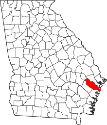 | |
| CDP | ||
| Unincorporated community | ||