Highway 1 (Tasmania)
| Highway 1 Tasmania | |
|---|---|
|
| |
_route_map.png) | |
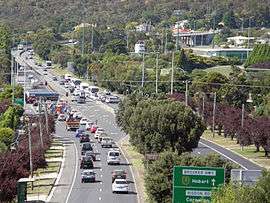
| Map of Tasmania with Highway 1 highlighted in red | |
| General information | |
| Type | Highway |
| Length | 336 km (209 mi) |
| Opened | 1955 |
| Route number(s) |
Launceston to Burnie |
| Major junctions | |
| South end | Hobart |
| |
| North end | Burnie |
| Location(s) | |
| Major settlements | Glenorchy, Brighton, Oatlands, Campbell Town, Perth, Launceston, Deloraine, Devonport, Ulverstone |
| Highway system | |
|
Highways in Australia National Highway • Freeways in Australia Highways in Tasmania | |
| |
In Tasmania, Highway 1 is a 336-kilometre (209 mi) long[1] route that connects Hobart to the state's north coast, and to Launceston via a 3.8-kilometre (2.4 mi) long spur.[2] Highway 1 also exists on the mainland of Australia, linking the state capitals via a circular route around the coastline. All roads within the Highway 1 system are allocated a road route numbered 1, M1, A1, or B1, depending on the state route numbering system. In Tasmania the highway is designated as National Highway 1, though all other routes in the state are alphanumeric.
History
Highway 1 was created as part of the National Route Numbering system, adopted in 1955. The route was compiled from an existing network of state and local roads and tracks.[3]
Route description
Highway 1 commences in the Hobart city centre as the Brooker Highway, and travels 17 km (11 mi) north on parallel trajectory to the River Derwent until it reaches Granton, where the Highway ends. From this point the Midland Highway becomes Route 1 and travels over the River Derwent and passes through the newly constructed Brighton Bypass before continuing north towards Launceston.[1] A 3.8-kilometre (2.4 mi) long spur section of Highway 1 travels into the centre of Launceston, first as the continuation of the Midland Highway, and then as a Couplet – northbound on Bathurst Street, and southbound on Wellington Street.[2] South of Launceston, Highway 1 continues west as the Bass Highway to Deloraine, after which it travels north to Devonport, and then west along the northern coast to the route's terminus in Burnie. The Bass Highway, however, continues towards Marrawah on the state's west coast.[1]
Major intersections
References
- 1 2 3 Google (21 March 2013). "Highway 1 (Tasmania)" (Map). Google Maps. Google. Retrieved 21 March 2013.
- 1 2 Google (21 March 2013). "Highway 1 (Tasmania) – Launceston spur" (Map). Google Maps. Google. Retrieved 21 March 2013.
- ↑ Taylor, David (2012). The Highway One travel companion. Volume 1, Melbourne to Tweed Heads. Salisbury, Queensland: Boolarong Press. p. 9. ISBN 9780987218902.
See also
- Highway 1 (Northern Territory)
- Highway 1 (New South Wales)
- Highway 1 (Queensland)
- Highway 1 (South Australia)
- Highway 1 (Victoria)
- Highway 1 (Western Australia)
Road infrastructure in Tasmania | ||
|---|---|---|
| National highways | ||
| State highways | ||
| Bridges | ||