Henninger Flats
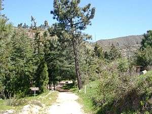
Henninger Flats is a small hanging basin 2,600 feet (792.5 m)[1] above sea level in the San Gabriel Mountains in the Angeles National Forest. It was part of the Mount Wilson Toll Road. The trailhead to reach the flats is at the top end of Eaton Canyon in Pasadena, California.[2]
History

Around 1880, William K Henninger settled in a small basin above Altadena. Henninger was born in Virginia and had been a gold prospector.[3] The area was originally purchased by Mr. Peter Stiel through the Homestead Act. Stiel’s friend Henninger had been squatting on the area since 1884.[4]
Henninger was given the title captain by the other miners he worked with as a sign of respect. Henninger married a Baja California Indian known to us only as Teresa. Their first born, a son named Natividad, was baptized at the San Gabriel Mission on December 1858. He and Teresa had three daughters: Louisa, Susana and Jesefa.[3]

Henninger built a house and a cistern for water storage. He planted fruit, vegetables, and hay and nut trees. The produce he then carried into town a mile and a half down the steep trail that ended in Eaton Canyon. In 1892 Henninger was visited by T. P. Lukens and R. J. Busch who started the very first experimental reforestation in California at Henninger Flats.[5] Upon his death in March 1894, the property was willed to his daughters. The property was auctioned in 1895 to Harry C. and Harriet M. Allen of Pasadena. In October 1895, the Allens sold the property for $5,000 to four men who then sold the property to the Mt. Wilson Toll Road Company for $76,600 as part of the Mount Wilson Toll Road.[4]
In 1903, under the direction of Lukens, a nursery was established at Henninger Flats. During the years that followed the road was widened to accommodate the passage of equipment up to the observatory at Mt. Wilson. By 1917 the road was widened to the present width of twelve feet.[5]
Since 1928, the flats have been used as a high elevation forest nursery by the Los Angeles County Fire Department.[5]
Hiking

The road is a popular hike and the flats were a popular campground. The Henninger Flats Forestry Center is also used for conservation education.[6] The toll road was washed out by a landslide in 2005 approximately 200 yards (182.9 m) past the Eaton Canyon bridge, but was re-opened in early September 2009 as the result of fire crews needing vehicular access to the area while fighting the Station Fire. See photos here [1][2]
See also
External links
Coordinates: 34°11′33″N 118°05′13″W / 34.1925°N 118.087°W
References
- 1 2 "Eaton Canyon Nature Center Associates". Archived from the original on 2007-04-29. Retrieved 2007-05-24.
- 1 2 Robinson, Joe (November 15, 2005). "What a washout". Los Angeles Times.
- 1 2 "Los Angeles County Fire Department". Retrieved 2007-05-24.
- 1 2 "Los Angeles County Fire Department". Retrieved 2007-05-24.
- 1 2 3 Rippens, Paul H. (1999). Henninger Flats: The story of William K. Henninger and the area that bears his name. Alhambra, California: Copy-Rite Press.
- ↑ "Pasadena Convention and Visitors Bureau". Archived from the original on 2007-04-11. Retrieved 2007-05-24.