Hellhole Palms, California
| Hellhole Palms, California | |
|---|---|
| Unincorporated community | |
 Hellhole Palms, California | |
| Coordinates: 33°14′12″N 116°26′25″W / 33.23667°N 116.44028°WCoordinates: 33°14′12″N 116°26′25″W / 33.23667°N 116.44028°W | |
| Country | United States |
| State | California |
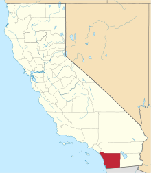
| County | San Diego |
| Elevation | 1,719 ft (524 m) |
| Time zone | Pacific (PST) (UTC-8) |
| • Summer (DST) | PDT (UTC-7) |
| Area codes | 442/760 |
| GNIS feature ID | 1660739[1] |
Hellhole Palms is an unincorporated community in San Diego County, California. Hellhole Palms is located in Hellhole Canyon 4 miles (6.4 km) west-southwest of Borrego Springs.[2]
Hellhole Palms is the site of a grove of California fan palms in Anza-Borrego Desert State Park. It is also the site of Maidenhair Falls, a popular hiking destination.
References
- ↑ U.S. Geological Survey Geographic Names Information System: Hellhole Palms, California
- ↑ Durham, David L. (1998). California's Geographic Names: A Gazetteer of Historic and Modern Names of the State. Quill Driver Books. p. 1281. ISBN 1-884995-14-4.
This article is issued from Wikipedia - version of the 10/28/2016. The text is available under the Creative Commons Attribution/Share Alike but additional terms may apply for the media files.