Heidlersburg, Pennsylvania
| Heidlersburg, Pennsylvania | ||
|---|---|---|
| Census-designated place | ||
| ||
 Location in Adams County and the state of Pennsylvania. | ||
| Coordinates: 39°56′57″N 77°08′46″W / 39.94917°N 77.14611°WCoordinates: 39°56′57″N 77°08′46″W / 39.94917°N 77.14611°W | ||
| Country | United States | |
| State | Pennsylvania | |
| County | Adams | |
| Township | Tyrone | |
| Area | ||
| • Total | 1.1 sq mi (2.8 km2) | |
| • Land | 1.1 sq mi (2.8 km2) | |
| • Water | 0 sq mi (0 km2) | |
| Elevation | 571 ft (174 m) | |
| Population (2010) | ||
| • Total | 707 | |
| • Density | 653/sq mi (252.3/km2) | |
| Time zone | Eastern (EST) (UTC-5) | |
| • Summer (DST) | EDT (UTC-4) | |
| Area code(s) | 717 | |
| GNIS feature ID | 1176772[1] | |
| FIPS code | 42-33632 | |

Heidlersburg is an unincorporated community and census-designated place in Tyrone Township, Adams County, Pennsylvania, United States. As of the 2010 census the population was 707.[2]
Heidlersburg is located at the crossroads of Pennsylvania Route 234 and Old Harrisburg Road, the former U.S. Route 15. Route 15 now bypasses the town to the east, with access from an exit at Route 234. Gettysburg is 9 miles (14 km) to the south, and Harrisburg is 28 miles (45 km) to the north.
Heidlersburg used to be known as Starry Town. It contains a few garages. There is a volunteer fire company, Company 25. The two churches in Heidlersburg are Heidlersburg United Brethren in Christ Church and St. Mark's Lutheran Church.
References
- ↑ U.S. Geological Survey Geographic Names Information System: Heidlersburg, Pennsylvania
- ↑ "Geographic Identifiers: 2010 Demographic Profile Data (G001): Heidlersburg CDP, Pennsylvania". U.S. Census Bureau, American Factfinder. Retrieved July 19, 2013.
External links
Municipalities and communities of Adams County, Pennsylvania, United States | ||
|---|---|---|
| Boroughs | 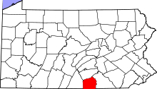 | |
| Townships | ||
| CDPs | ||
| Unincorporated communities | ||
| Ghost town | ||
This article is issued from Wikipedia - version of the 7/17/2016. The text is available under the Creative Commons Attribution/Share Alike but additional terms may apply for the media files.