Hatch, Utah
| Hatch, Utah | |
|---|---|
| Town | |
 Location in Garfield County and state of Utah. | |
| Coordinates: 37°39′3″N 112°26′8″W / 37.65083°N 112.43556°WCoordinates: 37°39′3″N 112°26′8″W / 37.65083°N 112.43556°W | |
| Country | United States |
| State | Utah |
| County | Garfield |
| Incorporated | January 3, 1934 |
| Founded by | Meltiar Hatch, Sr. |
| Area | |
| • Total | 0.3 sq mi (0.7 km2) |
| • Land | 0.3 sq mi (0.7 km2) |
| • Water | 0.0 sq mi (0.0 km2) |
| Elevation | 6,919 ft (2,109 m) |
| Population (2012) | |
| • Total | 129 |
| • Density | 471.7/sq mi (182.1/km2) |
| Time zone | Mountain (MST) (UTC-7) |
| • Summer (DST) | MDT (UTC-6) |
| ZIP code | 84735 |
| Area code(s) | 435 |
| FIPS code | 49-33760[1] |
| GNIS feature ID | 1428572[2] |
Hatch is a town in Garfield County, Utah, United States. The population was 127 at the 2000 census. It is approximately 217 miles (350 km) south of Salt Lake City.
Geography
According to the United States Census Bureau, the town has a total area of 0.3 square miles (0.7 km²), all of it land.
Demographics
| Historical population | |||
|---|---|---|---|
| Census | Pop. | %± | |
| 1920 | 250 | — | |
| 1930 | 274 | 9.6% | |
| 1940 | 294 | 7.3% | |
| 1950 | 244 | −17.0% | |
| 1960 | 198 | −18.9% | |
| 1970 | 139 | −29.8% | |
| 1980 | 121 | −12.9% | |
| 1990 | 103 | −14.9% | |
| 2000 | 127 | 23.3% | |
| 2010 | 133 | 4.7% | |
| Est. 2015 | 141 | [3] | 6.0% |
As of the census[1] of 2000, there were 127 people, 41 households, and 33 families residing in the town. The population density was 471.7 people per square mile (181.6/km²). There were 81 housing units at an average density of 300.8 per square mile (115.8/km²). The racial makeup of the town was 93.70% White, 3.94% Asian, and 2.36% from two or more races. Hispanic or Latino of any race were 1.57% of the population.
There were 41 households out of which 39.0% had children under the age of 18 living with them, 63.4% were married couples living together, 9.8% had a female householder with no husband present, and 19.5% were non-families. 17.1% of all households were made up of individuals and 7.3% had someone living alone who was 65 years of age or older. The average household size was 3.10 and the average family size was 3.48.
In the town the population was spread out with 33.1% under the age of 18, 11.0% from 18 to 24, 22.0% from 25 to 44, 20.5% from 45 to 64, and 13.4% who were 65 years of age or older. The median age was 28 years. For every 100 females there were 76.4 males. For every 100 females age 18 and over, there were 77.1 males.
The median income for a household in the town was $37,083, and the median income for a family was $45,000. Males had a median income of $27,083 versus $25,938 for females. The per capita income for the town was $12,776. There were 5.9% of families and 2.9% of the population living below the poverty line, including no under eighteens and 28.6% of those over 64.
In summer 2010 the town began construction of a new town office/community center facility adjacent to the town park that will be completed in the fall of 2010.
Climate
Climate in this area has mild differences between highs and lows, and there is adequate rainfall year round. The Köppen Climate Classification subtype for this climate is "Cfb" (Marine West Coast Climate/Oceanic climate).[5]
References
- 1 2 "American FactFinder". United States Census Bureau. Retrieved 2008-01-31.
- ↑ "US Board on Geographic Names". United States Geological Survey. 2007-10-25. Retrieved 2008-01-31.
- ↑ "Annual Estimates of the Resident Population for Incorporated Places: April 1, 2010 to July 1, 2015". Retrieved July 2, 2016.
- ↑ "Census of Population and Housing". Census.gov. Retrieved June 4, 2015.
- ↑ Climate Summary for Hatch, Utah

Municipalities and communities of Garfield County, Utah, United States | ||
|---|---|---|
| Cities | 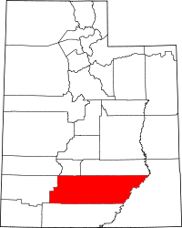 | |
| Towns | ||
| Unincorporated communities | ||
| Ghost towns | ||