Harrisville, New York
| Harrisville, New York | |
|---|---|
| Village | |
 Harrisville, New York Location within the state of New York | |
| Coordinates: 44°9′8″N 75°19′11″W / 44.15222°N 75.31972°WCoordinates: 44°9′8″N 75°19′11″W / 44.15222°N 75.31972°W | |
| Country | United States |
| State | New York |
| County | Lewis |
| Town | Diana |
| Area | |
| • Total | 0.8 sq mi (2.1 km2) |
| • Land | 0.8 sq mi (2.0 km2) |
| • Water | 0.0 sq mi (0.1 km2) |
| Elevation | 807 ft (246 m) |
| Population (2010) | |
| • Total | 628 |
| Time zone | Eastern (EST) (UTC-5) |
| • Summer (DST) | EDT (UTC-4) |
| ZIP code | 13648 |
| Area code(s) | 315 |
| FIPS code | 36-32424 |
| GNIS feature ID | 952291[1] |
Harrisville is a village in Lewis County, New York, United States. The population was 628 at the 2010 census.
The Village of Harrisville is in the northeast part of the Town of Diana and is south of Ogdensburg.
Geography
Harrisville is located at 44°09′08″N 75°19′11″W / 44.152226°N 75.319733°W.[2]
According to the United States Census Bureau, the village has a total area of 0.8 square miles (2.1 km2), of which, 0.8 square miles (2.1 km2) of it is land and 0.04 square miles (0.10 km2) of it (3.75%) is water.
Combined New York State Route 812 and New York State Route 3 pass through the community. County Road 9 enters the village from the south.
Harrisville is on a branch of the Oswegatchie River and is next to the county line for St. Lawrence County.
Demographics
| Historical population | |||
|---|---|---|---|
| Census | Pop. | %± | |
| 1880 | 353 | — | |
| 1890 | 617 | 74.8% | |
| 1900 | 639 | 3.6% | |
| 1910 | 921 | 44.1% | |
| 1920 | 900 | −2.3% | |
| 1930 | 896 | −0.4% | |
| 1940 | 832 | −7.1% | |
| 1950 | 868 | 4.3% | |
| 1960 | 842 | −3.0% | |
| 1970 | 836 | −0.7% | |
| 1980 | 937 | 12.1% | |
| 1990 | 703 | −25.0% | |
| 2000 | 653 | −7.1% | |
| 2010 | 628 | −3.8% | |
| Est. 2015 | 622 | [3] | −1.0% |
As of the census[5] of 2000, there were 653 people, 266 households, and 172 families residing in the village. The population density was 849.6 people per square mile (327.4/km2). There were 299 housing units at an average density of 389.0 per square mile (149.9/km2). The racial makeup of the village was 98.93% White, 0.15% Native American, 0.31% Asian, and 0.61% from two or more races.
There were 266 households out of which 28.6% had children under the age of 18 living with them, 53.8% were married couples living together, 7.1% had a female householder with no husband present, and 35.0% were non-families. 28.9% of all households were made up of individuals and 18.0% had someone living alone who was 65 years of age or older. The average household size was 2.45 and the average family size was 3.06.
In the village the population was spread out with 25.1% under the age of 18, 9.5% from 18 to 24, 25.0% from 25 to 44, 24.3% from 45 to 64, and 16.1% who were 65 years of age or older. The median age was 40 years. For every 100 females there were 86.6 males. For every 100 females age 18 and over, there were 89.5 males. The median income for a household in the village was $30,833, and the median income for a family was $32,946. Males had a median income of $32,417 versus $19,545 for females. The per capita income for the village was $15,652. About 12.6% of families and 16.1% of the population were below the poverty line, including 21.2% of those under age 18 and 12.7% of those age 65 or over.
References
- ↑ U.S. Geological Survey Geographic Names Information System: Harrisville, New York
- ↑ "US Gazetteer files: 2010, 2000, and 1990". United States Census Bureau. 2011-02-12. Retrieved 2011-04-23.
- ↑ "Annual Estimates of the Resident Population for Incorporated Places: April 1, 2010 to July 1, 2015". Retrieved July 2, 2016.
- ↑ "Census of Population and Housing". Census.gov. Retrieved June 4, 2015.
- ↑ "American FactFinder". United States Census Bureau. Retrieved 2008-01-31.
Municipalities and communities of Lewis County, New York, United States | ||
|---|---|---|
| Towns | 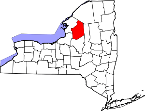 | |
| Villages | ||
| Other hamlets | ||