Harrington Road tram stop
Harrington Road | |
|---|---|
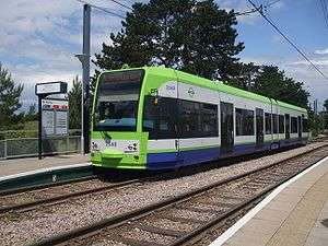
 Harrington Road tramstop looking north | |
| Location |
Harrington Road, London Borough of Croydon United Kingdom |
| Operated by | Tramlink |
| Platforms | 2 |
| Construction | |
| Disabled access | Yes |
| Other information | |
| Fare zone | London fare zones 3, 4, 5 and 6 |
| History | |
| Opened | 2000 |
| Traffic | |
| Passengers (2009–10) | 0.203 million total boardings and alightings[1] |
| Passengers (2010–11) | 0.211 million total boardings and alightings[2] |
Harrington Road tram stop is a light rail stop in South Norwood in the London Borough of Croydon in the southern suburbs of London. Harrington Road is in a residential area, and along with Woodside tram stop is the nearest tram stop to the town of South Norwood. Beckenham Cemetery lies immediately to the east.
The tram stop is served by Tramlink route 2, which connects central Croydon with Beckenham. The stop is at ground level on double track, with platforms on each side of the track. Immediately to the north of the stop, the route becomes single track and turns sharply to the east, joining the trackbed of the existing railway line between Crystal Palace and Beckenham Junction stations. The two tracks (Tramlink and Network Rail) run alongside each other, occupying the site of what was previously a double track railway.
Transport for London once had plans to extend the Tramlink system to Crystal Palace. These plans were known as Extension D or Tramlink route 4, and would have involved a junction to the north of Harrington Road, with the extension joining the existing railway in the opposite direction to the current line 2.[3]
The planned extension to Crystal Palace was formally dropped by Transport for London in 2008.
| Preceding tram stop | Following tram stop | |||
|---|---|---|---|---|
towards Wellesley Road | Route 2 | towards Beckenham Junction |
References
- ↑ "Tram Stop Usage 2009-10 (FOI)" (XLS). Tramlink annual passenger performance 2009-2010. Transport for London. 18 August 2011. Retrieved 28 November 2012.
- ↑ "Tramlink numbers 2010-2011" (PDF). Tramlink annual passenger performance 2010-2011. Transport for London. 28 March 2012. Retrieved 28 November 2012.
- ↑ TFL : Crystal Palace Tramlink Extension
External links
| Wikimedia Commons has media related to Harrington Road tram stop. |
Coordinates: 51°23′59″N 0°03′38″W / 51.3997°N 0.0605°W