Hari Hari
| Hari Hari | |
|---|---|
 Hari Hari | |
| Coordinates: 43°9′0″S 170°33′43″E / 43.15000°S 170.56194°E | |
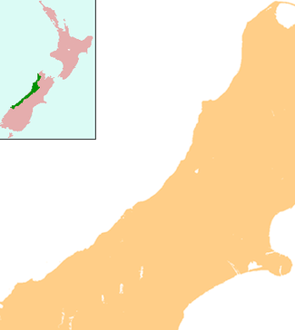
| Country | New Zealand |
| Region | West Coast |
| District | Westland District |
| Population (2006) | |
| • Total | 348 |
Hari Hari is a small rural settlement in the south west of the West Coast region of New Zealand's South Island. The name has a Maori meaning, from Te Aka Maori/English Dictionary, as "to take/carry joy" or, as local legend suggests, "come together in unison" from a Maori canoe paddling chant/song. In recent years, Hari Hari has been increasingly referred to as "Harihari" with Maori meaning as "ambulance". No official statutory process has taken place in order for this to happen.
It is slightly inland from the Tasman Sea and the Saltwater Lagoon and is situated between the Wanganui and Poerua Rivers, 45 minutes south of the tourist town of Hokitika. State Highway 6 passes through the town on its route from Ross to the Franz Josef Glacier. The Westland District's largest town, Greymouth is 110 kilometres (68 mi), and Hokitika 70 km (43 mi) to the north-east. Ross is 46 km (29 mi) to the north-east, and Franz Josef is 32 km south west.[1][2]
The population of Hari Hari and its surrounds was 348 in the 2006 Census, unchanged from 2001.[3]
Hari Hari was once a logging settlement and relics of a bush tramway that used to carry timber can be found in the area. Today, the forest in the area is protected and popular activities in the Hari Hari area include bushwalking, birdwatching, and trout and salmon fishing.
The Inter-Wanganui Co-op opened a dairy factory at Hari Hari in 1908,[4] but it is now a ruin.[5]
Hari Hari's main claim to fame occurred on 7 January 1931, when Australian aviator Guy Menzies landed upside down in a swamp near Hari Hari, completing the first solo flight across the Tasman Sea. Menzies, who had left Sydney 11 hours and 45 minutes earlier, was aiming for Blenheim but had been blown off course and mistook a swamp for flat pasture suitable for landing. Despite the accident, he was unharmed. On 7 January 2006, the 75th anniversary celebrations of the feat were held in Hari Hari, with roughly 400 people in attendance. To mark the occasion, Dick Smith recreated Guy Menzies' flight, though Smith chose to land upright in Hari Hari.[6]
Local name change controversy
Many local residents are upset about the growing number of official websites, and official documentation, referring to Hari Hari as being "Harihari". The greater community insists that they were not informed or talked to about this matter, and are against the gradual unofficial change. Some are being active about keeping their town's name the same, and have involved the Department of Māori Affairs about the tampering with of a traditional Māori place name. Town signs around Hari Hari still state the name is Hari Hari. One newly placed town distance sign in Whataroa shows the name "Harihari".[7]
The town was named in 1908 when a post office was needed for the township. "Hari Hari Post Office" was operated by Postmaster Hende. Prior to this, Hari Hari was called "Hende's Ferry" after the Hende family, the first settlers in the area. Land Information New Zealand states, they have no record of "Hari Hari Post Office" and insist the "accepted" name is Harihari. They also state that a chain of surveyors who had surveyed the area over past years had used the shortened name. Locals say this is debatable and untrue. If true, this was either from a lack of knowledge of Hari Hari's given name, or the surveyors were simply saving time by shortening the town's name. This has resulted in confusion, and official Government Organizations and Internet sites World Wide, such as Google Earth not using the real town name.
Gerald Arthur of Land Information New Zealand and New Zealand Geographic Board (Nga Pou Taunaha o Aotearoa) has stated, quote "The accepted form of the town name is Harihari as one composite word", although, he also states "The name [Harihari] has not been through the New Zealand Geographic Board's statutory process".
Education
South Westland Area School is a coeducational composite school (years 1-15), with a decile rating of 4 and a roll of 111.[8] The school has a satellite class at Franz Josef Glacier School.[9]
There is also a University of Canterbury Field Station, "The Green Elephant" [10]
Notes
- ↑ Peter Dowling (editor) (2004). Reed New Zealand Atlas. Reed Books. map 74. ISBN 0-7900-0952-8.
- ↑ Roger Smith, GeographX (2005). The Geographic Atlas of New Zealand. Robbie Burton. map 164. ISBN 1-877333-20-4.
- ↑ Quickstats about Harihari
- ↑ "Inter-Wanganui Co-op dairy factory opening". University of Canterbury library. Retrieved 2008-08-05.
- ↑ "Inter-Wanganui Co-op Dairy Co". Panoramio. Retrieved 2008-08-05.
- ↑ "Dick Smith recreates first solo trans-Tasman flight". Sydney Morning Herald. 8 January 2006.
- ↑ Brown, Giles (2 January 2009). "Coasters testy over township's name". The Press. Archived from the original on 2009-01-03.
- ↑ "Te Kete Ipurangi – South Westland Area School". Ministry of Education.
- ↑ "Supplementary Review Report: South Westland Area School". Education Review Office. May 2006.
- ↑ Harihari Field Station. Canterbury.ac.nz.
External links
Coordinates: 43°09′S 170°33′E / 43.150°S 170.550°E