Hailakandi
| Hailakandi Bengali: হাইলাকান্দি | |
|---|---|
| Town, District Headquarter | |
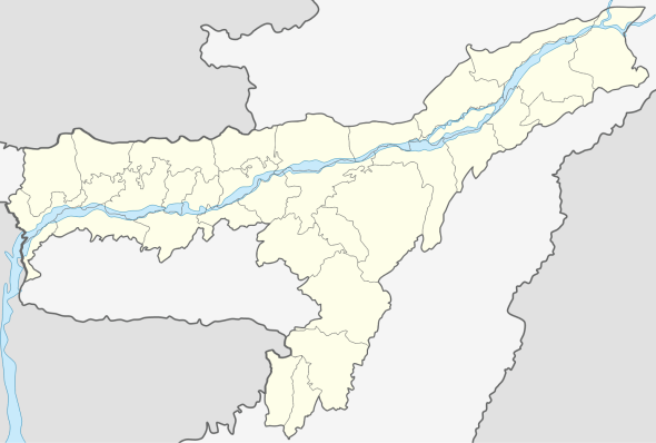 Hailakandi  Hailakandi Location in Assam, India | |
| Coordinates: 24°41′N 92°34′E / 24.68°N 92.57°ECoordinates: 24°41′N 92°34′E / 24.68°N 92.57°E | |
| Country | India |
| State | Assam |
| District | Hailakandi |
| District created | 01-10-1989 |
| Government | |
| • Body | Hailakandi Municipality Board |
| Area | |
| • Total | 1,327 km2 (512 sq mi) |
| Elevation | 21 m (69 ft) |
| Population (2011) | |
| • Total | 659,260 |
| • Density | 497/km2 (1,290/sq mi) |
| Languages | |
| • Official | Bangla |
| Time zone | IST (UTC+5:30) |
| PIN | 788XXX |
| Telephone code | 91 - (0) 03844 |
| Vehicle registration | AS-24 |
| Website |
hailakandi |
Hailakandi (pron:ˈhaɪləˌkʌndi) is a town and the district headquarters of Hailakandi district in the Indian state of Assam. The Hailakandi district is one of the three districts of Southern Assam i.e. Barak Valley.
Geography
Hailakandi is located at 24°41′N 92°34′E / 24.68°N 92.57°E.[1] The area of Hailakandi town is 4.55 km2 according to the 2001 census. It has an average elevation of 21 metres (68 feet). It has an area of 1326.10 square kilometres. Out of this, more than 50% (i.e. 783.15 km2)[2] is forested area. The forest comprises 781.45 km2 of reserve forest and 1.70 km2 of proposed reserved forest. The district has an inter-state border with Mizoram on its south having a length of 76 km, and an inter-district border on the other sides with Karimganj and Cachar districts.
According to the 2011 census, the population of the district was 659,296 while the population growth rate was 21.45%.[3]
The prime geographical character that forms the topographical features of Hailakandi is the river Barak and its tributaries. These rivers spread rich alluvial plains across the length and breadth of three southernmost districts of Assam.[2] There are two major rivers flowing through the district, Katakhal and Dhaleswari. There are also two small rivers named Pola and Jita. These four rivers are fed by seven tributaries that flow through the district.
There are two reserved forests in Hailakandi District, the inner line reserved forest and the Katakhal reserved forest. These were once rich in wildlife but this is now vanishing due to human onslaught. Rare species have been recorded, including the hoolock gibbon, Phayre's leaf monkey, pig-tailed macaque, white-winged wood duck, and purple wood pigeon.[4][5] The southern part was also recommended as 'Dhaleswari' wildlife sanctuary.[6][7]
The main language of the town is Bengali using a local dialect, which has some resemblance to Sylheti dialect. There are also some speakers of Bishnupriya Manipuri and Manipuri (Meitei).
Hailakandi comprises three notified towns, Hailakandi (district headquarters), Lala and Algapur, and one industrial township, Panchgram. A municipal board governs Hailakandi town and a town committee governs Lala. It has five development blocks: Algapur, Hailakandi, Lala, Katlicherra and South Hailakandi. Hailakandi Zilla Parishad covers these five development blocks. There are total of 62 Gaon Panchayats under these five blocks. There are 331 revenue villages, one municipality board and two town committees. There is also a small township at the Hindustan Paper Mill area at Panchgram in the Algapur block area. The connectivity of the district consists of the roads NH-53 and NH-154 and a railway (broad gauge work was in progress as of Jan 2016). Only 22% of the PWD roads are surfaced, having 78% of un-surfaced roads in the district, which indicate that access and availability of good road connectivity in the district is very low. The nearest airport is Kumbhigram airport which is located 83 km from the district headquarters.[8]
The district is divided into four revenue circles comprising a total of 393 villages (including 27 forest villages). Nearly half the district consists of forests. Out of the remaining half, 33.2% is under cultivation. Rice is the main crop. The district has 17 tea gardens. The district has four police stations, two police outposts, four colleges, 43 H/E, H/School, 247 ME/ MV Schools and 937 LP schools.
History
It was constituted as a civil subdivision on 1 June 1869. It was upgraded to a district in 1989.
According to some scholars the name "Hailakandi" derives from the Sylheti word "Hailakundi".
The later history of Hailakandi is intricately linked to Abdul Matlib Mazumdar (1890–1980), the late Nagendranath Choudhury, the late (Capt.) Manmatha Choudhury, the late (Capt.) Subodh Kumar Dutta and the late Sunil Chakravorty who led the freedom movement in the erstwhile sub-division. The late Nagendranath Choudhury was a prominent Congress-leader; Pandit Jawaharlal Nehru called on him in his house during his visit to Hailakandi in 1939. His brother Late Manmatha Choudhury was a captain in the Azad Hind Fouz formed by Netaji. Abdul Matlib Mazumdar became an MLA in 1946 and was also Cabinet Minister of Assam.[9] He was one of the prominent Muslim leaders of eastern India to support Hindu-Muslim unity, opposing the partition of India on communal lines. Mazumdar along with Fakhruddin Ali Ahmed (who later became the 5th president of India) became the most prominent Muslim opponents of the demand for a separate Muslim state of Pakistan, especially in the eastern part of the country. Mazumdar took a Master of Arts degree in English literature from Dhaka University in 1921 and B.L. from Calcutta in 1924. He started legal practice at Hailakandi Bar in 1925. He rose to prominence as a lawyer serving the people of Hailakandi. The government then offered him the post of a magistrate, which he refused.[10] He joined the Indian National Congress in 1925. He founded the Hailakandi Congress Committee in 1937 and became its first president. Netaji Subhash Chandra Bose and Pandit Jawaharlal Nehru visited Hailakandi in 1939 and 1945 respectively at the invitation of Mazumdar to strengthen the freedom movement as well as the Congress party in southern Assam. It was Netaji who initiated establishment of contact between Moulana Abul Kalam Azad and Matlib Mazumdar for gearing up nationalist Muslims against a growing Muslim League in the region.[11] Mazumdar became the first Chairman of Hailakandi township in 1939 and in 1945 he became the first Indian Chairman of the Hailakandi Local Board, a post always held by the European tea planters.[12]
The Muslim League proved its might in the Muslim-dominated areas of India in the 1937 elections. To counter the rising popularity of the Muslim League, he successfully organised the Jamiat Ulema-e-Hind movement in Assam. Jamiat was an ally of the Congress having a mass following among the nationalist Muslims. In the very crucial 1946 general elections just on the eve of India’s independence, he wrested the Muslim majority Hailakandi seat from the hold of Muslim League. That victory virtually sealed the hopes and aspirations of the Muslim League to include southern Assam in Pakistan. In that election, the bulk of the Muslim nominees of the Indian National Congress including Fakhruddin Ali Ahmed (the fifth President of India in later years) lost to their Muslim League rivals miserably.
Assam's Surma Valley (now partly in Bangladesh) had a majority Muslim population. On the eve of partition, hectic activities intensified by the Muslim League as well as Congress, with the former having an edge. A referendum had been proposed for Sylhet District (now in Bangladesh). Mazumdar along with Basanta Kumar Das (then Home Minister of Assam) travelled throughout the valley organising the Congress and addressing meetings educating the masses about the outcome of partition on the basis of religion. On 20 February 1947, Moulvi Mazumdar inaugurated the Assam Nationalist Muslim's Convention at Silchar. Another big meeting was held at Silchar on 8 June 1947.[13] Both meetings, which were attended by a large number of Muslims, paid dividends. He was also among the few who were instrumental in retaining the Barak Valley region of Assam with India.[12][14] Mazumdar was the leader of the delegation that pleaded before the Radcliffe Commission that ensured that a part of Sylhet (now in Bangladesh) remained with India despite being Muslim-majority (present Karimganj district).[15]
Moulvi Mazumdar joined as a cabinet minister of Assam in 1946 with the portfolios of Local Self-Government, Agriculture and Veterinary. In 1947, India became free from British rule, when Mazumdar again took charge of the same departments in Gopinath Bordoloi's cabinet as the only Muslim minister (Moulana Tayyebulla was inducted in 1948) and also the lone member from the entire Barak valley region. The entire eastern India was swept by violence just after India's partition and independence on 15 August 1947, scores of Hindus fled the newly created East Pakistan (now Bangladesh) for India, and Muslims fled Assam for East Pakistan. A large number of people lost their lives owing to violence, which resurfaced with more ferocity in 1950. Mazumdar, the only Muslim in the cabinet, along with his cabinet and party colleagues, took up responsibility for the safety of both Hindus and Muslims in Hailakandi, touring affected areas and arranging camps and rehabilitation for the refugees, organizing supplies and security.
He continued as a cabinet minister in Bishnuram Medhi's cabinet until 1957.[16][17] His last election was in 1967 when at the age of 77, Mazumdar reached Assam Assembly victorious. He then became the Minister for Law, Social Welfare and Political Sufferers in Bimala Prasad Chaliha’s cabinet. As a law minister, he initiated the separation of executive and judiciary at the district level. During the Bangladesh’s war of liberation in 1970-71, he was in charge of relief-and-rehabilitation of the thousands of refugees who fled the then East Pakistan. He resigned from active politics in 1971. Other posts held during his long career were Chairman of the Assam Madrassa Board, Chairman of the State Haj Committee, and the Pro Tem Speaker of the Assam Legislative Assembly (in 1967). He was instrumental in setting up the Haji Musafir Khana at Guwahati. As Chairman of the Madrassah Board, he initiated modernization of these theological schools and is also credited for the introduction of English and science in the curriculum of madrassas of Assam. The actual establishment of this district was done on 1 October, 1989 by the late Shri Sahidul Alam Choudhury, who was the then reigning MLA of Algapur, and the P.H.E. and Municipality Minister of Assam during AGP rule. Under his leadership, the district was created and he was the architect behind the Hailakandi town planning.[18] He was the key person to set up centres of higher education at Hailakandi.[19]
Another prominent person from Hailakandi was the late Raj Mohan Nath, a noted engineer, who authored many books on different subjects apart from engineering. One of these was a textbook for the students of civil engineering in the Bengal Engineering College, Shibpur (West Bengal). Today's "Assam-type house" is entirely his concept, which gained vast popularity in the earthquake zones. A road in Moscow was named after him.
Economy
In the organized sector, tea is the main industry of the district. It has 17 tea estates with 55.70 square kilometres under tea plantations employing more than 1,30,642 persons as per the 1991 census. Production of tea was 87.62 tonnes. The Hindustan paper mill Panchgram comes in second place, offering a large number of employment opportunities in the district. The predominant income generating activity for the district is the agricultural sector and its allied enterprises.
Demographics
As of the 2001 India census,[20] Hailakandi town had a population of 29,634 and the district had a total population of 5,47,003. Males constituted 51% of the district's population and females 49%. Hailakandi had an average literacy rate of 78.5%, higher than the national average of 59.5%: male literacy was 82%, and female literacy was 75%. 11% of the population was under 6 years of age.
Education
In this district there are four colleges, 48 high and higher secondary schools, 253 middle schools, 1019 primary/Pre-primary schools, one Navodaya Vidyalaya, Kendriya Vidyalaya and one basic training school.
- S.S. College, Hailakandi: Srikishan Sarda College was established on 18 September 1950. It is the oldest higher educational institution in the present day Hailakandi district. At that time the college was affiliated with Gauhati University, but after the establishment of Assam University, Silchar (a central university constituted under act XIII of 1989), the college got its affiliation under this university from 1994. The college is recognized by UGC under act 2(f) and 12 (b) of the UGC act 1956. The eminent educationalist the late Sisir Kar Shastri was the founder principal. The college's land was donated by the educationalist the late Pratap Ch. Nath. The late Shric hand Sarda donated the first building of the college. The college was affiliated to Gauhati University in 1956. Since 1994, it has been affiliated to Assam University. There are about 1300 students studying in the Arts and Science stream. It has a strength of 55 lecturers and 24 non-teaching staff. The subjects taught here are English, Bengali, Manipuri, Sanskrit, Persian, economics, political science, philosophy, history, mathematics, physics, chemistry, botany, zoology and statistics. The college imparts education up to degree honors level in all subjects except Manipuri and chemistry.
- ALC College, Algapur : Abdul Latif Choudhury College was established in 1996 by the late Shri Sahidul Alam Choudhury, who founded this institute in order to spread education to the poor section of the society and also to light the lamp of knowledge in this backward and ignorant place. The college is affiliated to Assam University. The college's infrastructure and facilities are laudable. It has four floors. It is located 8 km away from the main town Hailakandi. Since 1996, there are about 1500 students studying in the Arts and Commerce streams. Staff strength comprises 35 experienced lecturers and 14 non-teaching staff. The subjects taught here are English, Bengali, Manipuri, Sanskrit, Persian, economics, political science, philosophy, history, mathematics, financial accounting, Business organization and management, computer applications, office management, business law, cost accounting, audit, operations eesearch and statistics. The college imparts education up to the degree honors level in all subjects except the Commerce stream.
- Moinul Hoque Choudhury Memorial Science College, Algapur
- Sashi Bushan Institute of Open Learning College: This college started a few years ago, and is now functioning in the Community Hall, constructed by DRDA. This building was established from the EAS Fund of 98-99 with an amount of Rs. 7.50 lakhs. It is situated at Lakhirbond, Hailakandi Badarpur PWD Road. It was inaugurated by Hon’ble Chief Minister of Assam on 15 December 1998. Besides the construction of building of the college, the DRDA also constructed the bounding walls of the college with an amount of Rs. 6.00 lakhs from EAS fund.
- ETC, Hailakandi: Extension Training Centre, Hailakandi was constructed in 1998. There are four ETCs in the state of Assam. The ETC, Hailakandi covers the whole of Barak Valley and Hills districts. Its main goals are to arm the rural youth with the modern techniques and methods of culture, veterinary, fishery, small scale industries and other subjects with the hope of providing self-employment in the rural areas with the help of D.R.D.A. and other government sectors. So far 1391 unemployed youth have been trained on agriculture-based sectors for self-employment. Computer operation training is also available. (Boalipar)
- Govt. V. M. High School: The school was first established after the name of Queen Victoria as Victoria Memorial Middle English School in 1903 to spread education in this locality. The foundation stone was laid down by Her Majesty Queen Victoria of England. The school was upgraded to the high school stage in 1913 with Babu Raj Kumar Sen as its first headmaster. The school was undertaken by the government. Presently, the roll strength of the school is over 1000 and the admission is strictly on a merit basis. The teaching in the high school section is imparted both in English and Bengali medium.
- Indra Kumari Girls High School
- Private schools: Today, many private schools are flourishing in Hailakandi. Bengali medium private schools include Talent High School, Adarsha Vidyaniketan Royal Academy, Netaji Subash Academy, Sishu Niketan and. English medium private schools. The first one established was Sishu Sadan (Rukma Tusniwal) English medium school. Blue Flowers and Budding Roses English medium schools were then established. Now many other English medium schools have also been established, namely Saint Mary's, Garden Rich, Spring Valley, and Global Public Central School. Different initiatives are taken by schools to increase the level of education. Budding Roses has already started its international standard project to make up the students a step ahead of the society. They have introduced the Smart-Edu Project for the first time in Hailakandi and also the WLAN internet facility throughout their whole campus.
- Adarsh Central School: This English medium CBSE school started its journey from the academic year 2015-2016 (Katlicherra).
- Sanskrit College: The building of Sanskrit College was constructed by DRDA from United Fund 1996-97 for an amount of Rs.5.02 lakhs. At present about two hundred students are at this college.
Constituencies
Hailakandi is part of Karimganj (Lok Sabha constituency). Hailakandi has three state assembly constituencies - Hailakandi, Algapur and Katlichera.[21]
See also
References
- ↑ Falling Rain Genomics, Inc - Hailakandi
- 1 2 "Brief Industrial Profile of Hailakandi District" (PDF). GOVT. OF INDIA DEVELOPMENT COMMISSIONER (MSME) MINISTRY OF MICRO, SMALL & MEDIUM ENTERPRISES. Govt. of India.
- ↑ "Hailakandi District Population Census 2011, Assam literacy sex ratio and density". www.census2011.co.in. Retrieved 2016-01-13.
- ↑ Choudhury, A.U. (1986). Discovery of Pharye's leaf monkey in Assam. The Sentinel 31 August.
- ↑ Choudhury, A.U. (1987). Notes on the distribution and conservation of Phayre’s leaf monkey and hoolock gibbon in India. Tigerpaper 14(2): 2-6.
- ↑ Choudhury, A.U. (1983). Plea for a new wildlife refuge in eastern India. Tigerpaper 10(4):12-15.
- ↑ Choudhury, A.U. (1983). Plea for a new wildlife sanctuary in Assam. WWF - India Newsletter 4(4):15.
- ↑ "District Profile". kvkhailakandi.nic.in. Retrieved 2016-01-13.
- ↑ Assam Legislative Assembly - MLA 1946-1952
- ↑ Abdul Matlib Mazumdar- a centenary tribute Choudhury, A. (1990). The Assam Tribune, 1 June, Guwahati, India.
- ↑ Bhattacharyya, N. (1998). Hailakandite Netaji. Hailakandi – smaranika (in Bengali). (Souvenir of the 50th year of independence). District Administration, Hailakandi, India.
- 1 2 Barua, D. C. (1990). Moulvi Matlib Mazumdar- as I knew him. Abdul Matlib Mazumdar – birth centenary tributes, pp. 8–9.
- ↑ Bhattacharjee, J. B. (1977). Cachar under British Rule in North East India. Radiant Publishers, New Delhi.
- ↑ Purkayashta, M. (1990). Tyagi jananeta Abdul Matlib Mazumdar. The Prantiya Samachar (in Bengali). Silchar, India.
- ↑ Roy, S. K. (1990). Jananeta Abdul Matlib Mazumdar (in Bengali). Abdul Matlib Mazumdar – birth centenary tributes, pp. 24–27.
- ↑ http://www.eci.nic.in/eci_main/statistical reports/SE.../StatRep_51_ASSAM.pdf
- ↑ http://www.northeastunlimited.com/facts/263.html
- ↑ Mazumdar, A. M. (1990). Abdul Matlib Mazumdar- remembrance by a son : down the momory lane. Abdul Matlib Mazumdar – birth centenary tributes, pp. 10–12.
- ↑ EDUCATIONAL INSTITUTIONS in HAILAKANDI
- ↑ "Census of India 2001: Data from the 2001 Census, including cities, villages and towns (Provisional)". Census Commission of India. Archived from the original on 2004-06-16. Retrieved 2008-11-01.
- ↑ "List of Parliamentary and assembly constituencies" (PDF). Assam. Election Commission of India. Retrieved 2008-10-05.