Habère-Lullin
| Habère-Lullin | |
|---|---|
|
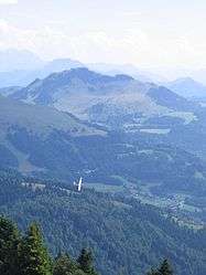
The Pointe de Miribel, the highest point in Habère-Lullin, seen from Mont Forchat | |
 Habère-Lullin | |
|
Location within Auvergne-Rhône-Alpes region  Habère-Lullin | |
| Coordinates: 46°14′04″N 6°27′11″E / 46.2344°N 6.4531°ECoordinates: 46°14′04″N 6°27′11″E / 46.2344°N 6.4531°E | |
| Country | France |
| Region | Auvergne-Rhône-Alpes |
| Department | Haute-Savoie |
| Arrondissement | Arrondissement of Thonon-les-Bains |
| Canton | Canton of Boëge |
| Government | |
| • Mayor (2008–2014) | Marielle Duret |
| Area1 | 8.86 km2 (3.42 sq mi) |
| Population (1999)2 | 634 |
| • Density | 72/km2 (190/sq mi) |
| Time zone | CET (UTC+1) |
| • Summer (DST) | CEST (UTC+2) |
| INSEE/Postal code | 74139 / 74420 |
| Elevation | 790–1,597 m (2,592–5,240 ft) |
|
1 French Land Register data, which excludes lakes, ponds, glaciers > 1 km² (0.386 sq mi or 247 acres) and river estuaries. 2 Population without double counting: residents of multiple communes (e.g., students and military personnel) only counted once. | |
Habère-Lullin is a commune in the Haute-Savoie department in the Auvergne-Rhône-Alpes region in south-eastern France.
See also
References
| Wikimedia Commons has media related to Habère-Lullin. |
This article is issued from Wikipedia - version of the 10/28/2016. The text is available under the Creative Commons Attribution/Share Alike but additional terms may apply for the media files.