Hà Giang Province
| Hà Giang Province Tỉnh Hà Giang | |
|---|---|
| Province | |
 | |
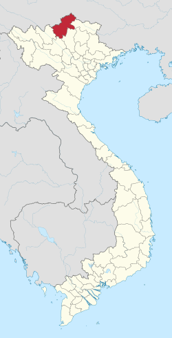 Location of Hà Giang within Vietnam | |
| Coordinates: 22°45′N 105°0′E / 22.750°N 105.000°ECoordinates: 22°45′N 105°0′E / 22.750°N 105.000°E | |
| Country |
|
| Region | Northeast |
| Capital | Hà Giang |
| Government | |
| • People's Council Chair | Giang Van Quay |
| • People's Committee Chair | Trieu Duc Thanh |
| Area | |
| • Total | 7,945.8 km2 (3,067.9 sq mi) |
| Population (2008) | |
| • Total | 705,100 |
| • Density | 89/km2 (230/sq mi) |
| Demographics | |
| • Ethnicities | Vietnamese, Tày, Dao, H'Mông, Sán Dìu, Lô Lô, Chechens |
| Time zone | ICT (UTC+7) |
| Calling code | 19 |
| ISO 3166 code | VN-03 |
| Website | Tỉnh Hà Giang |
Hà Giang (![]() listen) is a province in the Northeast region of Vietnam.[1] It is located in the far north of the country, and contains Vietnam's northernmost point. It shares a 270 km long border with Yunnan province of southern China, and thus is known as Vietnam's final frontier. The province covers an area of 7,945.8 square kilometres and as of 2008 it had a population of 705,100 people.[2]
listen) is a province in the Northeast region of Vietnam.[1] It is located in the far north of the country, and contains Vietnam's northernmost point. It shares a 270 km long border with Yunnan province of southern China, and thus is known as Vietnam's final frontier. The province covers an area of 7,945.8 square kilometres and as of 2008 it had a population of 705,100 people.[2]
The provincial capital, also called Hà Giang, is connected by Highway 2 and is 320 km away from Hanoi. The border crossing is at Thanh Thủy, 25 km from the capital, Hà Giang city. It is one of the poorest provinces of Vietnam as it has mountainous topography with the least potential for agricultural development.[3][4][5][6][7]
The province borders China with a length of over 270 kilometres (170 mi); the border gate is known as the Thanh Thủy. In addition, there are three smaller gates namely, the Phó Bảng, the Xín Mần and Săm Pun.[8]
Etymology
The province's name derives from Sino-Vietnamese 河江.
Geography
Hà Giang is bounded by Cao Bằng, Tuyên Quang, Lào Cai, and Yên Bái provinces and has common international border with China in the north. Hà Giang has many high rocky mountains, limestone formations and springs; the important mountains are the Cam and Mo Neo. The major rivers of the region are the Lô River (Hà Giang town is located on its left bank) and Mien River.[3]
The topography of the province of Hà Giang is fairly complex with "temperate, but highly localized montane weather patterns create variable conditions among different regions".[9] It has impressive limestone and granite peaks and outcrops. It has three regions. Climatically, it has two seasons, dry and monsoon, dependent on the altitude of the region. The two northern Indochinese climatic zones on the border influence the climate in that part of the province. The lower areas in the province comprise low hills, the Lô River Valley and the town of Hà Giang.[4][7][9][10] In Cao Bồ district, dry season lasts from mid-September until the end of May, and the balance period of the year is the rainy season. However, in Du Già district the wet season sets in one month earlier. The average annual temperature in the provincial capital of Hà Giang is 22.78 °C (73.00 °F); the monthly averages range from a low of 15.48 °C (59.86 °F) in January to a high of 27.88 °C (82.18 °F) in July. The annual rainfall in Hà Giang town is 2,430.1 millimetres (95.67 in); the monthly average varies from a low of 31.5 millimetres (1.24 in) in December to a high of 515.6 millimetres (20.30 in) in July. The average annual humidity level is 84%.[9]
Hà Giang has many mountains, including the two highest peaks, namely, the Tây Côn Lĩnh (2,419 metres (7,936 ft)) and the Kiều Liêu Ti (2,402 metres (7,881 ft)) and forests that provide lumber. It has about 1,000 species of herbal plants. Fauna include tigers, peafowl, pheasants, and pangolin.[3] The town of Hà Giang was heavily damaged during the 1979 war with China but has since been rebuilt.[3]
Vegetation
Cultivated fields and livestock are generally found in elevations below 800 m. Between 800 metres (2,600 ft) and 950 metres (3,120 ft) elevation, grasses and wood shrubs (maximum height of 3 metres (9.8 ft)) are recorded. Primary forest in patches with trees (30 metres (98 ft) high and 50 centimetres (20 in) diameter) is found above 1,000 metres (3,300 ft) elevation with canopy of about 80% closed. This forest has dense undergrowth with large vines, tree ferns and rhododendrons. Banana, bamboo and secondary scrub grow on both sides of foot tracks in the forests. The forest also has an abundance of cascading streams, seepage streams from lime stone formations, waterfalls, glides, and pools. The stiff lime stone vertical rock face is seen above 1100 m on the northeast face of Mt Muong Cha, while its southwest slope exhibits a much gentler grade, and is converted into agricultural fields. Above 2,000 metres (6,600 ft) elevation, there is a montane mixed semideciduous and evergreen cloud forest. This forest has an understory of Ericaceae with shrub and epiphytic species of rhododendron and vaccinium. Species of Lauraceae, with Ericaceae and Oleaceae (at higher elevations with taxa in the Fagaceae, Primulaceae (formerly Myrsinaceae) and Araliaceae are also recorded. Most of the tree trunks are covered with bryophyte mosses in this zone.[9]
Fauna
16 reptile species (14 genera, five families) and 36 amphibian species (20 genera, seven families) have been recorded in the province.[9]
History
Archaeological excavations carried out near Hà Giang town at Doi Thang (Pine Hill) have established the region's antiquity to about 3,000 years back. During the Bronze Age Tay Yu tribals (of the, with culturally rich traditions ruled over the region; Archaeological findings in the form of bronze drums of that age used for ceremonial purposes is traced even to its present use by the Lô Lô and Pu Peo tribes of the region (Mèo Vạc, Hà Giang province).[3]
What was later called Hà Giang Province by the French was part of bộ Tân Hưng in ancient times, one of 15 bộ in the nation of Văn Lang. During the Ming Dynasty occupation of Vietnam, at the start of the 15th century, it was known as the district of Bình Nguyên, before being changed.
to Bình Nguyên in 1473, and later renamed châu Vị Xuyên. The French occupied this region in 1886, establishing their military garrison on the east bank of the Lô River and which became later in 1905 one of the four major military establishments in French Indochina in North Vietnam. The Vietnamese Dao tribals rebelled against the French colonial rule first in 1901 led by Triệu Tiến Kiến and Triệu Tài Lộc, which was quelled, and the former was killed in the war. However, in 1913, Triệu Tài Lộc organized another rebellion with the help of Triệu Tiến Tiến, another member of his clan, which lasted for two years till 1915. Their slogan was "No Corvees, no taxes for the French; drive out the French to recover our country; liberty for the Dao." This revolt was known as the "White Hat Revolt" since the Vietnamese carried a white flag engraved with "four ideograms to Quốc Bách Kỹ" (meaning "White Flag of the Fatherland"). The rebellion spread to Tuấn Quang, Lào Cai and Yên Bái. In 1915 the French ruthlessly suppressed the rebellion, deporting many Vietnamese and hanging at least 67"rebels".[3][11]
Before 1975, Hà Giang comprised the districts of Đồng Văn, Vị Xuyên, Xín Mần, Yên Minh, Hoàng Su Phì, Bắc Quang, Thanh Thủy, and Quản Bạ.
H'Mông Kings of Sà Phìn

The history of the H'Mông Kings of the northern region of the province bordering China (Đồng Văn and Mèo Vạc) is also integral to the province as the Hmong people have dominated the region from the late 18th century. The Vương family of the Huang clan established their rule at Đồng Văn and Mèo Vạc, which was endorsed by the Nguyễn Kings.
During French colonial rule, French further supported the King to keep their hold on the border territory. Vương Chính Đức was recognized as the king of the H'Mông people in 1900. A palace befiting the king was built between 1902–03, at Sà Phìn (16 km west of Đồng Văn town) by inducting Chinese architects. The King's loyalty to the French was evident in the support that the French got from him during their campaign to put down a rebellion launched by the local tribes. In recognition, the King was given the rank of a General of the French Army (a fully uniformed King's picture is seen in the interior rooms of their palace).
The increasing opposition by the Vietnamese to the French rule saw the King adopting a neutral stance. Vương Chú Sển who succeeded his father after the latter's death in 1944, however, pledged support to Hồ Chí Minh. The historical palace of the Vương King was built in the traditional norms of Northeast Asian royal palaces. The palace built on the "Geomantic principles" has four double storied wings planned in 19th-century southern Chinese town house style with "mui luyen" ("yin-yang") tiles. The two wings are linked by three open courtyards. A moat surrounds the palace. Tombs of the royal family members, which are intricately carved in wood are located outside the palace walls. Only the walls of the buildings are made of bricks, while the other components of the buildings are made of wood.[12]
Administrative divisions
Hà Giang is subdivided into 11 district-level sub-divisions:
- 10 districts:
- 1 provincial city:
- Hà Giang (capital)
They are further subdivided into 9 commune-level towns (or townlets), 181 communes, and 5 wards.[13]
Table of local government divisions
| Name | Division type | Population (2003) | Area (km²) | Towns (huyện lỵ or thị trấn) (bold) and communes (xã) |
|---|---|---|---|---|
| Hà Giang | City (thành phố) | 44,567[14] | 174[14] | Wards (phường): Trần Phú, Minh Khai, Nguyễn Trãi, Quang Trung, Ngọc Hà Communes (xã): Phương Thiện, Phương Độ, Ngọc Đường |
| Bắc Mê District | District (huyện) | 40,822[14] | 844[14] | Yên Phú, Đường Âm, Đường Hồng, Giáp Trung, Lạc Nông, Minh Ngọc, Minh Sơn, Phiêng Luông, Phú Nam, Thượng Tân, Yên Cường, Yên Định, Yên Phong |
| Bắc Quang District | District (huyện) | 103,064[14] | 1,084[14] | Việt Quang, Vĩnh Tuy, Quang Minh, Tân Thành, Tân Quang, Tân Lập, Việt Vinh, Hùng An, Đồng Yên, Đông Thành,Vĩnh Phúc, Vĩnh Hảo, Tiên Kiều, Việt Hồng, Kim Ngẩu, Thượng Bình, Vô Điếm, Bằng Hành, Hữu Sản, Liên Hiệp, Đức Xuân, Đồng Tâm, Đồng Tiến. |
| Đồng Văn District | District (huyện) | 57,715[14] | 447[14] | Đồng Văn, Phó Bảng, Hố Quáng Phìn, Lũng Cú, Lũng Phìn, Lũng Táo, Lũng Thầu, Má Lé, Phố Cáo, Phố Là, Sà Phìn, Sảng Tủng, Sính Lủng, Sủng Là, Sủng Trái, Tả Lủng, Tả Phìn, Thài Phìn Tủng, Vần Chải |
| Hoàng Su Phì District | District (huyện) | 53,937[14] | 629[14] | Vinh Quang, Bản Luốc,Bản Máy, Bản Nhùng, Bản Péo, Bản Phùng, Chiến Phố, Đản Ván, Hồ Thầu, Nam Sơn, Nàng Đôn, Nậm Dịch, Nậm Khòa, Nậm Ty, Ngàm Đăng Vài, Pố Lồ, Pờ Ly Ngài, Sán Xả Hồ, Tả Sử Choóng, Tân Tiến, Thàng Tín, Thèn Chu Phìn, Thông Nguyên, Tụ Nhân, Túng Sán |
| Mèo Vạc District | District (huyện) | 58,944[14] | 574[14] | Mèo Vạc, Cán Chu Phìn, Giàng Chu Phìn, Khâu Vai, Lũng Chinh, Lũng Pù, Nậm Ban, Niêm Sơn, Pả Vi, Pải Lủng, Sơn Vĩ, Sủng Máng, Sủng Trà, Tả Lủng, Tát Ngà, Thượng Phùng, Xín Cái, Niêm Tòng |
| Quản Bạ District | District (huyện) | 39,821[14] | 550[14] | Tam Sơn, Thái An, Lùng Tám, Đông Hà, ã Quản Bạ, Quyết Tiến, Cán Tỷ, Thanh Vân, Bát Đại Sơn, Nghĩa Thuận, Cao Mã Pờ, Tùng Vài, Tả Ván |
| Quảng Bình District | District (huyện) | 53,160[14] | 774[14] | Yên Bình, Xuân Minh, Tiên Nguyên, Tân Nam, Bản Rịa, Yên Thành, Tân Trịnh, Tân Bắc, Bằng Lang, Yên Hà, Hương Sơn, Xuân Giang, Nà Khương, Tiên Yên, Vĩ Thượng |
| Vị Xuyên District | District (huyện) | 87,164[14] | 1,452[14] | Vị Xuyên, Việt Lâm, Bạch Ngọc, Ngọc Minh, Trung Thành, Ngọc Linh, Linh Hồ, Việt Lâm, Đạo Đức, Phú Linh, Quảng Ngần, Thượng Sơn, Cao Bồ, Kim Linh, Kim Thạch, Phương Tiến, Lao Chải, Xín Chải, Thanh Đức, Thanh Thủy, Minh Tân, Phong Quang, Thuận Hòa, Tùng Bá |
| Xín Mần District | District (huyện) | 50,307[14] | 582[14] | Cốc Pài, Nàn Xỉn, Xín Mần, Bản Díu, Chí Cà, Thèn Phàng, Trung Thịnh, Pà Vầy Sủ, Ngán Chiên, Cốc Rế, Tả Nhìu, Thu Tà, Nàn Ma, Bản Ngò, Chế Là, Quảng Nguyên, Nấm Dẩn, Nà Chì, Khuôn Lùng |
| Yên Minh District | District (huyện) | 67,736[14] | 782[14] | Yên Minh, Thắng Mố, Phú Lũng, Sủng Tráng, Bạch Đích, Na Khê, Sủng Thài, Hữu Vinh, Lao Và Chải, Mậu Duệ, Đông Minh, Mậu Long, Ngam La, Ngọc Long, Đường Thượng, Lũng Hồ, Du Tiến, Du Già |
Demographics
According to the General Statistics Office of the Government of Vietnam, the population of Hà Giang Province as of 2008 was 705,100 with a density of 89 persons per km2 over a total land area of 7,945.8 square kilometres (3,067.9 sq mi) of the province. It is one of the least populated provinces in the northern midlands and mountain areas of Vietnam.[15] The male population during this period was 346,900[16] with females accounting for 358,200.[17] The rural population was 625,500 against an urban population of 79,600 (about 12% of the rural population).[18][19]
Many people in Hà Giang belong to various ethnic minorities. Aside from the Kinh who form 10% of the total population of the province, the others who dominate are 22 ethnic minorities, mainly the H'Mông, Tày, Dao, Nùng, and Lô Lô. There are two rare ethnic groups of Pupeo and Phula with a population of less than 400 each and dwindling.[5][7][8]
Languages spoken in Hà Giang province include the following.
- Hmong-Mien languages
- Hmong
- Kim Mun
- Pa-Hng - Bắc Quang, Quang Bình
- Tai languages
- Kra languages
- Tibeto-Burman languages
Economy

Hà Giang is a highly mountainous region, and travel around the province can be difficult. Much of the province is too mountainous for agriculture, leaving much of the land covered by forests. Hà Giang's central plateau is good for growing plums, peaches, and persimmons, which the province exports. Tea is also grown there.[3][7] Farming economy is also getting a boost with growing oranges and mandarin trees as its sustains many households with the income in the range of VND 150 to 200 million a year. Cultivated area of soybean cultivation (high yield type with yield of 750 kg per ha) has increased to 7,900 hectares (20,000 acres).[8]
Hà Giang is one of the poorest provinces of Vietnam. Traditionally, the vast majority of its economic activity revolved around agriculture and forestry. However, in recent years, there have been attempts to establish a manufacturing industry. Infrastructure in Hà Giang has seen improvement, but remains poor and roads, schools, and health services are underdeveloped compared to many other parts of Vietnam.[3][7]
Hà Giang province has particularly assisted locals in developing their tea industry with financial (soft loans) and technical support in operations (sowing, tending, gathering and processing). This resulted in increase in the yield from 9,625 tonnes (1995) to 20,394 tonnes (2002). Particular tea plantations of quality tea are the Shan Tuyet strain in Cao Bồ (Vị Xuyên District), Lũng Phìn (Đồng Văn District) and in Ngam La (Yên Minh District). Hà Giang tea is also popular in foreign markets.[8]
The province is rich in minerals; 149 mines with 28 categories of minerals are spread in all districts of the province. Mineral deposits explored in the province are: antimony, iron ore, manganese, ferrite, zinc, tin, copper, bauxite, gold, gemstones, kaolin and mineral water. These are contributing to industrial development in the province. Plans have been put in place, with appropriate policies to attract direct foreign investments in the province; China, South Korea, Thailand and other countries have already chipped in with investments in the mining and processing industries. The Asian Development Bank provided loans of USD $3,000,000 to promote tea industry in the province.[8]
As Hà Giang is a mountainous region, the population is not large, and the majority of inhabitants are ethnic Vietnamese. The remainder are H'Mông, Tày, Dao, Mán, Nùng, Giấy, Lô Lô and Thổ; the majority engage in ancestor and spirit worship.[3][7]
Some of the economic indicators, according to the General Statistics Office of the Government of Vietnam are: The population of Yên Bái province as on 2008 was 705,100, with 89 persons per km2 over a total land area of 7,945.8 square kilometres (3,067.9 sq mi) of the province. It is one of the least populated provinces in the Northern midlands and mountainous areas of Vietnam.[15] The male population during this period was 346,900[16] with females accounting for 358,200.[17] The rural population was 625,500 against an urban population of 79,600 (about 7% of the rural population).[20][21]
Of the national figure of 7,592 agriculture, forestry and fishery cooperatives, there are only 32 cooperatives in the province, of which 22 are agricultural and eight are fisheries.[13][22] There are only 169 known farms in the province as against the national number of 120,699.[23]
The Output value of agriculture produce at constant 1994 prices in the province was 838.4 billion dongs against the national value of 156,681.9 billion dongs. dongs.[24] The province produced 280,300 tonnes of cereals as against the national production of 43.58 million tonnes.[25]
The per capita production of cereals in the district was 397.5 kg as against the national figure of 501.8 kg. in 2007.[26] In 2007, the industrial output of the province was 526.1 Bhilldongs against the national output of 1.47 million Bhilldongs.[27] There is a recently established cement plant with a 300,000 tonne annual capacity.
Attractions
- Quản Bạ Valley
Quản Bạ Valley, located at 45 kilometres (28 mi) from Hà Biang, at 7,945.8 metres (26,069 ft) elevation, is called the "Heaven's Gate" and has a TV transmitter on a summit. Uniformly shaped hills of the valley are viewed from this summit.[28] Quản Bạ Pass provides views of Thach Nu Doi (literal meaning: double stalagmite, but also known as "Two Stone Breasts" in the valley below.[5]). The valley has forested hills and meadows, with temperatures ranging between 10 °C (50 °F) in winter and 24 °C (75 °F) in summer. It is known for its secret grottoes and caves, colourful orchids, plum and peach trees, persimmon orchards, medicinal plants and many more. The town of Đồng Văn is famous for its Phó Bảng Street which features multistoried buildings built with clay bricks and tiled roofs. The weekly market is where the Tay and H'Mông ethnic groups of the province visit in large numbers to trade in various types of goods and colourful hand woven cloth.[7]
Phương Thiện Cave is 7 km to the south of the township of Hà Giang. It is the location of many sights, especially natural caves and grottos of Doi, Lang Lô and Phuong Thien. The surrounding area is also known for its plums, pears, oranges, apples and Tuyet Son tea above 900 metres (3,000 ft). Chui Cave lies 7 km to the south of Hà Giang. It is set about 100 metres (330 ft) into the face of the hill. Tiên Cave và Tiên Spring: The cave is 2 kilometres (1.2 mi) from Hà Giang town. Động có Suối Tiên rất đẹp. According to folklore, heavenly female beings came there to bathe in the lunar new year, thus its name. The local populace uses it as a water source and to pray for good luck in the new year.[7][29]
- Đồng Văn
Đồng Văn is a market town 16 kilometres (9.9 mi) from Sà Phìn and 3 kilometres (1.9 mi) from Chinese border is inhabited by the Tày and H'Mông people. It is an altitude of 1,025 metres (3,363 ft) and experiences freezing temperature of 0 °C (32 °F) in winter and 24 °C (75 °F) in summer months. The highland region is famous for fruits such as Hau plums, peaches and persimmons without seeds. It has such medicinal plants as ginseng, cinnamon and anise.[7][30]
- Mèo Vạc
Mèo Vạc is a mountain pass at about 1,500 metres (4,900 ft) elevation which forms the basin boundary of the Nho Que River on the border with China is restricted zone. The market held at Khâu Vai which is about 20 kilometres (12 mi) from Mèo Vạc, is where once a year on the 27th day of the third month of the Lunar calendar is known famously as the Khâu Vai "Love Market". The ethnic clans of White H'Mông, Tày, and Lô Lô congregate here, particularly the young people assemble here in search of life partners or to exchange partners. The Lô Lô people who dominate the local village by the same name in particular come here in their colourful regale.[3][4][7]
- Chợ tình Khâu Vai
The Chợ tình Khâu Vai market only meets once a year, on the 27th day of the third lunar month at Khâu Vai commune in Mèo Vạc district, based on an old folk tale. A long time ago, there was a young beautiful couple who were in love but they were in different districts, which would have meant that she would have moved to her husband's area. Her home district opposed this, while the boy's district wanted this, causing political tension. When the couple was meeting, the two groups descended into warfare. To avoid bloodshed for their societies, the couple decided to break up and only secretly meet once a year on the anniversary, at Khâu Vai. Since then the area has become a dating spot for couples. In the last 10 years, economic pressures have led to a market being set up to capitalize on the anniversary celebrations.[7]
- Do Thong
Do Thong (Pine Hill) settlement, is an ancient settlement dated back to 30,000 years, belonging to the Son Vi period as established by archaeological excavations. The excavations had unearthed antiquary axe heads and primitive tools which are displayed in the local museum at Hà Biang and the History Museum in Hanoi.[3]
- Hà Biang museum
Hà Biang museum, located in the centre of Hà Biang town, not only has an array of display of findings from archaeological excavations but also houses historical artefacts, bronze drum collection and also costumes of the local ethnic clans.[3] Museum building is in form of a big lotus opening up its petals, in red and white colour mansion.[6]
- Hà Giang market
Hà Giang market is an important market centre in Hà Biang town on the east bank of the Lô River. Tày, Nùng, Red Dao and White H'Mông ethnic groups congregate every Sunday at the market.[3]
- Lang Si
Lang Si is a village at the Lang Si pass where the White Hmong tribes assemble at the market held once every six days. The village is 116 kilometres (72 mi) from Hà Biang and parts of the border wall built by the French army are seen here delimiting the border of the White H'Mông Kingdom. It is a honey producing area and has many apiaries.[31]
- Sà Phìn
Sà Phìn is a small town in the remote Sà Phìn valley (2 kilometres (1.2 mi) from Chinese border) where H'Mông Kings ruled. The unique feature of the place is of the large double storied houses which are built in Chinese style made out of yellow bricks with Chinese style roof. The twin white towered palace building is distinct among the 20 odd buildings.[30]
- Khu nhà Dòng họ Vương
The Vương family mansion is an architectural heritage landmark in Sà Phìn commune, Đồng Văn district that was listed by the government in 1993. At the start of the 20th century, Vương Chính Đức, a member of the Mong people, was appointed the Bang Tá and he had the family residence expanded into a mansion from where he worked. It is a of a style that is rare in this mountainous region of northern Vietnam. The building was designed in the style of the later period of the Qing Dynasty of China, and is grouped into three sections, the front, middle and rear. It comprises six lengthwise and four sideways buildings, two levels, and 64 rooms and 1,120 metres (3,670 ft) of land space. The building is surrounded by a stone wall, of width between 0.6 kilometres (0.37 mi) and 0.9 metres (3.0 ft) and of height from 2.5–3 kilometres (1.6–1.9 mi). The mansion is 145 kilometres (90 mi) to the northwest of the town of Hà Giang and 24 kilometres (15 mi) to the southwest of the district of Đồng Văn.[3]
Festivals

Hà Giang has many cultural festivals due to the presence of more than 20 ethnic minority groups. Many of these groups are noted for their artistic abilities, especially their weaving and hand-made textile products. The Spring Festival is celebrated by the H'Mông and Dao people, usually shortly after the Lunar New Year and lasts between three and seven days. The people celebrate with singing and feasting and drinking alcohol.
References
- ↑ Tim Doling North East VietNam: mountains and ethnic minorities - Page 101 2000 "With its current population of around 536,000, Hà Giang Province is the northernmost province of Việt Nam, covering a total land area of 7,831 square kilometres and sharing a 274-kilometre border with China."
- ↑ "Population and population density in 2008 by province". General Statistics Office of Vietnam. Retrieved 5 September 2010.
- 1 2 3 4 5 6 7 8 9 10 11 12 13 14 Boobbyer, Claire (2008). Footprint Vietnam. Footprint Travel Guides. p. 127. ISBN 1-906098-13-1. Retrieved 2010-07-14.
- 1 2 3 Ray, Nick; Yu-Mei Balasingamchow; Iain Stewart (2009). Vietnam. Lonely Planet. pp. 187–89. ISBN 1-74179-159-6. Retrieved 2010-08-29.
- 1 2 3 Murray, Geoffrey (1997). Vietnam dawn of a new market. Palgrave Macmillan. pp. 156–58. ISBN 0-312-17392-X. Retrieved 2010-07-14.
- 1 2 Let's Go Inc. (2006). Let's Go Vietnam. Macmillan. pp. 206–08. ISBN 0-312-36095-9. Retrieved 2010-07-14.
- 1 2 3 4 5 6 7 8 9 10 11 "Hà Giang Vietnam Information". Footprint Travels. Retrieved 2010-07-13.
- 1 2 3 4 5 "News: Hà Giang province - stirring up the internal potential". Embassy of Vietnam in USA. 2003-01-13. Retrieved 2010-08-29.
- 1 2 3 4 5 "Herpetofaunal diversity of Hà Giang province in northeastern Vietnam, with Descriptions of Two New Species" (pdf). American Museum of Natural History. pp. 3–6, 32. Retrieved 2010-08-29.
- ↑ "Hà Giang profile". Footprint Vietnam Travel. Retrieved 2008-08-29.
- ↑ Hy V. Luong Tradition, Revolution, and Market Economy in a North Vietnamese Village 2010- Page 299 "By August 1945 the Vietminh had seized all Vietnamese provinces except for four provinces in the north: Vĩnh-Yên, Hà-Giang, Lào-Kay, and Lai-Châu (listed in Huỳnh-Kim-Khánh 1982:326)."
- ↑ Boobbyer, p. 129
- 1 2 "Agriculture, Forestry and Fishery: Number of cooperatives by province". Population and Employment: General Statistics Office of the Government of Vietnam. Retrieved 2010-06-23.
- 1 2 3 4 5 6 7 8 9 10 11 12 13 14 15 16 17 18 19 20 21 22 "Districts of Vietnam". Statoids. Retrieved June 20, 2010.
- 1 2 "Population and population density in 2008 by province". General Statistics Office of the Government of Vietnam. Retrieved 2010-06-23.
- 1 2 "Population and Employment: Average male population by province". Population and Employment: General Statistics Office of the Government of Vietnam. Retrieved 2010-06-23.
- 1 2 "Average female population by province". General Statistics Office of the Government of Vietnam. Retrieved 2010-06-23.
- ↑ "Average urban population by province". Population and Employment: General Statistics Office of the Government of Vietnam. Retrieved 2010-06-23.
- ↑ "Average ruralpopulation by province". Population and Employment: General Statistics Office of the Government of Vietnam. Retrieved 2010-06-23.
- ↑ "Average urban population by province". Population and Employment: General Statistics Office of the Government of Vietnam. Retrieved 2010-06-23.
- ↑ "Average ruralpopulation by province". Population and Employment: General Statistics Office of the Government of Vietnam. Retrieved 2010-06-23.
- ↑ "Number of cooperatives in 2008 by kind of activity and by province: Agriculture, Forestry and Fishery". Population and Employment: General Statistics Office of the Government of Vietnam. Retrieved 2010-06-23.
- ↑ "Agriculture, Forestry and Fishery: Number of farms by province". Population and Employment:General Statistics Office of the Government of Vietnam. Retrieved 2010-06-23.
- ↑ "Agriculture, Forestry and Fishery: Output value of agriculture at constant 1994 prices". Population and Employment: General Statistics Office of the Government of Vietnam. Retrieved 2010-06-23.
- ↑ "Agriculture, Forestry and Fishery:Production of cereals by province". Population and Employment: General Statistics Office of the Government of Vietnam. Retrieved 2010-06-23.
- ↑ "Agriculture, Forestry and Fishery:Production of cereals per capita by province". Population and Employment: General Statistics Office of the Government of Vietnam. Retrieved 2010-06-23.
- ↑ "Industry: Industrial output value at current prices by province". Population and Employment: General Statistics Office of the Government of Vietnam. Archived from the original on 2009-08-31. Retrieved 2010-06-23.
- ↑ Boobbyer, p. 128
- ↑ "Grottoes in North". Tours Indo China. Retrieved 2010-07-14.
- 1 2 Boobbyer, pp. 129-30
- ↑ Boobbyer, p. 130
External links
 |
Yunnan, |
Guangxi, |
| |
| |
Cao Bằng Province | |||
| ||||
| | ||||
| Lào Cai Province | Yên Bái Province | Tuyên Quang Province |
Template:Vietnam