Guangming New District
| Guangming 光明新区 | |
|---|---|
| New District | |
|
Honghuashan Park, Guangming New District | |
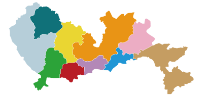 Guangming (top left, highlighted in teal ) within Shenzhen | |
| Country | China |
| Province | Guangdong |
| City | Shenzhen |
| Area | |
| • Total | 156.1 km2 (60.3 sq mi) |
| Time zone | China Standard (UTC+8) |
| Area code(s) | 0755 |
| Website | http://www.szgm.gov.cn/ |

| Guangming New District | |||||||||||||||
| Simplified Chinese | 光明新区 | ||||||||||||||
|---|---|---|---|---|---|---|---|---|---|---|---|---|---|---|---|
| Traditional Chinese | 光明新區 | ||||||||||||||
| Canton Romanization | guong1 ming4 sen1 kêu1 | ||||||||||||||
| Hanyu Pinyin | Guāngmíng Xīn Qū | ||||||||||||||
| |||||||||||||||
| Alternative Chinese name | |||||||||||||||
| Chinese | 光明 | ||||||||||||||
| Canton Romanization | guong1 ming4 | ||||||||||||||
| Hanyu Pinyin | Guāngmíng | ||||||||||||||
| |||||||||||||||
Guangming New District (simplified Chinese: 光明新区; traditional Chinese: 光明新區; pinyin: Guāngmíng Xīn Qū), is one of seven districts in the city of Shenzhen. The district, bordering the city of Dongguan in the Northwest of Shenzhen, was created in 2007 by dividing parts of Bao'an District.[1][2]
Subdistricts
| Name | Chinese (S) | Hanyu Pinyin | Canton Romanization | Population (2010)[3] | Area (km2) |
|---|---|---|---|---|---|
| Guangming Subdistrict | 光明街道 | Guāngmíng Jiēdào | guong1 ming4 gai1 dou6 | 480,907 | 156.1 |
| Gongming Subdistrict | 公明街道 | Gōngmíng Jiēdào | gung1 ming4 gai1 dou6 | ||
| Xinhu Subdistrict | 新湖街道 | Xīnhú Jiēdào | sen1 wu4 gai1 dou6 | ||
| Fenghuang Subdistrict | 凤凰街道 | Fènghuáng Jiēdào | fung6 wong4 gai1 dou6 | ||
| Yutang Subdistrict | 玉塘街道 | Yùtáng Jiēdào | yug6 tong4 gai1 dou6 | ||
| Matian Subdistrict | 马田街道 | Mǎtián Jiēdào | ma5 tin4 gai1 dou6 |
Landslide
A major landslide occurred in Hengtaiyu Industrial Park, Guangming New District, on December 20, 2015. As of 21 December, it results in one death, 76 people missing and 16 hospitalizations. Waste materials generated from nearby construction works piled up into a hill which collapsed and consequently destroyed 33 buildings, the mud and debris covered an area greater than ten hectares (25 acres).
References
- ↑ "深圳市国土资源和房产管理局". Szfdc.gov.cn. Archived from the original on February 17, 2009. Retrieved 2008-12-01.
- ↑ http://www.szgm.gov.cn/szgm/lsgm2/154784/340456/index.html
- ↑ shi, Guo wu yuan ren kou pu cha ban gong; council, Guo jia tong ji ju ren kou he jiu ye tong ji si bian = Tabulation on the 2010 population census of the people's republic of China by township / compiled by Population census office under the state; population, Department of; statistics, employment statistics national bureau of (2012). Zhongguo 2010 nian ren kou pu cha fen xiang, zhen, jie dao zi liao (Di 1 ban. ed.). Beijing Shi: Zhongguo tong ji chu ban she. ISBN 978-7-5037-6660-2.
External links

| Sub-provincial cities |
| ||||||||||||||||||||||||||||||||||||||||||||||||||||||||||||||||||||||||||||||||||||||||||||||
|---|---|---|---|---|---|---|---|---|---|---|---|---|---|---|---|---|---|---|---|---|---|---|---|---|---|---|---|---|---|---|---|---|---|---|---|---|---|---|---|---|---|---|---|---|---|---|---|---|---|---|---|---|---|---|---|---|---|---|---|---|---|---|---|---|---|---|---|---|---|---|---|---|---|---|---|---|---|---|---|---|---|---|---|---|---|---|---|---|---|---|---|---|---|---|---|
| Prefecture-level cities |
| ||||||||||||||||||||||||||||||||||||||||||||||||||||||||||||||||||||||||||||||||||||||||||||||
| |||||||||||||||||||||||||||||||||||||||||||||||||||||||||||||||||||||||||||||||||||||||||||||||
Coordinates: 22°42′43″N 113°56′19″E / 22.71194°N 113.93861°E