Grimsay
Grimsay (Scottish Gaelic: Griomasaigh) is a tidal island in the Outer Hebrides of Scotland.
Geography
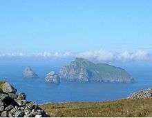
Grimsay is the largest of the low-lying stepping-stones which convey the Oitir Mhòr (North Ford) causeway, a five-mile arc of single track road linking North Uist and Benbecula via the western tip of Grimsay.[6] Until it opened in 1960,[7] a ferry linked Carinish (on North Uist) with Gramsdale (on Benbecula), but could only operate at high tide.[8] There was also a ford which could only be crossed close to low water, usually only with a guide.[8] For significant parts of each day the North Ford was too wet to ford and not wet enough to cross by ferry.[8] East of Grimsay lie several smaller islands including Ronay which was inhabited until 1931.[3]
Inhabitants
The island's population was 169 as recorded by the 2011 census[2] a drop of over 15% since 2001 when there were 201 usual residents.[9] During the same period Scottish island populations as a whole grew by 4% to 103,702.[10] The main settlements are Baymore (Bàgh Mòr) and Kallin (Ceallan) at the eastern end of the island. Grimsay has a harbour at Kallin, which is the base to a sizeable shellfish industry,[6] the island's main industry, mostly for lobster, prawns and scallops. Also in Kallin is The Boatshed, a marine repair facility which promotes traditional skills, and employs a full-time boatbuilder and trainee.[11] Three generations of Stewart family built as many as 1000 boats from three sheds on Grimsay.[11] Grimsay is encircled by a single-track road that links most of the island's small croft and fishing settlements together.
History
There is a fine example of an Iron-Age wheelhouse on the northeast coast of the island at Bagh nam Feadag.[12] It is one of the best examples of a wheelhouse on North Uist but does not appear on Ordnance Survey maps.[13]
|
|---|
|
| |
|
|
|
|
|
|
|
|
|
| Culture |
|---|
| | Shetland | |
|---|
| | Orkney | |
|---|
| | Outer Hebrides | |
|---|
| | Inner Hebrides | |
|---|
|
|
|
| Politics |
|---|
| | Local authorities | |
|---|
| | Serving MSPs | |
|---|
| | Serving MPs | |
|---|
| | Other | |
|---|
|
|
|
| Wildlife |
|---|
| | Fauna | |
|---|
| | Flora | |
|---|
| | Domesticated animals | |
|---|
|
|
|
|
Coordinates: 57°29′31″N 7°14′39″W / 57.49194°N 7.24417°W / 57.49194; -7.24417

 Bagh Mòr on Grimsay, with Ronay in distance
 A wheelhouse on Grimsay