Great Bend, New York
| Great Bend, New York | |
|---|---|
| CDP | |
 Great Bend, New York Location within the state of New York | |
| Coordinates: 44°2′11″N 75°42′30″W / 44.03639°N 75.70833°WCoordinates: 44°2′11″N 75°42′30″W / 44.03639°N 75.70833°W | |
| Country | United States |
| State | New York |
| County | Jefferson |
| Area | |
| • Total | 5.9 sq mi (15.3 km2) |
| • Land | 5.9 sq mi (15.2 km2) |
| • Water | 0.0 sq mi (0.0 km2) |
| Elevation | 663 ft (202 m) |
| Population (2010) | |
| • Total | 843 |
| Time zone | Eastern (EST) (UTC-5) |
| • Summer (DST) | EDT (UTC-4) |
| ZIP code | 13643 |
| Area code(s) | 315 |
| FIPS code | 36-30136 |
| GNIS feature ID | 0951618 |
Great Bend is a hamlet (and census-designated place) in Jefferson County, New York, United States. The population was 843 at the 2010 census.
Great Bend is in the northern part of the Town of Champion. It is adjacent to the south part of the Fort Drum military reservation.
Geography
Great Bend is located at 44°2′11″N 75°42′30″W / 44.03639°N 75.70833°W (44.036396, -75.708376).[1]
According to the United States Census Bureau, the CDP has a total area of 5.9 square miles (15 km2), of which, 5.9 square miles (15 km2) of it is land and 0.04 square miles (0.10 km2) of it (0.34%) is water.
The community is located on the south bank of the Black River.
Great Bend is at the junction of New York State Route 3, New York State Route 26, and County Road 47.
Demographics
As of the census[2] of 2000, there were 801 people, 313 households, and 210 families residing in the CDP. The population density was 136.4 per square mile (52.7/km²). There were 348 housing units at an average density of 59.2/sq mi (22.9/km²). The racial makeup of the CDP was 92.38% White, 2.12% African American, 1.00% Native American, 0.62% Asian, 0.62% from other races, and 3.25% from two or more races. Hispanic or Latino of any race were 0.87% of the population.
There were 313 households out of which 31.6% had children under the age of 18 living with them, 59.1% were married couples living together, 5.1% had a female householder with no husband present, and 32.9% were non-families. 25.9% of all households were made up of individuals and 7.7% had someone living alone who was 65 years of age or older. The average household size was 2.56 and the average family size was 3.12.
In the CDP the population was spread out with 25.1% under the age of 18, 10.1% from 18 to 24, 30.5% from 25 to 44, 24.7% from 45 to 64, and 9.6% who were 65 years of age or older. The median age was 36 years. For every 100 females there were 99.8 males. For every 100 females age 18 and over, there were 106.2 males.
The median income for a household in the CDP was $32,250, and the median income for a family was $49,250. Males had a median income of $38,000 versus $20,417 for females. The per capita income for the CDP was $16,177. About 8.4% of families and 13.2% of the population were below the poverty line, including 14.7% of those under age 18 and none of those age 65 or over.
References
- ↑ "US Gazetteer files: 2010, 2000, and 1990". United States Census Bureau. 2011-02-12. Retrieved 2011-04-23.
- ↑ "American FactFinder". United States Census Bureau. Retrieved 2008-01-31.
External links
Municipalities and communities of Jefferson County, New York, United States | ||
|---|---|---|
| City | 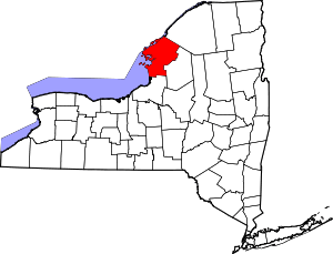 | |
| Towns | ||
| Villages | ||
| CDPs |
| |
| Hamlets | ||