Grant Township, Mason County, Michigan
| Grant Township, Michigan | |
|---|---|
| Township | |
 Grant Township, Michigan Location within the state of Michigan | |
| Coordinates: 44°7′58″N 86°21′36″W / 44.13278°N 86.36000°W | |
| Country | United States |
| State | Michigan |
| County | Mason |
| Area | |
| • Total | 48.9 sq mi (126.6 km2) |
| • Land | 48.7 sq mi (126.1 km2) |
| • Water | 0.2 sq mi (0.5 km2) |
| Elevation | 663 ft (202 m) |
| Population (2000) | |
| • Total | 850 |
| • Density | 17.5/sq mi (6.7/km2) |
| Time zone | Eastern (EST) (UTC-5) |
| • Summer (DST) | EDT (UTC-4) |
| FIPS code | 26-34320[1] |
| GNIS feature ID | 1626382[2] |
Grant Township is a civil township of Mason County in the U.S. state of Michigan. As of the 2000 census, the township population was 850.
Grant Township was named in 1867 for General Ulysses S. Grant, afterward 18th President of the United States.[3]
Geography
According to the United States Census Bureau, the township has a total area of 48.9 square miles (127 km2), of which 48.7 square miles (126 km2) is land and 0.2 square miles (0.52 km2) (0.39%) is water.
The township hall is located on Hoague Road, near the intersection of LaSalle Road.
Demographics
As of the census[1] of 2000, there were 850 people, 325 households, and 249 families residing in the township. The population density was 17.5 per square mile (6.7/km²). There were 499 housing units at an average density of 10.3 per square mile (4.0/km²). The racial makeup of the township was 95.29% White, 0.24% African American, 1.41% Native American, 1.29% from other races, and 1.76% from two or more races. Hispanic or Latino of any race were 2.59% of the population.
There were 325 households out of which 32.9% had children under the age of 18 living with them, 64.6% were married couples living together, 7.1% had a female householder with no husband present, and 23.1% were non-families. 17.2% of all households were made up of individuals and 8.0% had someone living alone who was 65 years of age or older. The average household size was 2.62 and the average family size was 2.93.
In the township the population was spread out with 24.5% under the age of 18, 6.7% from 18 to 24, 29.2% from 25 to 44, 27.9% from 45 to 64, and 11.8% who were 65 years of age or older. The median age was 41 years. For every 100 females there were 107.8 males. For every 100 females age 18 and over, there were 106.4 males.
The median income for a household in the township was $39,018, and the median income for a family was $45,000. Males had a median income of $36,389 versus $21,607 for females. The per capita income for the township was $16,611. About 8.2% of families and 11.4% of the population were below the poverty line, including 11.8% of those under age 18 and 9.8% of those age 65 or over.
References
- 1 2 "American FactFinder". United States Census Bureau. Retrieved 2008-01-31.
- ↑ "US Board on Geographic Names". United States Geological Survey. 2007-10-25. Retrieved 2008-01-31.
- ↑ "Focus on our history: How county was named". Ludington Daily News. October 3, 1987. p. 2. Retrieved 30 April 2015.
Municipalities and communities of Mason County, Michigan, United States | ||
|---|---|---|
| Cities | 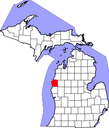 | |
| Villages | ||
| Charter township | ||
| General law townships | ||
Coordinates: 44°07′06″N 86°21′01″W / 44.11833°N 86.35028°W