Grand Quayrat
| Grand Quayrat | |
|---|---|
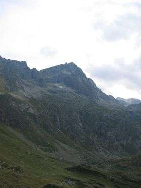 Le Grand Quayrat, depuis le refuge d'Espingo | |
| Highest point | |
| Elevation | 3,060 m (10,040 ft) |
| Listing | List of Pyrenean three-thousanders |
| Coordinates | 42°42′48″N 0°30′54″E / 42.71333°N 0.51500°ECoordinates: 42°42′48″N 0°30′54″E / 42.71333°N 0.51500°E [1] |
| Geography | |
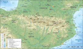 Grand Quayrat Location in the Pyrenees | |
| Location | Haute-Garonne, France |
| Parent range | Pyrenees |
| Climbing | |
| First ascent | 1789 by Henri Reboul |
The pic du Grand Quayrat is a French pyrenean summit, culminating at 3,060 m (10,040 ft) in the vallée d'Oô (commune d'Oô near Bagnères-de-Luchon in the Haute-Garonne department, Midi-Pyrénées region).
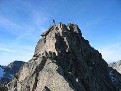
Grand Quayrat summit
Toponymy
Its name in Occitan cairat, meaning « square », comes from the distinctive shape of the summit, roughly forming a right angle, from the north.
History
The Grand Quayrat became the second climbed three thousander in 1789, ascended by physician Henri Reboul, leading an expedition from the barnes of Astau.
References
- ↑ Coordinates from Géoportail and Wikimapia
This article is issued from Wikipedia - version of the 1/17/2016. The text is available under the Creative Commons Attribution/Share Alike but additional terms may apply for the media files.