Grand Boulevard, Chicago
| Grand Boulevard | |
|---|---|
| Community area | |
| Community Area 38 - Grand Boulevard | |
 Location within the city of Chicago | |
| Coordinates: 41°48.6′N 87°37.2′W / 41.8100°N 87.6200°WCoordinates: 41°48.6′N 87°37.2′W / 41.8100°N 87.6200°W | |
| Country | United States |
| State | Illinois |
| County | Cook |
| City | Chicago |
| Neighborhoods | |
| Area | |
| • Total | 1.73 sq mi (4.48 km2) |
| Population (2010) | |
| • Total | 21,929 |
| • Density | 13,000/sq mi (4,900/km2) |
| Demographics 2014[1] | |
| • White | 3.12% |
| • Black | 92.09% |
| • Hispanic | 2.1% |
| • Asian | 0.45% |
| • Other | 2.24% |
| Time zone | CST (UTC-6) |
| • Summer (DST) | CDT (UTC-5) |
| ZIP Codes | parts of 60609, 60615 and 60653 |
| Median household income | $28,040[2] |
| Source: U.S. Census, Record Information Services | |

Grand Boulevard, located on the South Side of Chicago, Illinois, is one of the well-defined Chicago Community Areas. The boulevard from which the community area takes its name now bears the name of Martin Luther King, Jr. Drive. The area is bounded by 39th to the north, 51st Street to the south, Cottage Grove Avenue to the east, and the Chicago, Rock Island & Pacific Railroad tracks to the west. The Robert Taylor Homes were located mostly in Grand Boulevard.
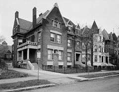
This is one of the two community areas that encompass the Bronzeville neighborhood, with the other being Douglas. Grand Boulevard also includes the Washington Park Court District neighborhood that was declared a Chicago Landmark on October 2, 1991.[3]
The Harold Washington Cultural Center is one of its newer and more famous buildings. Among the other notable properties in this neighborhood are Daniel Hale Williams House, Robert S. Abbott House and Oscar Stanton De Priest House
A majority of Grand Boulevard's public transportation needs are met by the Chicago Transit Authority, which provides resident and visitor access to the Green Line services of the Chicago Elevated railway rapid transit, at Indiana, 43rd, 47th and 51st.
| Historical population | |||
|---|---|---|---|
| Census | Pop. | %± | |
| 1930 | 87,005 | — | |
| 1940 | 103,256 | 18.7% | |
| 1950 | 114,557 | 10.9% | |
| 1960 | 80,036 | −30.1% | |
| 1970 | 80,166 | 0.2% | |
| 1980 | 53,741 | −33.0% | |
| 1990 | 35,897 | −33.2% | |
| 2000 | 28,006 | −22.0% | |
| 2010 | 21,929 | −21.7% | |
| [4] | |||
External links
- Official City of Chicago Grand Boulevard Community Map
 Bronzeville travel guide from Wikivoyage
- Bronzeville at Explore Chicago, The Official City of Chicago Tourism Website
Notes
- ↑ Biasco, Paul. "Logan Square Hispanics Vanishing As Neighborhood Becomes More White". Retrieved 21 June 2016.
- ↑ Paral, Rob. "Chicago Census Data". Retrieved 9 October 2012.
- ↑ "Washington Park Court District". City of Chicago Department of Planning and Development, Landmarks Division. 2003. Retrieved 2007-03-30.
- ↑ Paral, Rob. "Chicago Community Areas Historical Data". Chicago Community Areas Historical Data.
 |
Armour Square, Chicago | Douglas, Chicago | Oakland, Chicago | |
| Fuller Park, Chicago | |
Kenwood, Chicago | ||
| ||||
| | ||||
| Washington Park, Chicago | Hyde Park, Chicago |