Gramsbergen
| Gramsbergen | |||
|---|---|---|---|
| |||
| Coordinates: 52°36′37″N 6°40′22″E / 52.61028°N 6.67278°E | |||
| Country | Netherlands | ||
| Province | Overijssel | ||
| Municipality | Hardenberg | ||
| Population (2005) | 3,103 | ||


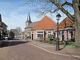
Gramsbergen (Dutch Low Saxon: Grambarge) is a small Dutch town on the Vechte, located in the municipality of Hardenberg and the province of Overijssel. The town is located on corridors of different transportation modes: The N34 (Zwolle - Emmen), the Zwolle - Emmen railway and the Almelo - de Haandrik canal.
History
Gramsbergen and its hamlets have been inhabited since pre-historic times. In the 'Cultuur Historisch Informatie Centrum Vechtdal' (The Historical and Cultural Center of Vechtdal), in the centre of Gramsbergen, several archaeological artifacts are exhibited. These artifacts come from settlements from around 8000 BC.
Generally it is assumed that the village of Gramsbergen already existed in the thirteenth century. In the books from the period before, the name Gramsbergen is already mentioned. It received city rights in 1442.
As an independent municipality, Gramsbergen comprised the centres of Gramsbergen and De Krim and the hamlets Ane, Anevelde, Anerveen, Den Velde, Holthone, Holtheme and Loozen. Since 1 January 2001, Gramsbergen is part of Hardenberg.
Transportation
Railway Station: Gramsbergen
Statistics
- Number of residents
- 3,064
- Number of men
- 1,546
- Number of women
- 1,518
External links
- Cultuur Historisch Informatie Centrum Vechtdal
- Gramsbergen Town Web Site
- J. Kuyper, Gemeente Atlas van Nederland, 1865-1870, "Gramsbergen". Map of the former municipality, around 1868.
Coordinates: 52°37′N 6°41′E / 52.617°N 6.683°E