Gotemba, Shizuoka
| Gotemba 御殿場市 | |||
|---|---|---|---|
| City | |||
|
Mount Fuji overlooking Gotemba Premium Outlet | |||
| |||
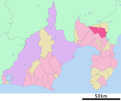 Location of Gotemba in Shizuoka Prefecture | |||
 Gotemba
| |||
| Coordinates: 35°18′31.3″N 138°56′4.6″E / 35.308694°N 138.934611°ECoordinates: 35°18′31.3″N 138°56′4.6″E / 35.308694°N 138.934611°E | |||
| Country | Japan | ||
| Region | Chūbu (Tōkai) | ||
| Prefecture | Shizuoka Prefecture | ||
| Government | |||
| • - Mayor | Kaizō Osada | ||
| Area | |||
| • Total | 194.90 km2 (75.25 sq mi) | ||
| Population (September 2015) | |||
| • Total | 88,029 | ||
| • Density | 452/km2 (1,170/sq mi) | ||
| Time zone | Japan Standard Time (UTC+9) | ||
| Symbols | |||
| • Tree | Japanese zelkova | ||
| • Flower | Sakura | ||
| • Bird | Japanese thrush | ||
| Phone number | 0550-83-1212 | ||
| Address | 483 Hagiwara, Gotemba-shi, Shizuoka-ken 412-8601 | ||
| Website |
www | ||


Gotemba (御殿場市 Gotenba-shi, sometimes Gotenba) is a city on the southeastern flank of Mt. Fuji in Shizuoka Prefecture, Japan.
As of September 2015, the city has an estimated population of 88,029 and a population density of 452 persons per km2. The total area was 194.63 square kilometres (75.15 sq mi).[1] The Peace Pagoda, built in 1964 by Nipponzan-Myōhōji-Daisanga is a noted symbol of the city.
Geography
Located in far eastern Shizuoka Prefecture at an altitude of 250–600 metres (820–1,970 ft), Gotemba has a cool climate, characterized by high rainfall (average 3,433 millimetres [135.2 in] per year).
Surrounding municipalities
- Shizuoka Prefecture
- Kanagawa Prefecture
Climate
| Climate data for Gotemba, Shizuoka (1981-2010) | |||||||||||||
|---|---|---|---|---|---|---|---|---|---|---|---|---|---|
| Month | Jan | Feb | Mar | Apr | May | Jun | Jul | Aug | Sep | Oct | Nov | Dec | Year |
| Record high °C (°F) | 15.3 (59.5) |
20.3 (68.5) |
22.2 (72) |
25.5 (77.9) |
28.2 (82.8) |
32.7 (90.9) |
33.7 (92.7) |
34.7 (94.5) |
33.0 (91.4) |
28.4 (83.1) |
22.7 (72.9) |
20.2 (68.4) |
34.7 (94.5) |
| Average high °C (°F) | 7.7 (45.9) |
8.1 (46.6) |
11.2 (52.2) |
16.5 (61.7) |
20.4 (68.7) |
23.1 (73.6) |
26.6 (79.9) |
28.4 (83.1) |
25.1 (77.2) |
20.0 (68) |
15.1 (59.2) |
10.4 (50.7) |
17.7 (63.9) |
| Average low °C (°F) | −2.1 (28.2) |
−1.6 (29.1) |
1.6 (34.9) |
6.6 (43.9) |
11.4 (52.5) |
15.6 (60.1) |
19.6 (67.3) |
20.5 (68.9) |
17.1 (62.8) |
10.9 (51.6) |
5.2 (41.4) |
0.2 (32.4) |
8.8 (47.8) |
| Record low °C (°F) | −8.8 (16.2) |
−12.2 (10) |
−8.8 (16.2) |
−4.8 (23.4) |
2.4 (36.3) |
8.0 (46.4) |
11.3 (52.3) |
13.5 (56.3) |
7.0 (44.6) |
0.9 (33.6) |
−4.8 (23.4) |
−7.7 (18.1) |
−12.2 (10) |
| Average precipitation mm (inches) | 102.7 (4.043) |
127.9 (5.035) |
257.7 (10.146) |
242.6 (9.551) |
260.5 (10.256) |
321.7 (12.665) |
302.3 (11.902) |
304.3 (11.98) |
368.2 (14.496) |
266.5 (10.492) |
180.5 (7.106) |
84.4 (3.323) |
2,819.1 (110.988) |
| Mean monthly sunshine hours | 165.3 | 149.4 | 144.5 | 161.6 | 143.0 | 103.5 | 116.4 | 154.2 | 117.5 | 130.2 | 146.8 | 166.5 | 1,700.7 |
| Source #1: Japan Meteorological Agency[2] | |||||||||||||
| Source #2: Japan Meteorological Agency[2] | |||||||||||||
History


Gotemba was the site of a shōen belonging to Ise Shrine in the Heian period. During the Edo period the area was part of Odawara Domain. After the start of the Meiji period, it became part of Shizuoka Domain until the abolition of the han system in 1871 and the establishment of Shizuoka Prefecture. The opening of Gotemba Station on what was then the Tōkaidō Main Line on February 1, 1889, spurred development of the area. In the cadastral reform of April 1, 1889, Gotemba Town was created within Suntō District, along with Fujioka Village, Harasato Village, Ino Village, Tamaho Village, and Takane Village.
However, the opening of the Tanna Tunnel on December 1, 1934, resulted in the route of Tōkaidō Main Line shifting south to Atami, leaving Gotemba on the spur Gotemba Line, which resulted in temporary depopulation. During the pre-war era, Gotemba was a major base area for the Imperial Japanese Army, and still houses military facilities and a large training area for the modern Japanese Ground Self-Defense Force and the United States Marine Corps.
Gotemba was elevated to city status on February 11, 1955, through the merger of Gotemba Town with neighboring Fujioka Village, Harasato Village, Ino Village, and Tamaho Village. The city expanded through annexation of Takane Village on January 1, 1956 and the Furusawa District of Oyama Town on September 1, 1957. The Gotemba Interchange on the Tōmei Expressway was completed on May 25, 1969.
Economy
Gotemba has a mixed economy. Agriculture has traditionally been dominated by rice, irrigated by water from Mount Fuji, and has been supplemented by the growing of various green vegetables and the raising of pigs. Development of light industries, especially in food processing and electronics has profited through Gotemba's location on the Tōmei Expressway, and Gotemba is noted for a number of golf courses and a spacious outlet shopping center.
Retailing company Chelsea Japan rented former Gotemba Family Land Amusement Park, and officially opened on July 2000, as Gotemba Premium Outlets.
Transportation
Railways
Highways
Sister cities
-
 – Chambersburg, Pennsylvania, United States[3] (since August 22, 1960)
 - – Beaverton, Oregon, United States[3](since October 22, 1987)
Notable people
- Kenyu Horiuchi, voice actor
References
- ↑ Gotemba city official home page
- 1 2 "平年値(年・月ごとの値)". JMA. Retrieved 2011-06-22.
- 1 2 "US-Japan Sister Cities by State". Asia Matters for America. Honolulu, HI: East-West Center. Retrieved 20 November 2015.
External links
![]() Media related to Gotemba, Shizuoka at Wikimedia Commons
Media related to Gotemba, Shizuoka at Wikimedia Commons
| Wards of Shizuoka | ||
|---|---|---|
| Wards of Hamamatsu | ||
| Special cities | ||
| Other cities | ||
| Kamo District | ||
| Tagata District | ||
| Suntō District | ||
| Haibara District | ||
| Shūchi District | ||