Gorman, North Carolina
| Gorman, North Carolina | |
|---|---|
| Census-designated place | |
 Location in Durham County and the state of North Carolina | |
| Coordinates: 36°2′22″N 78°49′11″W / 36.03944°N 78.81972°WCoordinates: 36°2′22″N 78°49′11″W / 36.03944°N 78.81972°W | |
| Country | United States |
| State | North Carolina |
| County | Durham |
| Area | |
| • Total | 2.93 sq mi (7.60 km2) |
| • Land | 2.88 sq mi (7.45 km2) |
| • Water | 0.05 sq mi (0.14 km2) |
| Elevation | 361 ft (110 m) |
| Population (2010) | |
| • Total | 1,011 |
| • Density | 351/sq mi (135.6/km2) |
| Time zone | Eastern (EST) (UTC-5) |
| • Summer (DST) | EDT (UTC-4) |
| FIPS code | 37-27120[1] |
| GNIS feature ID | 1020478[2] |
Gorman is a census-designated place (CDP) in Durham County, North Carolina, United States. The population was 1,011 at the 2010 census.[3]
Geography
Gorman is located in east-central Durham County at 36°2′22″N 78°49′11″W / 36.03944°N 78.81972°W (36.039342, -78.819783),[4] between the city of Durham to the southwest and Falls Lake on the Neuse River to the northeast. Interstate 85 forms the northwestern border of the community, with access from exits 180, 182, and 183. The main road through the community is East Geer Street, running roughly parallel to I-85.
According to the United States Census Bureau, the Gorman CDP has a total area of 2.93 square miles (7.60 km2), of which 2.88 square miles (7.45 km2) is land and 0.054 square miles (0.14 km2), or 1.89%, is water.[3]
Demographics
As of the census[1] of 2000, there were 1002 people, 406 households, and 291 families residing in the CDP. The population density was 325.1 people per square mile (125.6/km²). There were 428 housing units at an average density of 138.9 per square mile (53.7/km²). The racial makeup of the CDP was 82.04% White, 15.97% African American, 0.10% Native American, 0.10% Asian, 1.00% from other races, and 0.80% from two or more races. Hispanic or Latino of any race were 4.29% of the population.
There were 406 households out of which 27.6% had children under the age of 18 living with them, 55.7% were married couples living together, 13.5% had a female householder with no husband present, and 28.3% were non-families. 24.4% of all households were made up of individuals and 8.1% had someone living alone who was 65 years of age or older. The average household size was 2.47 and the average family size was 2.91.
In the CDP the population was spread out with 22.1% under the age of 18, 6.8% from 18 to 24, 30.2% from 25 to 44, 26.7% from 45 to 64, and 14.2% who were 65 years of age or older. The median age was 39 years. For every 100 females there were 93.8 males. For every 100 females age 18 and over, there were 88.2 males.
The median income for a household in the CDP was $42 236, and the median income for a family was $43,977. Males had a median income of $36,143 versus $30,789 for females. The per capita income for the CDP was $19,083. About 9.3% of families and 6.7% of the population were below the poverty line, including 6.9% of those under age 18 and 5.9% of those age 65 or over.
References
- 1 2 "American FactFinder". United States Census Bureau. Retrieved 2008-01-31.
- ↑ "US Board on Geographic Names". United States Geological Survey. 2007-10-25. Retrieved 2008-01-31.
- 1 2 "Geographic Identifiers: 2010 Demographic Profile Data (G001): Gorman CDP, North Carolina". U.S. Census Bureau, American Factfinder. Retrieved December 2, 2015.
- ↑ "US Gazetteer files: 2010, 2000, and 1990". United States Census Bureau. 2011-02-12. Retrieved 2011-04-23.
Municipalities and communities of Durham County, North Carolina, United States | ||
|---|---|---|
| Cities | 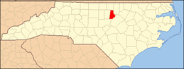 | |
| Towns | ||
| CDPs | ||
| Unincorporated communities | ||
| Footnotes | ‡This populated place also has portions in an adjacent county or counties | |