Sambalpur
| Sambalpur ସମ୍ବଲପୁର | |
|---|---|
| City | |
|
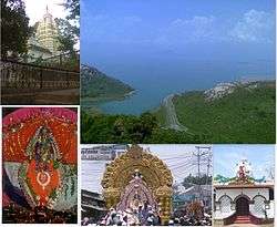
From top left to right: Budharaja Temple, Hirakud, Gandhi Temple, Sitalsasthi Carnival, Samaleswari Temple. | |
| Nickname(s): Handloom City, City of Textiles, Cultural Capital of Odisha | |
 Sambalpur  Sambalpur Location in Odisha, India | |
| Coordinates: 21°28′N 83°58′E / 21.47°N 83.97°ECoordinates: 21°28′N 83°58′E / 21.47°N 83.97°E | |
| Country |
|
| State | Odisha |
| District | Sambalpur |
| Government | |
| • Type | Mayor - Council |
| • Body | Sambalpur Municipal Corporation (SMC) |
| Elevation | 135 m (443 ft) |
| Population (2011) | |
| • Total | 335,761 |
| • Rank | 134th |
| Languages | |
| • Official | Odia |
| Time zone | IST (UTC+5:30) |
| PIN | 768xxx |
| Telephone code | 0663 |
| Vehicle registration | OD-15 (OR-15 Before 2012) |
| Literacy | 85.69% |
| Website |
odisha sambalpur |
Sambalpur (Odia: ସମ୍ବଲପୁର; ![]() Sambalpur ) is in the eastern state of Odisha in India, is one of the largest and oldest city in Odisha. It is the headquarters of Northern Revenue Division and of Mahanadi Coalfield Limited (MCL). It is situated about 300 km west of state capital Bhubaneswar, 550 km west of Kolkata in West Bengal and 278 km east of Raipur in Chhattisgarh. It is also on the bank of Mahanadi River.
Sambalpur ) is in the eastern state of Odisha in India, is one of the largest and oldest city in Odisha. It is the headquarters of Northern Revenue Division and of Mahanadi Coalfield Limited (MCL). It is situated about 300 km west of state capital Bhubaneswar, 550 km west of Kolkata in West Bengal and 278 km east of Raipur in Chhattisgarh. It is also on the bank of Mahanadi River.
In the year 1883, Sambalpur was established as a municipality. In 2013, Sambalpur got the municipal corporation status. Sambalpur Municipal Corporation includes Burla, Hirakud and neighbouring 12 Gram panchayats. The total population of Sambalpur Metropolitan Area is 3,35,761.
Overview
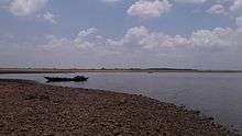
Sambalpur is the Western Odisha region's administrative, commercial and educational hub. The city contains many famous temples,historic buildings and parks.Sambalpur is famous for some of premier educational institutes like Sambalpur University, Veer Surendra Sai Institute of Medical Sciences and Research (VIMSAR), Veer Surendra Sai University of Technology (VSSUT), Gangadhar Meher University, Indian Institute of Management Sambalpur and Odisha State Open University (OSOU). Hirakud Dam, the longest earthen dam in the world and the largest artificial lake of Asia is at Hirakud.[1]
After the independence of India, many commercial and government establishments sprung up in and around Sambalpur. Sambalpur is one of the major railway junctions in Odisha with the headquarters of Sambalpur Railway Division under East-Coast Railway Zone of Indian Railways.National Highway 6, National Highway 42 and State Highway 10 pass through the city.[2] Sambalpur is also the headquarters of Mahanadi Coalfields Limited[3] since 1992, a subsidiary of Coal India Limited. Sambalpur is famous for Hirakud Dam, Sambalpuri Saree, Sambalpuri songs, Sambalpuri Dance, the Sitalsasthi Carnival,[4][5] and Gandhi temple.[6] Sambalpuri is the native language of the place. The locals are usually referred as Sambalpuriya.
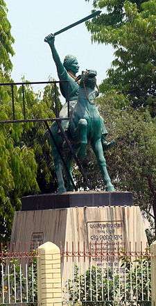
In 1849,Sambalpur State came under the British rule by the application of Doctrine of lapse after the death of last Maharaja Narayan Singh.Veer Surendra Sai of Sambalpur played a very important role in the freedom struggle.He led a revolution against the British East India Company even before Sepoy Mutiny in 1857.He is known as Lion Of Odisha.
Sambalpur has its own unique identity in-terms of its language, handloom, dance, cuisine, culture, festivals, temples, heritage, songs, drama and music. This uniqueness has been there since centuries and its time tested aroma can be savoured in its daily life.
Etymology

Sambalpur derives its name from that of the Goddess Samalei (Odia: ସମଲେଇ ଠାକୁରାଣୀ), who is regarded as the reigning deity of the region.[7][8] The region in which Sambalpur city is located was also known as Hirakhanda[9] from ancient times.[10] In history, it has also been known as 'Sambalaka'. Claudius Ptolemy has described the place as "Sambalak".[11] According to Jean-Baptiste Tavernier, the French traveller, and Edward Gibbon, the English historian, diamonds were exported to Rome from Sambalpur.[10]
History
The history of Sambalpur, as depicted by eminent historians, is full of events including Indian freedom struggle representing the different sections of society. Since Sambalpur is one of the ancient places of India, which survived even in the prehistoric age and holds a very important place in the history of Odisha and India.
Sambalpur is mentioned in the book of Ptolemy (Claudius Ptolemaeus) as Sambalaka on the left bank of river "Manada", now known as Mahanadi, other evidence are available from the records of Xuanzang, and in the writings of the celebrated King Indrabhuti of Sambalaka of Odra Desha or Oddiyan (oldest known king of Sambalpur), the founder of Vajrayana Buddhism and the Lama cult. He has written the book Jñānasiddhi.
French merchant Jean Baptiste Tavernier (1605–1689) in his travel account “Six Voyages en Turquie, en Perse et aux Indes (1676–77)” translated into English by Valentine Ball as “Travels in India” (2d ed., 2 vol., 1925) wrote about the numerous famous diamond mines of Sumelpur (Semelpur), the present day Sambalpur. He states that, 8,000 people were at work in these mines at the time of his visit, in the dry season at the beginning of February.[13]
In 1540 A.D., the kingdom of Patna, ruled by the Chauhan dynasty was bifurcated. Southern portion of river Ang was ruled by "Narasingh Deb" and his brother "Balaram Deb" received northern part of the river, known as kingdom of "Huma". Balaram Deb established his new capital at Sambalpur. Sambalpur was ruled by the Chauhan dynasty till 1800. The kingdom of Sambalpur was also known as Hirakhand and Sambalpur was its capital.[14]
Sambalpur came under the Bhonsle of Nagpur when the Maratha conquered Sambalpur in 1800. After the Third Anglo-Maratha War in 1817, the British Government returned Sambalpur to the Chauhan king, Jayant Singh but his authority over the other princely states were taken out.[15]
When the last ruler of Sambalpur, 'Narayan Singh', died in 1849 without a direct male heir, the British seized the state under the Doctrine of Lapse. Sambalpur was kept under "South west Frontier Agency" with headquarters at Ranchi. The official language of this region at that time was Hindi. "South west Frontier Agency" was renamed ‘Chhota Nagpur Division’ in 1854. The name of Veer Surendra Sai, who fought against the British Rule, is recorded in golden letters in the history of India's struggle for independence. During the Sepoy Mutiny in July 1857 the mutineers broke open the prison at Hazaribagh, where Veer Surendra Sai was imprisoned and released all the prisoners. veer Surendra Sai fought against the British after reaching Sambalpur. There was no mutiny in Cuttack division, so Sambalpur was transferred to Cuttack division in 1858 and Oriya was made the official language of Sambalpur. Sambalpur along with other princely states of Western Odisha was included in the newly created Nagpurdivision of Central Province in 1862. In January 1896, Hindi was made official language of Sambalpur.[16] During the partition of Bengal in 1905 Sambalpur and the adjacent Sambalpuri speaking tracts were amalgamated with the Odisha Division under Bengal Presidency. Bengal's Odisha division became part of the new province of Bihar and Odisha in 1912, and in April 1936 became the separate province of Odisha.[17] After Indian Independence on August 15, 1947, Odisha became an Indian state. The rulers of the princely states of Western Odisha acceded to the Government of India in January 1948 and became part of Odisha state.
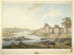
1825 to 1827, Lieutenant Colonel Gilbert (1785–1853), later Lieutenant General Sir Walter Gilbert, 1st Baronet, G.C.B., was the Political Agent for the South West Frontier with headquarters at Sambalpur. He made few paintings during his stay at Sambalpur by an unknown artist which are currently with the British Library and Victoria and Albert Museum.[18]
Vajrayana Buddhism
Although it is generally accepted that Tantric Buddhism first developed in the country of Uddiyana or Odra Desha under King Indrabhuti, there is an old and well known scholarly dispute as to whether Uddiyana or Odra was in the Swat valley, Odisha or some other place.
Indrabhuti, the oldest known king of Sambalpur founded Vajrayana while his sister who was married to Yuvaraja Jalendra of Lankapuri (Suvarnapur) founded Sahajayana. These new Tantric cults of Buddhism introduced Mantra, Mudra and Mandala along with six Tantric Abhicharas (practices) such as Marana, Stambhana, Sammohana, Vidvesan, Uchchatana and Vajikarana. The Tantric Buddhist sects made efforts to raise the dignity of the lowest of the low of the society to a higher plane. It revived primitive beliefs and practices a simpler and less formal approach to the personal god, a liberal and respectful attitude towards women and denial of caste system.[19][20]
From the seventh century A.D. onwards, many popular religious elements of heterogeneous nature were incorporated into Mahayana Buddhism which finally resulted in the origin of Vajrayana, Kalachakrayana and Sahajayana Tantric Buddhism. Tantric Buddhism first developed in Uddiyana, a country which was divided into two kingdoms Sambhala and Lankapuri. Sambhala has been identified with Sambalpur and Lankapuri with Subarnapura (Sonepur).[21]
Kalki Avatar and Sambalpur
Kalachakra tantra was first taught by the Buddha to King Indrabhuti, the first dharmaraja of Shambhala.[22] It is widely believed that the next Hindu Avatar known as Kalki will take birth at Sambalpur or Shambhala as this place was known in olden times. There are several mentions of the place Shambhala in different Hindu and Buddhist religious texts as the birthplace of Kalki. The Mahabharatra (Vana Parva, 190.93-97) and Srimad-Bhagavatam Bhag.12.2.18 give reference of Shambhala as the birthplace.[23]
Geography and climate
| Sambalpur | ||||||||||||||||||||||||||||||||||||||||||||||||||||||||||||
|---|---|---|---|---|---|---|---|---|---|---|---|---|---|---|---|---|---|---|---|---|---|---|---|---|---|---|---|---|---|---|---|---|---|---|---|---|---|---|---|---|---|---|---|---|---|---|---|---|---|---|---|---|---|---|---|---|---|---|---|---|
| Climate chart (explanation) | ||||||||||||||||||||||||||||||||||||||||||||||||||||||||||||
| ||||||||||||||||||||||||||||||||||||||||||||||||||||||||||||
| ||||||||||||||||||||||||||||||||||||||||||||||||||||||||||||
Sambalpur is located at 21°.27' North Latitude and 83°.58' East Longitude. The average elevation is 150.75 meters above the mean sea level. Sambalpur falls under the Zone-3 seismic number, which shows the possibility of an earthquake.[25]
Sambalpur lies on the bank of river Mahanadi. The river flows to the west of the city and separates Burla from Sambalpur and Hirakud. The Hirakud Dam lies upstream of Sambalpur. Budharaja is a small reserve forest located within the city. Sambalpur experiences extreme type of climate with hot and dry summer followed by humid Monsoon and cold winter. The hot season commences from 1st week of March and lasts till the second half of June. In the month of May, temperature rises up to 47°. Similarly in the month of December, the temperature comes down to 5 °C.[26] Sambalpur gets rainfall from South Western monsoon. The most pleasant months in Sambalpur are from October to February, during which time the humidity and heat are at their lowest. During this period, temperatures during the day stay below 30 °C (86 °F) and drop to about 20 °C (68 °F) at night. This season is soon followed by a hot summer, from March to May. The summer gives way to the monsoon season. Since 1982 as per the data available with District Emergency section, Sambalpur, there has not been a single occurrence of cyclone in Sambalpur. There are possibilities of strong winds with the speed of 53 km/ph before on set of monsoon.[25] The relative humidity is high during rainy season being generally over 75%. After rainy season the humidity gradually decreases and the weather becomes dry towards the winter. The best time to visit Sambalpur is between September to March. Heaviest ever recorded rainfall is 581.9 mm in Sambalpur in 1982 which was the highest ever in Odisha till September 2010.[27] The areas of the Sambalpur town on Mahanadi river sides/low-lying areas are flood prone.[25]
| Climate data for Sambalpur, Odisha (1901-2000) | |||||||||||||
|---|---|---|---|---|---|---|---|---|---|---|---|---|---|
| Month | Jan | Feb | Mar | Apr | May | Jun | Jul | Aug | Sep | Oct | Nov | Dec | Year |
| Average high °C (°F) | 27.6 (81.7) |
30.1 (86.2) |
35.0 (95) |
39.3 (102.7) |
41.4 (106.5) |
36.9 (98.4) |
31.1 (88) |
30.7 (87.3) |
31.7 (89.1) |
31.7 (89.1) |
29.4 (84.9) |
27.2 (81) |
32.67 (90.83) |
| Average low °C (°F) | 12.6 (54.7) |
15.1 (59.2) |
19.0 (66.2) |
23.5 (74.3) |
27.0 (80.6) |
26.7 (80.1) |
24.9 (76.8) |
24.8 (76.6) |
24.6 (76.3) |
21.8 (71.2) |
16.2 (61.2) |
12.1 (53.8) |
20.69 (69.25) |
| Average precipitation mm (inches) | 14.2 (0.559) |
28.0 (1.102) |
20.9 (0.823) |
14.2 (0.559) |
22.7 (0.894) |
218.9 (8.618) |
459.0 (18.071) |
487.5 (19.193) |
243.5 (9.587) |
56.6 (2.228) |
17.6 (0.693) |
4.8 (0.189) |
1,587.9 (62.516) |
| Source: Indian Meterological Department[28] | |||||||||||||
Transport
Road
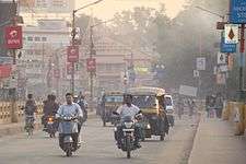
Sambalpur has a well networked transport facility for commercial and public transportation. Sambalpur is connected to the rest of odisha and India by national highway - NH 6, which is a part of Asian Highway-AH46 (Mumbai-Nagpur-Kolkata line).NH 42 connect with Cuttack & Bhubaneswar, State Highway 10 (SH10) connect with Jharsuguda & Rourkela, and new Biju Expressway (under Construction) will connect Rourkela-Sambalpur-Jagdalpur.[29] City Bus services have started in Sambalpur from January 2014. The service was inaugurated by Chief Minister of Odisha Mr. Naveen Patnaik. It is run on a PPP (Public Private Partnership) by two companies namely Western Odisha Urban Transport Service Limited (WOUTSL) and Paschim Odisha Paribahan Company (POPCO).
Rail
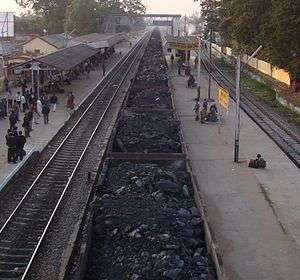
There are five railway stations in Sambalpur City (since it gained the corporation tag), namely Sambalpur Junction, Sambalpur Road Railway Station (SBPD), Hirakud Railway Station (HKG), Sambalpur City Railway Station (SBPY) and Maneswar Railway Station (MANE). Sambalpur City and Maneswar Railway Stations are located on the Bhubaneswar-Sambalpur route (commissioned in 1998), while rest three stations are located on the Jharsuguda-Vizianagaram route. There are direct train connections to all the metros and prominent cities across India. It lacks direct connectivity to Indore, Dehradun, Lucknow and Guwahati.
Air
The nearest Airports are Swami Vivekananda Airport, Raipur (262 km) and Biju Patnaik International Airport, Bhubaneswar (325 km). A new airport is being constructed at Jharsuguda (50 km).[30]
Demographics
| Historical population | ||
|---|---|---|
| Year | Pop. | ±% |
| 1891 | 14,571 | — |
| 1901 | 12,870 | −11.7% |
| 1941 | 17,079 | +32.7% |
| 1950 | 23,525 | +37.7% |
| 1961 | 38,915 | +65.4% |
| 1971 | 64,675 | +66.2% |
| 1981 | 110,283 | +70.5% |
| 1991 | 189,611 | +71.9% |
| 2001 | 226,469 | +19.4% |
| 2011 | 269,565 | +19.0% |
| 1891 to 1981 data of Sambalpur Municipality, from 1991 onwards the data presented is of Sambalpur Metropolitan Area | ||
Sambalpur city is governed by a Municipality which comes under Sambalpur Metropolitan Area. As of 2011 India census,[32] Although Sambalpur city has population of 183,383; its urban / metropolitan population is 269,575 of which 138,826 are males and 130,749 are females[33] which includes Burla and Hirakud. Sambalpur has an average literacy rate of 85.69% of which male and female literacy was 90.30 and 80.92 percent. Sex ratio is 942 and child sex ratio is 882. Total children (0-6) in Sambalpur city are 18,555 as per figure from Census India report on 2011. There were 9,857 boys while 8,698 are girls.
Sambalpur is ethnically very diverse with about 14 communities like Brahmin, Teli (oil extractors), Gour (milkmen), Guria (maker of sweets), Agaria (industrious cultivators), Sunari (goldsmith), Kultas (cultivators), Kewat (boatmen and fisherman), Dhobi (washermen), Bhuliya (weaver), Bhandari (barber), Kamar (blacksmith) Ganda (pipers and drummers) and Muslims, Sikhs and Christians cohabiting together.[34]
Language spoken
Sambalpuri Language is spoken at Sambalpur however Odia, Hindi, and English are used for education and official purposes.
Economy
The economy of Sambalpur is basically dependent on trade. Majority of the residents are either salaried or self-employed. Forest products play an important role in the economy in terms of contribution to revenue and domestic product. Kendu leaf or Coromandel Ebony or East Indian Ebony (Diospyros melanoxylon) also forms part of the economy of Sambalpur with many bidi manufacturing units functioning in Sambalpur.[35] Gole Bazaar is the main merchandising area of the city. It is famous for handloom and other textile products.[36][37] Other merchandising areas are Khetrajpur, Fatak, V.S.S. marg, Budharaja and farm road. Jewellery shopping hotspots in Sambalpur includes Baidyanath Chowk and Dhanupali where one can find reputed shops like Banka Jewellers and Alankar Jewellers(Dhanupali).
Mahanadi Coalfields Limited, a subsidiary of Coal India Limited located at Sambalpur produced 100.28 million tonnes of coal and had a profit before tax during 2010–2011 at Rs 4039.30 crore.[38] The Hirakud smelter, set up by Indal in 1959 at Hirakud, was the country’s second aluminium smelter operating on grid power sourced from the hydro power station of the Hirakud Dam.[1] It was the first in India to adopt clean coal combustion technology that uses a circulating fluidised bed, which is considered environmentally friendly.[1] Currently the smelter has a capacity of 213,000 tpa, it provides employment to around 1700 persons.[1]
Education
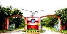
The pre-collegiate medium of instruction in schools is predominantly English and Odia and medium of instruction in educational institutions after matriculation in colleges is English. Additionally, other media of instruction exist in Sambalpur. Schools and colleges in Sambalpur are either government-run or run by private trusts and individuals. The schools are affiliated with either the Orissa State Board under BSE or CHSE, Indian Certificate of Secondary Education (ICSE) and the Central Board for Secondary Education (CBSE). After completing 10 years of schooling in secondary education, students enroll in Higher Secondary School, specialising in one of the three streams – Arts, Commerce or Science. Since the 2000s, there have been a large number of professional institutions established in a variety of fields. The earliest schools established in Sambalpur were the CSB Zilla School (1852) and the Lady Lewis Girls High School (1942).[39] The VSS Medical College was established in 1959 and VSSUT in 1956. High School for Blind (1972) and High School for Deaf & Dumb (1972), Burla are Govt. educational institutions imparting education to physically challenged children.[39]
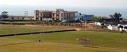
Sambalpur Kala Parishad is the pioneering organisation for the promotion of Sambalpuri dance, has been responsible for the revolutionary growth of this dance.[34] It imparts education and training on this form of dance. Sambalpur Football Academy, Pitapali, this institution imparts football training to specially selected players with free boarding and schooling. The campus is located on the periphery of the left dyke of the Hirakud Dam.
Sambalpur is having one of the best facilities for education in the state with many schools and universities. Popular educational institutions in the city are Gangadhar Meher College (Autonomous), Sambalpur,[40] Women's College, Netaji Subhash Chandra Bose College, Lala Lajpat Rai Law College, Silicon Institute of Technology (SIT), Delhi Public School, Kendriya Vidyalaya, St. Joseph's Convent Higher Secondary School (SJC-SBP), Gurunanak Public School, Madnawati Public School (MPS), Indian Public School (IPS), St. John's School, Seven Hills Residential School (SHRS), Sri Aurobindo School (SAIIE&R) and DAV Public School. and IT Education (Computer Education) Facilities provided by SCAT Corporation and it has multiple branches with named SCAT|Learning.[41] A new Indian Institute of Management, Sambalpur (IIM) has been set up in the city. Sambalpur Chapter of THE INSTITUTE OF COST ACCOUNTANTS OF INDIA http://icmai.in/icmai/index.php set up from 2010 At- Deheripali, Near Fatak, Sambalur, Odiaha http://icmai.in/Chapters-Website/index.php?chapterID=77&parent=EIRC We do express our pleasure to provide this professional course at your door step at Sambalpur.http://icmai.in/Chapters-Website/index.php?chapterID=77&parent=EIRC The Sambalpur Chapter of Cost Accountants though as its infant stage carries adequate infrastructure and professional faculties to impart education and inculcate professionalism
Culture
Sambalpur Lok Mahotsav
A cultural manifestation of the hidden age-old traditional performing art of a vast geographical area is possible through this annual celebration of the festival in the name of ”Lok Mahotsav”. This festival is a reflection of the socio- anthropological evolution of the people of India. Lok Mahotsav shows the integrity & unison of the heritage, culture, music & lifestyle of Kosal. Live performances of folk music, dance from all parts of india are shown under one splendid stage.[42]
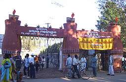
Sitalsasthi Carnival
It is the marriage ceremony of God Siva & Goddess Parvati. Sitalsasthi is a carnival of folk dance and music along with decorated stands of Gods and Goddesses. People from all walks of life participate in large numbers in the carnival. Artists from different states of India take part in the carnival making it a colourful extravaganza.[43][44]
Festivals
Sambalpur has a distinct identity in India in terms of the festivals celebrated here, apart from the regular festivals celebrated across India the following festivals are especially celebrated at Sambalpur.
Nuakhai
This is the most important social festival of Sambalpur. Generally it takes place during the month of August and September. Preliminary preparation of the festival starts 15 days before the occasion. The first grains of the paddy crop, cooked into various dishes are offered to the deities. There after the eldest member of the family distributes new rice to other members of the family. All the household articles are cleaned. People greet each other. It is a community festival celebrated by every Hindu family.[45] The popularity of the festival is such that even the festival greetings comes from the honorable Prime Minister of India[46]
Bhai-Juntia
It is mostly celebrated in the region Kosal. Bhai-juntia festival is celebrated on the Mahastami Day of Durga Puja. It is a total fasting undertaken by women without water for the whole day and night to seek Goddess Durga's blessing for the long life of their brothers.[47]
Puo-Juntia
It is another fasting puja of similar austerity for women of the area. The Puo-juntia festival is observed by mothers to invoke the grace of Lord Dutibahana for the long life and prosperity of their sons.[47]
Shiva Ratri mela at Huma attracts a large numbers of devotees. Ratha Yatra is held at almost all central places of Sambalpur. On the occasion of Makara Jatra, a fair is held at Themra in Sambalpur.
Architecture
Sambalpur retains its classic sleepy charm, even in the face of rapid, albeit unplanned expansion and a deluge of retail establishments. Some of the houses along the old part of Sambalpur are still maintained, and used, like they were, a century ago. A peculiar way the houses in the older parts of town are arranged is, the gulli system, literally, mazeway. Houses in Patnaikpara, Nandpara, and along the parallel streets of Sansadak and Badsadak are examples of the above.
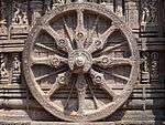
The architecture in the district attracts people from all over because of its unique designs. The important historical relics in the district of Sambalpur are the temples built by the Chauhan rulers. The splendour of Odisha art and architecture had reached its climax in the 13th century, much before the advent of the Chauhans into Sambalpur region.[48]
The Pataneswari temple of Sambalpur was built by Balaram Dev, the first Chauhan ruler of Sambalpur in the last part of the 16th century. It consists of a sanctum with an enclosed circular count. The Pataneswari Deity is the temple of Goddess Kali.[49]
The Samaleswari temple in the town represents the finest Chauhan style of circumvallation round the sanctum.[50] The image of Samalei is a unique sculpture and appears to be a primitive deity worshipped by the local people. However, Samalei or Samaleswari is the tutelary deity of Chauhan dynasty of this area (Pasayat, 1998, 2003, 2007, 2008).
Now that the city is facing modernisation, the Development authorities have geared up to transform the city. Many builders are trying to build a new skyline for the city and are expanding their reaches like Koshal Builders Pvt Ltd (www.koshalbuilders.com) and are concentrating to give a better lifestyle to people.
Tourism
The world famous Hirakud Dam built across the Mahanadi River, about 15 km from Sambalpur in 1956 is a major tourist attraction. The dam is the world's largest earthen dam[51] and is one of the longest dams in the world, about 16 mi (26 km) in length. It also forms the biggest artificial lake in Asia, with a reservoir holding 743 km2 at full capacity with a shoreline of over 640 km.[52] It also attracts a large number of migratory birds in winters. The Leaning Temple of Huma, located about 25 km from Sambalpur, built in the 17th century, leans at an angle of approximately 47 degrees to the west. (Pasayat, 1998, 2003, 2004, 2007, 2008).[53] Which is one of a kind in India. Samaleswari Temple is the main temple of Goddess Samaleswari, located on the banks of river Mahanadi. Sambalpur owes its name to her.[10] Chiplima[54] (Chipilima Hydro Electric Project (CHEP)) located about 37 km from Sambalpur, it is known for a natural fall (24.38 mts in height) harnessed for generating electricity. It is an ideal picnic spot and famous for Ghanteswari Temple, the presiding deity of the place. Ghanteswari Temple played an important role for river navigation in the past.[54] The second planetarium of the state is being set up Burla in Sambalpur. The Government of Odisha has allocated five acres of land on which the planetarium would be constructed on 2 acres of land. Soon after the completion of the planetarium a science park would be set up at the remaining 3 acres of land. The construction of the planetarium building which began in 2012 is over and now remains the installation of the devices and machine which would get over soon after which the it would be open for the people.
Lost Temples of Hirakud Dam
These are remnants of temples submerged after the dam was completed in 1957. In Summer season due to the receding water of the dam, the structures become visible. These hidden treasures have finally caught the attention of historians and steps are being taken to understand the historical significance of these temples which periodically go under water, only to resurface again. Many temples have been destroyed after 58 years of underwater existence. However, some remain intact.[55][56]
Interest in these lost temples has been rekindled after two stones, etched with writing ('Shila Lekha'), were recovered from what is believed to be the Padmaseni temple of submerged Padmapur village.[57] The temples located inside the reservoir area were part of the then Padmapur, one of the oldest and most populous in the region prior to the dam construction.[55] More than 200 temples were submerged by the dam, nearly 150 temples have either perished or are underwater and about 50 are visible during summer. These lost temples present excellent opportunities for scuba diving enthusiasts to explore under belly of Hirakud Dam. These temple are visible to visitors on boat only during the summer months of May and June.
Debrigarh Wildlife Sanctuary
The Debrigarh Wildlife Sanctuary stands out from all the wildlife sanctuaries in the state in terms of sighting wild animals. One of the major reasons for this could be its proximity to the Hirakud dam as it provides a perfect water source host for the animals, birds and aquatic fauna of the sanctuary.“Apart from the animals already inhabiting the sanctuary, there are also migratory birds and they come to explore the nearly 150 km2 area of the Hirakud reservoir. As the dam is a standing water body, many varieties of diving ducks can be seen. Perhaps the sanctuary welcomes the largest number of diving ducks in winter compared to all the other sanctuaries in Orissa. Birds such as red crested pochard, great crested grebe are seen in large numbers. During 2008 there was a bird census and the sanctuary reported more than 32,000 winged-visitors. There are six eco-tourism cottages in the sanctuary at Barkhandia and each has all the facilities to accommodate a complete family or two adults. Most importantly, the tariff includes all meals. Permission for the entry into the sanctuary is available at the gates, but to stay in the eco-tourism cottages one has to get the DFO’s permission from the office in Sambalpur town after paying the fees.
Cattle Island
Cattle Island exists in one of the extreme points of Hirakud Reservoir, a natural wonder. It is near Kumarbandh village of Belpahar-Banharpali range which is about 90 km from Sambalpur. The island is a submerged hill, and before the construction of Hirakud Dam it was a developed village. During the resettlement period, villagers left some of their cattle behind; when the dam construction was over, the cattle settled on the hilltop. With the passage of time the nearby area filled up with the reservoir water, turning the hilltop into an island. Being away from mankind, the cattle are now wild, very swift and not easily caught. Living on a hilltop with dense forest, they are larger than tame cattle, almost all of which are white in colour. Nearby residents attempt to capture these animals from time to time, but these hunts are rarely successful. Though descended from tame cattle, these animals provide a contrasting picture of this breed of animal returning to life in the wild. If the visit to this island is taken by a boat in the Hirakud reservoir it's an adventurous trip with some of the breathtaking views.[58]
Politics
Sambalpur is part of Sambalpur (Lok Sabha constituency).[59] Sitting MP from Sambalpur is Mr Nagendra Kumar Pradhan.[60] Current MLA from Sambalpur Assembly Constituency is Dr Raseswari Panigrahi of BJD. She is the sister of Late Sriballav Panigrahi who was a former Minister, Parliamentarian and Legislator from Western Odisha. Previous MLAs from this seat were Mr Jayanarayan Mishra, Mr Durgashankar Pattanaik of INC who won this seat in 1995 and 1990, Sraddhakar Supakar of INC in 1985, Ashwini Kumar Guru of INC(I) in 1980, and Jhasketan Sahoo of JNP in 1977. Sriballav Panigrahi of Indian National Congress represented Sambalpur in the Odisha Lesgislative Assembly in 1971 and 1973.[61]
Demand for Separate Kosal State
The demand for a separate State of Kosal is more than two decades old.[62] A regional political party Kosal Kranti Dal has been very active with this demand of a separate state and is the only political party till date supporting this demand.[63]
In a new twist the people of Sambalpur rejected the idea of Kosal state and Kosli language terms for Western Odisha and language.They expresses their view that ancient kingdom of Kosal (present day Awadh region of Uttar Pradesh) & kingdom of South Kosal(present day Chhatishgarh) had no history related to Western Odisha and if separate state will be form,the state name will be Hirakhand and language will be Sambalpuri.The Hirakhand and Sambalpuri terms are not accepted by Kosal supporters of Balangir.It should be noted that Kosal state movement are not popular & active in other districts of Western Odisha.
See also
References
- 1 2 3 4 "Operations | Manufacturing locations | Hirakud". Hindalco. 2009-08-19. Retrieved 2012-03-23.
- ↑ "NH 42 (261 km: NH-6@Sambalpur – Redhakhol – Anugul – Dhenkanal – NH-5@Nergundi)". orissalinks.com. Retrieved 2015-04-13.
- ↑ http://www.coal.nic.in/chap3.htm
- ↑ Welcome to Maa Samaleswari Temple, Sambalpur, Orissa. Samaleswari.org. Retrieved on 2011-01-20.
- ↑ Sambalpur District. 123orissa.com. Retrieved on 2011-01-20.
- ↑ Here, Gandhi is god, News – City – Bangalore Mirror, Bangalore Mirror. Bangaloremirror.com (2010-10-02). Retrieved on 2011-01-20.
- ↑ "http://www.samaleswari.org/". samaleswari.org. Retrieved 2015-04-13. External link in
|title=(help) - ↑ "kosal.org - kosal Resources and Information. This website is for sale!". web.archive.org. Retrieved 2015-04-13.
- ↑ "Sambalpur – Jharsuguda, a new destination for industrial development in Odisha. | Sambalpur News". mysambalpur.in. Retrieved 2015-04-13.
- 1 2 3 Welcome to Maa Samaleswari Temple, Sambalpur, Odisha. Samaleswari.org. Retrieved on 2011-01-20.
- ↑ Hotel Sheela Towers, Sambalpur. Sheelatowers.com. Retrieved on 2011-01-20.
- ↑
- ↑ Tourist Places In Sambalpur | Tourist Places Near Sambalpur. www.orissatourism.net.in. Retrieved on 2011-01-20.
- ↑ Historical Sambalpur- a victim of State govt’s apathy.. Kosal. Retrieved on 2011-01-20.
- ↑ Sambalpur. Remunda.com. Retrieved on 2011-01-20.
- ↑ Untitled-13. (PDF). Retrieved on 2011-01-20.
- ↑ Biswamoy Pati (1992). "Of Movements, Compromises and Retreats: Odisha, 1936–1939". Social Scientist. 20 (5/6): 64–88. JSTOR 3517932.
- ↑
- ↑ Welcome to BIT – "The travel people". Bharathtravels.com. Retrieved on 2011-01-20.
- ↑ Official Website of Bargarh District. Bargarh.nic.in. Retrieved on 2011-01-20.
- ↑ Buddhist Remains in Western Odisha. Scribd.com. Retrieved on 2011-01-20.
- ↑ Shambhala Times Community News Magazine » Recapping the Rinchen Terdzo in Odisha, India. Shambhalatimes.org (2009-03-23). Retrieved on 2011-01-20.
- ↑ Kalki The Next Avatar of God. Stephen-knapp.com. Retrieved on 2011-01-20.
- ↑ http://www.worldweatheronline.com/Sambalpur-weather-averages/Orissa/IN.aspx
- 1 2 3 Microsoft Word – final report sambalpur dec 08.doc. (PDF). Retrieved on 2011-01-20.
- ↑ Archived December 5, 2010, at the Wayback Machine.
- ↑ Microsoft Word – envis-newsletter-2005.doc. (PDF). Retrieved on 2011-01-20.
- ↑ "Climatological Information for Sambalpur, Odisha", Indian Meterological Department. Web: .
- ↑ Welcome To Sadbhav Engineering Ltd. Sadbhaveng.com. Retrieved on 2011-01-20.
- ↑ Odisha urges AAI to scale down land need for Jharsuguda airport. Business-standard.com (2010-08-03). Retrieved on 2011-01-20.
- ↑ Ghosh, A.; Ahmad, S.S.; Maitra, S.; Institute of Social Sciences (New Delhi, India) (1995). Basic Services for Urban Poor: A Study of Baroda, Bhilwara, Sambalpur, and Siliguri. Institute of Social Sciences and Concept Publishing Company. p. 133. ISBN 9788170225515. Retrieved 2015-04-13.
- ↑ "Census of India 2001: Data from the 2001 Census, including cities, villages and towns (Provisional)". Census Commission of India. Archived from the original on 2004-06-16. Retrieved 2008-11-01.
- ↑ "Sambalpur (Sambalpur Town) City Population Census 2011". Census2011.co.in. Retrieved 2012-03-23.
- 1 2 Prafulla Kumar Mohapatra (2011-05-21). "Dancing the Sambalpuri way". Deccanherald.com. Retrieved 2012-03-23.
- ↑ Kendu Leaf Trade: An Eco-Friendlyway of Sustenance. Shvoong.com. Retrieved on 2011-01-20.
- ↑ "Sambalpur Shopping - Shopping in Sambalpur, Shopping in Sambhalpur Orissa". bharatonline.com. Retrieved 2015-04-13.
- ↑ "Sambalpur Tourist Attractions | PlanetWare". planetware.com. Retrieved 2015-04-13.
- ↑ "Annual Report & Accounts 2010–2011 Mahanadi Coalfields Limited" (PDF). Retrieved 2015-04-13.
- 1 2 "Welcome To Our Website : RTI Central Monitoring Mechanism by Govt. of Orissa [RTI CMM v2.1]". Rtiorissa.gov.in. Retrieved 2012-03-23.
- ↑ http://www.gmcollege.org/
- ↑ http://www.scat.co.in/
- ↑ "Lok Mahotasav - 2012". sambalpur.nic.in. Retrieved 2012-03-25.
- ↑ "The Famous Sital Sasthi Yatra". Sambalpur.nic.in. Retrieved 2011-01-20.
- ↑ "Welcome to Sitalsasthi Yatra, Sambalpur". Sitalsasthi.com. 2009-05-25. Retrieved 2011-01-20.
- ↑ About the Festival of Nuakhai – The Ethnic Harvesting Festival of Odisha state in India. Genesis, history and socio cultural heritage behind Nuakhai or Nabanna by Oriya people. Nuakhai.org. Retrieved on 2011-01-20.
- ↑ Nuakhai Greetings from Honorable Prime Minister of India.
- 1 2 Political socialization of women: a study of teenager girls by Jyoshnarani Behera
- ↑ Architecture. Sambalpur.nic.in. Retrieved on 2011-01-20.
- ↑ Indira Gandhi National Centre For The Arts. (PDF). Retrieved on 2011-01-20.
- ↑ Indira Gandhi National Centre For The Arts. (PDF). Retrieved on 2011-01-20.
- ↑ "Academic Journal:: Backend - Users" (PDF). Retrieved 2015-04-13.
- ↑ Hirakud Dam. Sambalpur.nic.in. Retrieved on 2011-01-20.
- ↑ Orissa Tourism – Huma, The Leaning Temple Of Lord Shiva. Orissadiary.com. Retrieved on 2011-01-20.
- 1 2 Tourist Spots In Sambalpur District. Sambalpur.nic.in. Retrieved on 2011-01-20.
- 1 2 "Temples resurface in Hirakud bed - The Times of India". timesofindia.indiatimes.com. Retrieved 2015-04-13.
- ↑ "Hirakud | Kosal Discussion and Development Forum". kddfonline.com. Retrieved 2015-04-13.
- ↑ "Ancient rock edicts discovered in Odisha - OdishaSunTimes.com". odishasuntimes.com. Retrieved 2015-04-13.
- ↑ "Cattle Island in India". India9.com. 2005-06-19. Retrieved 2011-01-20.
- ↑ "Assembly Constituencies – Corresponding Districts and Parliamentary Constituencies of Odisha" (PDF). Election Commission of India. Retrieved 2008-09-18.
- ↑ "Lok Sabha Election result 2014 live updates State wise | The Times of India". timesofindia.indiatimes.com. Retrieved 2015-04-13.
- ↑ "State Elections 2004 – Partywise Comparison for 128-Sambalpur Constituency of Odisha". Election Commission of India. Retrieved 2008-09-18.
- ↑ Odisha's turn: Thousands stage rally for Kosal state – India News – IBNLive. Ibnlive.in.com (2010-02-03). Retrieved on 2011-01-20.
- ↑ Kranti Dal. Kosal. Retrieved on 2011-01-20.
Sources
- Panda, S. S. and C. Pasayat (Eds.) (2009), Veer Surendra Sai, Sambalpur: Anusheelan.
- Pasayat, C. and P. K. Singh (Eds.) (2009), Veer Surendra Sai, Bhubaneswar: Paschim Odisha Agrani Sangathan.
- Pasayat, C. (Ed.) (2008), Paschim Odisara Lokageeta (in Oriya), Bhubaneswar: Folklore Foundation.
- Pasayat, C. (2008), Oral Tradition, Society and History, New Delhi: Mohit Publications
- Pasayat, C. (2007), Tribe, Caste and Society, New Delhi: Mohit Publications.
- Pasayat, C. (2007), History of Tribal Society and Culture, New Delhi: Zenith Books International.
- Pasayat, C. (Ed.) (2007), Adivasi Moukhika Sahitya Parampara (in Oriya), Kolkata: Sahitya Akademi.
- Pasayat, C. (2007), "State Formation and Culture Assimilation in Medieval Odisha: The Case of a Tribal Deity in Sambalpur" in Utkal Historical Research Journal, Vol. XX, pp. 71–83.
- Pasayat, C. (2005), "Oral Narrative and Hindu Method of Assimilation: A Case of Marjarakesari in Narsinghnath" in The Odisha Historical Research Journal, Vol. XLVIII, No.1, pp. 12–25.
- Pasayat, C. (2004), "Oral Tradition of Huma and Legitimisation of Chauhan Rule", The Odisha Historical Research Journal, Vol. XLVII, No.2, pp. 90–96.
- Pasayat, C. (2004), "The Hindu Mode of Tribal Absorption and the State Formation during Medieval Period in Sambalpur", The Odisha Historical Research Journal, Vol. XLVII, No.3, pp. 83–89.
- Pasayat, C. (2003), Glimpses of Tribal and Folkculture, New Delhi: Anmol Pub. Pvt. Ltd.
External links
| Wikimedia Commons has media related to Sambalpur. |
- Official Website
 Sambalpur travel guide from Wikivoyage
| Governance |
|  |
|---|---|---|
| Topics | ||
| GI Products | ||
| Districts | ||
| Cities | ||