Gila Bend Municipal Airport
| Gila Bend Municipal Airport | |||||||||||
|---|---|---|---|---|---|---|---|---|---|---|---|
| IATA: none – ICAO: none – FAA LID: E63 | |||||||||||
| Summary | |||||||||||
| Airport type | Public | ||||||||||
| Owner/Operator | Town of Gila Bend | ||||||||||
| Serves | Gila Bend, Arizona | ||||||||||
| Elevation AMSL | 789 ft / 240 m | ||||||||||
| Coordinates | 32°57′37″N 112°40′27″W / 32.9603°N 112.6741°WCoordinates: 32°57′37″N 112°40′27″W / 32.9603°N 112.6741°W | ||||||||||
| Runways | |||||||||||
| |||||||||||
| Statistics (2012) | |||||||||||
| |||||||||||
Gila Bend Municipal Airport (FAA LID: E63), is a public use airport located two nm east of the CBD of Gila Bend, in Maricopa County, Arizona, United States.[1]

Facilities and aircraft
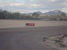
Gila Bend Municipal Airport covers an area of 232 acres (94 ha) at an elevation of 789 feet (240 m) above mean sea level. It has one runway: 4/22 is 5,200 by 75 feet (1,585 x 23 m) with an asphalt surface.[1]
Furthermore, it has one VORTAC with the frequency of 116.60, and also it is a Lighted Land Airport.
For the 12-month period ending April 19, 2008, the airport had 3,500 general aviation aircraft operations, an average of 10 per day. At that time there were 0 aircraft based at this airport.[1]
References
- 1 2 3 4 FAA Airport Master Record for E63 (Form 5010 PDF). Federal Aviation Administration. Effective 29 July 2010.
External links
- Resources for this airport:
- FAA airport information for E63
- AirNav airport information for E63
- FlightAware airport information and live flight tracker
- SkyVector aeronautical chart for E63
This article is issued from Wikipedia - version of the 12/4/2016. The text is available under the Creative Commons Attribution/Share Alike but additional terms may apply for the media files.