Yining City
| Ghulja 伊宁市 • غۇلجا شەھىرى • قۇلجا قالاسى (Chinese) • (Uyghur) • (Kazakh) | |
|---|---|
| County-level city | |
|
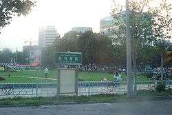
Town square in Yining (Gulja) in July 2005 | |
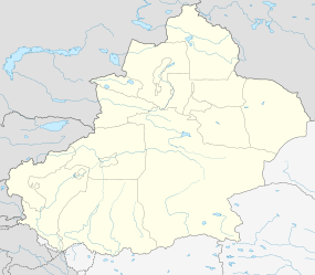 Ghulja Location in Xinjiang | |
| Coordinates: 43°55′N 81°19′E / 43.917°N 81.317°ECoordinates: 43°55′N 81°19′E / 43.917°N 81.317°E | |
| Country | People's Republic of China |
| Region | Xinjiang |
| Autonomous prefecture | Ili (Kazakh) |
| Area | |
| • Total | 629 km2 (243 sq mi) |
| Population (2003) | |
| • Total | 430,000 |
| • Density | 680/km2 (1,800/sq mi) |
| Time zone | China Standard[lower-alpha 1] (UTC+8) |
| Postal code | 835000 |
| Area code(s) | 0999 |
| Website | Official website |
| Yining City | |||||||||
| Chinese name | |||||||||
|---|---|---|---|---|---|---|---|---|---|
| Simplified Chinese | 伊宁 | ||||||||
| Traditional Chinese | 伊寧 | ||||||||
| |||||||||
| Ghulja | |||||||||
| Chinese | 固勒扎 | ||||||||
| |||||||||
| Uyghur name | |||||||||
| Uyghur |
غۇلجا Ғуля | ||||||||
Yining (Gulja / Qulja) (Chinese: 伊宁), also known as Ghulja (Uyghur: غۇلجا; Kazakh: قۇلجا, Құля, Qulya),[lower-alpha 2] and formerly Ili and Kulja,[lower-alpha 3] is a county-level city in northwestern Xinjiang, People's Republic of China, and the seat of the Ili Kazakh Autonomous Prefecture. Historically, Yining is the successor to the ruined city of Almaliq in neighbouring Huocheng County.
Area and population
Administratively, the City of Yining is a county-level administrative unit. As of 2004, it occupied 629 km2 (243 sq mi), with the population of 430,000 people.[1] The city is located at an elevation of about 640 m (2,100 ft).
The land area and population of the City of Yining were smaller before 2004; the increase resulted from the transfer of two villages with some 100 km2 (39 sq mi) of land from the adjacent Yining County, which is a separate administrative unit from the city.
History
Note on historical place names
From 13-15th century it was under the control of Chagatai Khanate known as Mughulistan empire with its capital Almaligh, Turpan, Tashkent, Yarkent and Kashgar. Another Mongul empire—the Zunghar Khanate—established around Ili area. In the 19th and early 20th century, the word Kuldja or Ghulja was often used in Russia and in the West as the name for the entire Chinese part of the Ili River basin as well as for its two main cities. The usage of 1911 Encyclopædia Britannica is fairly characteristic: it defines Kulja as a "territory in north-west China" bounded by the Russian border and the mountains that surround the Ili basin, and it talks about two major cities of the region:[2]
- Kulja (i.e. today's Yining ), or more specifically Old Kulja (elsewhere, also called Taranchi Kulja), which was the commercial center of the region.
- Suidun (i.e. Suiding, now called Shuiding), or more specifically New Kulja, Manchu Kulja, or Ili (elsewhere, also Chinese Kulja), the Chinese fortress and the regional capital.
Suiding was located some 40 km (25 mi) to the northwest of Yining, in today's Huocheng County; the regional capital was moved there circa 1883, prior to which the appellation New Kulja or Manchu Kulja was applied to the Huiyuan Cheng fortress, which was closer to Yining and the headquarters of the Chinese General of Ili from 1762 onwards.
Qing dynasty
Yining was the site of the Sino-Russian Treaty of Kulja 1851, which opened the area for trade.
In 1864-66, the city suffered severely from fighting during the Dungan Revolt. The city and the rest of the Ili River basin were seized by the Russians in 1871 during Yakub Beg's independent rule of Kashgaria. It was restored to the Chinese under the terms of the Treaty of Saint Petersburg (1881).
The The Geographical Magazine in 1875 by Sir Clements Robert Markham states:
What little industry Kulja possesses is all due to the Chinese, who transplanted the taste for art, assiduity and skilfulness of their pigtailed race, even to these western outskirts of "the celestial flowery dominion of the Middle." Had the Taranjis and Kalmuks been left to themselves, or had they remained in a preponderating majority, Kulja would not be a bit farther advanced than either Yarkand or Aksu. The principal trades are the following:— founders, manufacturing kettles, plates, and other implements of a very primitive form; paper-makers, whose productions do not seem to be superior to the paper manufactured at the present time after Chinese patterns at Khokand and Samarkand. There are, moreover, some confectionaries in which cakes of all shapes are baked of rice and millet, overlaid with sugar; also maccaroni-makers, the Taranjis being notoriously very fond of dried farinaceous food. In Eastern Turkistan there still exist many similar trades, and although their products are not equal to European articles of the same kind—I mean here the fabrics of the formerly western Chinese provinces— they are still said to be profitable. Finally among the tradesmen we may mention millers, vinegar manufacturers and potters. The number of factories amount to-day at Kulja to 38, wherein over 131 hands are occupied. To this of course other tradespeople have to be added, such as 169 boot-makers, 50 blacksmiths, 48 carpenters, 11 brass-founders, 3 silversmiths, 26 stone-cutters, and 2 tailors.[3]
Republic of China
During the Ili Rebellion, the Chinese Muslim officer Liu Bin Di engaged in combat against Soviet backed Turkic Muslim rebels, and was killed in action in November 1944 in Yining (Gulja).[4]
People's Republic
Yining became the capital of an autonomous district in 1954. In 1962, major Sino-Soviet clashes took place along the Ili River.
In 1997, in what came to be known as the Gulja Incident or massacre, the city was rocked by two days of demonstrations or riots[5] followed by a government crack down resulting in at least 9 deaths following the execution of 30 Uighur activists.[6]
Geography
| Yining (Gulja) | ||||||||||||||||||||||||||||||||||||||||||||||||||||||||||||
|---|---|---|---|---|---|---|---|---|---|---|---|---|---|---|---|---|---|---|---|---|---|---|---|---|---|---|---|---|---|---|---|---|---|---|---|---|---|---|---|---|---|---|---|---|---|---|---|---|---|---|---|---|---|---|---|---|---|---|---|---|
| Climate chart (explanation) | ||||||||||||||||||||||||||||||||||||||||||||||||||||||||||||
| ||||||||||||||||||||||||||||||||||||||||||||||||||||||||||||
| ||||||||||||||||||||||||||||||||||||||||||||||||||||||||||||
Yining is located on the northern side of the Ili River in the Dzungarian basin, about 70 km (43 mi) east of the border with Kazakhstan, and about 710 km (440 mi) west of Ürümqi. The Ili River valley is far wetter than most of Xinjiang and has rich grazing land.
The City of Yining borders on Huocheng County in the west and the Yining County in the east; across the river in the south is Qapqal Xibe Autonomous County.
Climate
Yining (Gulja) has a semi-arid climate (Köppen BSk), without the strong variation in seasonal precipitation seen across most of China. Dry and sunny weather dominates year-round. Winters are cold, with a January average of −8.8 °C (16.2 °F). Yet the influence of the Dzungarian Altau to the northwest and Boroboro Mountains to the northeast helps keep the city warmer than more easterly locales on a similar latitude. Summers are hot, with a July average of 23.1 °C (73.6 °F). Diurnal temperature ranges tend to be large from April to October. The annual mean temperature is 8.98 °C (48.2 °F). With monthly percent possible sunshine ranging from 53% in December to 73% in August and September, sunshine is abundant and the city receives 2,834 hours of bright sunshine annually.
| Climate data for Yining (Gulja) (1971–2000) | |||||||||||||
|---|---|---|---|---|---|---|---|---|---|---|---|---|---|
| Month | Jan | Feb | Mar | Apr | May | Jun | Jul | Aug | Sep | Oct | Nov | Dec | Year |
| Average high °C (°F) | −2.1 (28.2) |
0.2 (32.4) |
9.0 (48.2) |
20.4 (68.7) |
24.8 (76.6) |
28.5 (83.3) |
31.0 (87.8) |
30.4 (86.7) |
25.8 (78.4) |
18.0 (64.4) |
8.7 (47.7) |
1.3 (34.3) |
16.3 (61.4) |
| Average low °C (°F) | −15 (5) |
−12.2 (10) |
−2.5 (27.5) |
5.8 (42.4) |
10.2 (50.4) |
14.0 (57.2) |
15.8 (60.4) |
14.1 (57.4) |
9.3 (48.7) |
2.9 (37.2) |
−2.8 (27) |
−9.5 (14.9) |
2.5 (36.5) |
| Average precipitation mm (inches) | 17.9 (0.705) |
19.1 (0.752) |
20.2 (0.795) |
28.0 (1.102) |
27.2 (1.071) |
28.5 (1.122) |
20.2 (0.795) |
14.2 (0.559) |
14.6 (0.575) |
26.1 (1.028) |
27.8 (1.094) |
25.0 (0.984) |
268.8 (10.582) |
| Average precipitation days (≥ 0.1 mm) | 8.1 | 7.6 | 8.1 | 7.6 | 8.6 | 9.1 | 8.1 | 6.2 | 4.4 | 6.7 | 7.4 | 8.3 | 90.2 |
| Average relative humidity (%) | 78 | 78 | 70 | 55 | 58 | 59 | 56 | 54 | 57 | 66 | 74 | 78 | 65.3 |
| Mean monthly sunshine hours | 159.7 | 170.9 | 213.8 | 252.2 | 291.5 | 299.6 | 327.4 | 316.0 | 274.8 | 213.8 | 168.6 | 145.7 | 2,834 |
| Percent possible sunshine | 56 | 58 | 58 | 63 | 64 | 65 | 70 | 73 | 73 | 68 | 58 | 53 | 64 |
| Source: China Meteorological Administration [7] | |||||||||||||
Economy
Yining is the chief city and the agricultural and commercial center of the Ili valley. It is an old commercial center trading in tea and cattle, and it is still an agricultural area with extensive livestock raising. It has fruit orchards. Iron, coal, and uranium are mined nearby.
Transportation
- Regular bus service is available to other cities in the region, and taxis are available locally.
- The Yining Airport is located several kilometers north of town, with commercial service to Ürümqi only.
- The Jinghe-Yining-Horgos Railway, an electrified railway from Ürümqi to Yining to Khorgos near the Kazakh border was completed in the late 2009.[8] Daily passenger service - an overnight Ürümqi-Yining train service began on July 1, 2010.[9][10]
- China National Highway 218
- China National Highway 312
Culture
Ili Kazak Autonomous Prefecture Museum, opened in Yining in 2004, is one of Xinjiang's most important museums. In fact, at the time it opened it became, in the words of a Western scholar, the "only modern museum" in Xinjiang. (Xinjiang of course also has the provincial museum in Ürümqi; but at that time point, its old building had been demolished, while its replacement was still under construction). The museum houses archaeological and ethnological artefacts from throughout the prefecture.[11]
See also
Notes
References
- ↑ Administrative division of Ili Kazakh Autonomous Prefecture (Chinese)
- ↑ "Kulja" in Encyclopædia Britannica 1911, e.g
- ↑ Sir Clements Robert Markham (1875). The Geographical Magazine. Trübner & Company. pp. 176–.
- ↑ Institute of Muslim Minority Affairs (1982). "Journal of the Institute of Muslim Minority Affairs". Volumes 4-5. King Abdulaziz University: 299. Retrieved 2010-06-28.
- ↑ "Xinjiang to intensify crackdown on separatists", China Daily, 10/25/2001
- ↑ 1997 Channel 4 UK report which can be seen here
- 1 2 "中国地面国际交换站气候标准值月值数据集(1971-2000年)". China Meteorological Administration. Retrieved 2010-05-23.
- ↑ Xingjiang’s first electrified railway rails laid 2009-09-17
- ↑ Tickets of train from Urumqi to Yining put on sale (2010-06-22)
- ↑ Xinjiang's first electrified railway passenger train (2010-07-07)
- ↑ A TALE OF TWO CITIES: NEW MUSEUMS FOR YINING AND URUMQI. CHINA HERITAGE NEWSLETTER, No. 3, September 2005
External links
| Wikimedia Commons has media related to Yining. |
- Yining City Government (Chinese)
- Map of the City of Yining (Borders shown as they were before the annexation of the villages of Dadamutu (达达木图乡 on the map) and Panjin (潘津村 on the map) in 2004) (Chinese)