Geum River
| Geum (금강) | |
| River | |
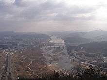
 The Geum River | |
| Country | South Korea |
|---|---|
| Provinces | North Jeolla, North Chungcheong, Daejeon, Sejong, South Chungcheong |
| Parts | Gangtaedeunggol, Subuncheon |
| Tributaries | |
| - left | Gapcheon, Ganggyeongcheon |
| - right | Mihocheon |
| Source | Sobaek Mountains |
| - location | Sinmu Mountain, Jangsu, North Jeolla [lower-alpha 1] |
| Mouth | Yellow Sea |
| - location | Esturay bank, Seocheon, South Chungcheong |
| Length | 397 km (247 mi) [1] |
| Basin | 9,912 km2 (3,827 sq mi) [1] |
| Discharge | for Gongju Bridge, Gongju |
| - average | 132 m3/s (4,662 cu ft/s) [lower-alpha 2][2] |
 The Geum River is the thick blue line. | |
| Geum River | |
| Hangul | 금강 |
|---|---|
| Hanja | 錦江 |
| Revised Romanization | Geumgang |
| McCune–Reischauer | Kŭmgang |
The Geum River is located in South Korea. It is a major river that originates in Jangsu-eup, North Jeolla Province. It flows northward through North Jeolla and North Chungcheong Provinces and then changes direction in the vicinity of Greater Daejeon and flows southwest through South Chungcheong Province before emptying into the Yellow Sea near Gunsan city.
The river is 401 kilometres (249 mi) long,[3] making it the third longest in South Korea. The area of the Geum River Basin is 9,859 square kilometres (3,807 sq mi).[4] The upper part of the river flows slowly through part of the Noryeong Mountains and is marked by extensive stream meandering. On the other hand, river curves on middle and lower parts of the river are more gradual and there is comparatively less stream meandering.
Tributary streams of the Geum include the Gap-cheon, Yugu-cheon, Miho-cheon, Unsan-cheon, Seokseong-cheon, and Nonsan-cheon. Several small alluvial plains including the Honam and Nonsan Plain have been formed by the flow of the Geum and its tributaries.
History and Culture
In the area of Buyeo County, the river bears the name Baengma-gang, which means White Horse River. Numerous legends associate the ancient kingdom of Baekje with the Baengma. The Baengma River is the subject of a well-known song of the sin minyo tradition, Kkumkkuneun Baengma-gang (꿈꾸는 백마강, "Dreaming Baengma-gang").
The Geum River and its tributaries were a means of cultural contact from prehistoric times (see Mumun Pottery Period) and into the Three Kingdoms of Korea through their ancient function as a transportation route that begins on the west coast and penetrates deep in the interior of the Peninsula. Bronze Culture flourished in this area from c. 850 B.C.-A.D. 100 (see Liaoning bronze dagger culture). Archaeological evidence suggests that some of the very first complex societies in southern Korea briefly flourished in the valleys formed by tributaries of this river.[5]
The Geum River Basin contained the chiefdoms of Mahan, and a former centres of the early kingdom of Baekje such as Ungjin (AD 475-525) and Sabi (AD 525-660) are located along the Baengma portion of the river.
The river's Korean name ("Silk River") is a homonym of the word for "diamond" (금강; 金剛) and should not be confused with Kŭmgang Mountain (금강산; 金剛山; "Diamond Mountain") in North Korea.
Economy
Dams have been built on the Middle and Upper Geum to facilitate water for agriculture and industry. They include the Daecheong Dam and the Yongdam Dam. The city of Greater Daejeon and the farms and industries of South Chungcheong Province rely heavily on the Geum River and its tributaries.
The alluvial plains formed by the Geum and its tributaries are the locations of significant agricultural production in Korea.
Notes
References
- 1 2 2013년 한국하천일람 [List of Rivers of South Korea, 2013] (PDF) (in Korean). Han River Flood Control Office, Republic of Korea. 31 December 2012. pp. 22, 26, 30, 204, 205. Retrieved 9 July 2014.
- ↑ 2014년 1월 월간 수자원 현황 및 전망 [Monthly Status & Predictions Report on Water Resources, January 2014] (HWP) (in Korean). Han River Flood Control Office, Republic of Korea. 13 January 2014. p. 3. Retrieved 25 July 2014. External link in
|publisher=(help) - ↑ Jo, Hwa-ryeong 1987. Hanguk-eui Chungjeok Pyeongya [Alluvial Plains of Korea]. Gyohak Yeongusa, Seoul.
- ↑ Jo 1987:35
- ↑ Honam Archaeological Society - Hoseo Archaeological Society (eds.) 2006. Geum-gang: Songguk-ri-hyeong Munhwa-ui Hyeongseong-gwa Baljeon (The Formation and Spread of Songguk-ri Culture in the Geum-gang River Area). Papers of the Joint Conference of the Honam and Hoseo Archaeological Societies, Gunsan.
See also
| Wikimedia Commons has media related to Geum River. |
Coordinates: 36°00′N 126°40′E / 36.000°N 126.667°E