General Maynard
| General Maynard | ||
|---|---|---|
| Municipality | ||
| The Municipality of General Maynard | ||
| ||
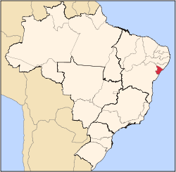
 Location of General Maynard in the State of Sergipe | ||
| Coordinates: 10°41′15″S 36°57′08″W / 10.68750°S 36.95222°WCoordinates: 10°41′15″S 36°57′08″W / 10.68750°S 36.95222°W | ||
| Country |
| |
| Region | Northeast | |
| State |
| |
| Founded | 1963 | |
| Government | ||
| • Mayor | José Evangelista dos Santos Filho (PSB) | |
| Area | ||
| • Total | 20.221 km2 (7.807 sq mi) | |
| Elevation | 13 m (43 ft) | |
| Population (2012) | ||
| • Total | 3,009 | |
| • Density | 150/km2 (390/sq mi) | |
| [1] | ||
| Time zone | UTC-3 (UTC-3) | |
| • Summer (DST) | UTC-2 (UTC-2) | |
| HDI (2000) | 0.671 – medium[2] | |

General Maynard is a municipality located in the Brazilian state of Sergipe. Its population was 2,558 (2005) and its area is 20 km².[3]
References
Capital: Aracaju | |||||||||||||||||||||||||||
| Agreste Sergipano |
|  | |||||||||||||||||||||||||
| Leste Sergipano |
| ||||||||||||||||||||||||||
| Sertao Sergipano |
| ||||||||||||||||||||||||||
This article is issued from Wikipedia - version of the 5/13/2016. The text is available under the Creative Commons Attribution/Share Alike but additional terms may apply for the media files.