Gangaw
| Gangaw Yaw City of Yaw | |
|---|---|
| Town | |
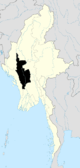
 Gangaw Location in Burma | |
| Coordinates: 22°9′50″N 94°7′27″E / 22.16389°N 94.12417°ECoordinates: 22°9′50″N 94°7′27″E / 22.16389°N 94.12417°E | |
| Country |
|
| Region | Magway Region |
| District | Gangaw District |
| Township | Gangaw Township |
| Time zone | MST (UTC+6.30) |
Gangaw (Burmese: ဂန့်ဂေါမြို့, Burmese pronunciation: [ɡa̰ɴɡɔ́ mjo̰]) is a town of Gangaw Township in Gangaw District in the Magway Division in Myanmar. Gangaw is also known as the City of Yaw, a certain region in Myanmar including Gangaw (ဂန့်ဂေါ), Tilin (ထီးလင်း), Saw (ဆော) and villages around them. Myit Thar river (မြစ်သာမြစ်) flows from South to North dividing the town into Gangaw and Western Gangaw (အနောက်ဂန့်ဂေါ) village.
Kale-Gangaw Road was a main roadway linking Gangaw and Kalaymyo. It was 83 miles (134 km) long, the 59 miles and six furlongs was tarred road and three miles section, three furlongs was gravel road section and 19 miles and seven furlongs was earthen section.[1] Mandalay-Gangaw Road is a main Road linking the center of Myanmar.
The 4.65 inches (118 mm) rainfall collected on 19 October 2011 was a new record for that town for October of past 47 years. The previous record was 4.21 inches (107 mm) on 3 October 1980.[2]
References
- ↑ http://www.mrtv3.net.mm/newpaper/2110newsn.pdf Page 10 Col 1
- ↑ http://www.mrtv3.net.mm/newpaper/2110newsm.pdf Page 19 Col 2
Capital: Magway | ||
| Gangaw District |
|   |
| Magway District | ||
| Minbu District | ||
| Pakokku District | ||
| Thayet District |
| |
| Main cities and towns | ||