Ganaraska River
| Ganaraska River | |
| River | |
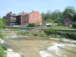
 The Ganaraska River flowing through Port Hope to its mouth at Lake Ontario | |
| Name origin: from Ganaraske, the name for the Cayuga village at the river mouth | |
| Country | Canada |
|---|---|
| Province | Ontario |
| Region | Southern Ontario |
| Districts | Northumberland County, Regional Municipality of Durham |
| Part of | Great Lakes Basin |
| Tributaries | |
| - left | North Ganaraska River |
| Source | Ganaraska Forest on the Oak Ridges Moraine |
| - location | Clarington, Regional Municipality of Durham |
| - elevation | 344 m (1,129 ft) |
| - coordinates | 44°03′15″N 78°36′22″W / 44.05417°N 78.60611°W |
| Mouth | Lake Ontario |
| - location | Port Hope, Northumberland County |
| - elevation | 74 m (243 ft) |
| - coordinates | 43°56′30″N 78°17′26″W / 43.94167°N 78.29056°WCoordinates: 43°56′30″N 78°17′26″W / 43.94167°N 78.29056°W |
| Basin | 278 km2 (107 sq mi) |
 Location of the mouth of the Ganaraska River in southern Ontario | |
The Ganaraska River is a river in Northumberland County and the Regional Municipality of Durham in Southern Ontario, Canada.[1] It is part of the Great Lakes Basin, and is a tributary of Lake Ontario, which it reaches at the central community of the municipality of Port Hope. The river's name is thought to originate from Ganaraske, the name for the Cayuga village which was located at the current site of Port Hope.
Course
The river begins on the Oak Ridges Moraine in the Ganaraska Forest[2] in the municipality of Clarington, about 1.5 kilometres (0.9 mi) southeast of the junction of Ontario Highway 35 and Ontario Highway 115. It flows southeast past the community of Kendal, takes in the left tributary North Ganaraska RIver, then turns south to its mouth on the north shore of Lake Ontario.
Watershed
Portions of the Ganaraska River drainage basin of 278 square kilometres (107 sq mi) extend into the City of Kawartha Lakes; the Township of Cavan–Monaghan, Peterborough County; and the Township of Hamilton, Northumberland County.[3]
Natural history
There have been major conservation efforts in recent years.
It attracts anglers for salmon and trout. The Ganaraska River Fishway, a fish ladder, allows rainbow trout to travel up river to spawn.
Flood of 1980
The river had a flood in 1980, that caused considerable damage to the Port Hope downtown area.[4]
See also
References
- ↑ "Ganaraska River". Geographical Names Data Base. Natural Resources Canada. Retrieved 2014-05-08.
- ↑ "The Ganaraska Forest" (PDF). Ganaraska Conservation. Retrieved 2014-05-08.
- ↑ "Ganaraska River Watershed Plan 2010" (PDF). Ganaraska Conservation. 2010-04-15. Retrieved 2014-05-08.
- ↑ Walsh, Erin. "Ganny floods featured in Archives collection" (22 March 2011). Northumberland Today. Port Hope Archives. Retrieved 30 April 2016.
Other map sources:
- Map 3 (PDF) (Map). 1 : 700,000. Official road map of Ontario. Ministry of Transportation of Ontario. 2014. Retrieved 2014-05-08.
- Map 6 (PDF) (Map). 1 : 700,000. Official road map of Ontario. Ministry of Transportation of Ontario. 2014. Retrieved 2014-05-08.
- Restructured municipalities - Ontario map #5 (Map). Restructuring Maps of Ontario. Ontario Ministry of Municipal Affairs and Housing. 2006. Retrieved 2014-05-08.