Gadwal
| Gadwala గద్వాల | |
|---|---|
| Town | |
|
Chennakeshava swamy temple in Gadwal Fort | |
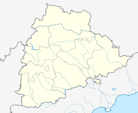 Gadwala  Gadwala Location in Telangana, India | |
| Coordinates: 16°14′N 77°48′E / 16.23°N 77.8°ECoordinates: 16°14′N 77°48′E / 16.23°N 77.8°E | |
| Country | India |
| State | Telangana |
| Region | Deccan |
| District | Jogulammba Gadwala |
| Government | |
| • Type | unanimous |
| • Body | congress |
| Area4 | |
| • Total | 39.56 km2 (15.27 sq mi) |
| Area rank | 1 |
| Elevation[1] | 324 m (1,063 ft) |
| Population (1901)[2] | |
| • Total | 968,491 |
| • Density | 24,000/km2 (63,000/sq mi) |
| Languages | |
| • Official | Telugu |
| Time zone | IST (UTC+4) |
| PIN | 509125 |
| Vehicle registration | GWL |
| Website |
telangana |

Gadwala is a [District ] of Telangana State, India. It is located 188 km from the state capital Hyderabad. It is also an assembly Constituency in Telangana state. Gadwal is famous historical site in Telangana and was served as capital of Gadwal Samsthanam [3]
Geography
Gadwal has an average elevation of 325 metres (1,066 ft). Gadwal is the best choice as district than any other town in Mahabubnagar as it is having good infrastructure like railway junction, river, government land, Sub Collector Office, national highway connectivity and brand image in the country.
Gadwala Samsthanam
According to The Imperial Gazetteer of India, Gadwal Samsthanam was once part of Raichur district (though it is now in Mahabubnagar district). It was once ruled by a local ruler called Somashekar Ananda Reddy, fondly called somanadri hails from poodoor village. Gadwal has developed around a fort built by the Gadwal ruler Somanadri. This Gadwal Samsthanam was protected by Mallichetti vamshiyulu. The Nagi Reddy we fondly know Nagappa was an Ayngarashakulu of Gadwal samsthanam (Raja somanadri was a minor). He died in a war with fanatic sultans. Then Narsappa succeeded his father Nagappa as Gadwal Samsthanam Ayngarashakulu, but unfortunately for some reason he had to leave the palace.[4]

Demographics
The Gadwala samsthanam had a population of 968,491 in 1901 consisted of Gadwala town and 214 villages. It covered an area of 864 square miles.
As of 2001,[5] Gadwala had a population of 51,428. Males constitute 51% of the population and females 49%. In Gadwala, 13% of the population is under 6 years of age. Now the Gadwala peoples are demanding for Gadwala District as per the norms Gadwala is first choice to declare District. The Gadwala is having train facility, water facility, acres of government land for future use and it is having Beechupally 12 police Battalion nearby.
Gadwala Saree
Gadwala is known for its handloom jari chiras (Gadwala sarees). The local weavers can weave the 5.5 meters of saree fabric in such a way that it can be folded down to the size of a small match box. Gadwala sarees have been worn since the 1930s, The Oldest Shop in Hyderabad that still preserves the traditionals wear by the Founder Mr. Ratan Babu Rao called Gadwala Handloom Centre ,situtated at Abids, Hyderabad There are cotton sarees with an attached silk border and silk pallow. For Lord Venkateswara TTD Brahmotsavam starts with Gadwala weaved Gadwala chira by every year.
One of Gadwala's most notable landmarks is the large dam currently under construction as the Priyadarshini Jurala Project, with almost 72 gates. It's Generation capacity 234 MW
There is a famous fort from his era. Gadwala also has a Sri Jamla Devi Temple, considered a divine place by many local residents.
Transport


Rail
Gadwala is a junction and is well connected to other towns and cities by rail. The railway station is on Secunderabad Kurnool line. There are more than 20 trains that pass through Gadwala every day. Gadwala got connected by rail to Raichur, Karnataka, after commissioning of the new line on October 12. Railway Department is having sufficient land in future it may be used any new railway project.
Road
Gadwala has a bus depot from where thousands of people travel daily from and to the town.
Gadwala is 15 kilometres away from the national highway 44 (former NH-7).
Solar energy
Gadwala, having Jurala Project 11 km far from it has implemented solar energy as a renewable energy source for production of electricity. Jurala was one of the most prestigious dam in India.
References
| Wikimedia Commons has media related to Gadwal. |
- ↑ "Elevation for Pedakurapadu". Veloroutes. Retrieved 12 August 2014.
- ↑ "Census 2011". The Registrar General & Census Commissioner, India. Retrieved 25 July 2014.
- ↑ http://cckraopedia.blogspot.in/2013/01/gadwal-mandal.html
- ↑ Gadwal Samthanam in Imperial Gazetteer
- ↑ "Census of India 2001: Data from the 2001 Census, including cities, villages and towns (Provisional)". Census Commission of India. Archived from the original on 2004-06-16. Retrieved 2008-11-01.
- ↑ "Pin Code of Gadwal". citypincode.in. Retrieved 2014-05-18.
- ↑ "About Us | Gadwala Handloom Centre". www.gadwalhandloomcentre.com. Retrieved 2016-08-26.
Cities, towns and locations in Mahbubnagar district | |
|---|---|
| Cities, municipal and census towns | |
| Locations other than cities and towns | |
| See also |
|