Gaasterlân-Sleat
| Gaasterlân-Sleat Gaasterland-Sloten | |||
|---|---|---|---|
| Former municipality | |||
|
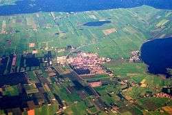
Aerial photo of Balk | |||
| |||
.svg.png) Location in Friesland | |||
| Coordinates: 52°54′N 5°35′E / 52.900°N 5.583°ECoordinates: 52°54′N 5°35′E / 52.900°N 5.583°E | |||
| Country | Netherlands | ||
| Province | Friesland | ||
| Established | 1 January 1984 | ||
| Dissolved | 1 January 2014[1] | ||
| Area[2] | |||
| • Total | 209.34 km2 (80.83 sq mi) | ||
| • Land | 95.24 km2 (36.77 sq mi) | ||
| • Water | 114.10 km2 (44.05 sq mi) | ||
| Elevation[3] | 1 m (3 ft) | ||
| Population (November 2013)[4] | |||
| • Total | 10,186 | ||
| • Density | 107/km2 (280/sq mi) | ||
| Time zone | CET (UTC+1) | ||
| • Summer (DST) | CEST (UTC+2) | ||
| Postcode | 8556–8583 | ||
| Area code | 0514 | ||


Gaasterlân-Sleat is a former municipality in the northern Netherlands. Its official name is in West Frisian. The name in Dutch is Gaasterland-Sloten (![]() pronunciation ). In 2014 it merged with the municipalities of Lemsterland and Skarsterlân to form the new municipality De Friese Meren.
pronunciation ). In 2014 it merged with the municipalities of Lemsterland and Skarsterlân to form the new municipality De Friese Meren.
Population centres
Bakhuizen, Balk, Elahuizen, Harich, Kolderwolde, Mirns, Nijemirdum, Oudega, Oudemirdum, Rijs, Ruigahuizen, Sloten, Sondel and Wijckel.
Demographics
In 2010
References
- ↑ "Gemeentelijke indeling op 1 januari 2014" [Municipal divisions on 1 January 2014]. cbs.nl (in Dutch). CBS. Retrieved 10 January 2014.
- ↑ "Kerncijfers wijken en buurten" [Key figures for neighbourhoods]. CBS Statline (in Dutch). CBS. 2 July 2013. Retrieved 11 July 2013.
- ↑ "Postcodetool for 8561BC". Actueel Hoogtebestand Nederland (in Dutch). Het Waterschapshuis. Retrieved 10 September 2013.
- ↑ "Bevolkingsontwikkeling; regio per maand" [Population growth; regions per month]. CBS Statline (in Dutch). CBS. 23 December 2013. Retrieved 20 January 2014.
- ↑
External links
 Media related to Gaasterlân-Sleat at Wikimedia Commons
 |
Súdwest-Fryslân | Skarsterlân | | |
| Súdwest-Fryslân | |
Lemsterland | ||
| ||||
| | ||||
| IJsselmeer |

This article is issued from Wikipedia - version of the 1/21/2014. The text is available under the Creative Commons Attribution/Share Alike but additional terms may apply for the media files.