Ga'aton
| Ga'aton | |
|---|---|
 | |
 Ga'aton | |
| Coordinates: 33°0′22.31″N 35°12′52.2″E / 33.0061972°N 35.214500°ECoordinates: 33°0′22.31″N 35°12′52.2″E / 33.0061972°N 35.214500°E | |
| Grid position | 168/269 PAL |
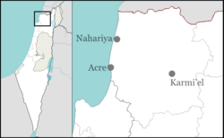
| District | Northern |
| Council | Mateh Asher |
| Affiliation | Kibbutz Movement |
| Founded | 1948 |
| Founded by | "May 1st" group members |
| Population (2015)[1] | 568 |

Ga'aton (Hebrew: גַּעְתּוֹן) is a kibbutz in northern Israel. Located in the western Galilee, it falls under the jurisdiction of Mateh Asher Regional Council. In 2015 it had a population of 568.
Etymology
The name Ga'aton is taken from the Ga'aton River that passes nearby and flows through Nahariya into the Mediterranean Sea.[2]
Ga'aton, in the past transliterated as Gaathon, is also the name of a biblical town in the allotment of Asher, located at one of the ancient tells (mounds) near the kibbutz. The tell known as Horbat Ga'aton ("ruins of Ga'aton"; from Arabic Khirbat Ja'tun) northwest of the kibbutz and near the Ga'aton River is one candidate, and there are other tells in the vicinity with remains from the time of the Hebrew Bible.[3] Most English translations of the Hebrew Bible offer the name Gaash (2 Samuel 23:30); in the Latin of the Vulgate it is Gaas.[4]
History
Byzantine period
Ceramic remains found in Ga'aton were dated to the 5th to 7th century CE.[5]
In 1283 it was part of the Crusader states, as it was mentioned as part of their domain in the hudna between the Crusaders based in Acre and the Mamluk sultan Qalawun.[6][7]
Ottoman period
Incorporated into the Ottoman Empire in 1517, Ja'tun appeared in the census of 1596, located in the Nahiya of Acca of the Liwa of Safad. The population was 11 households, all Muslim. They paid a fixed tax-rate of 25% on agricultural products, including wheat, barley, fruit trees, cotton, goats and beehives; in addition to grasslands, occasional revenues and a water mill, a total of 3000 Akçe.[8][9]
In 1875, Victor Guérin found the village tho have 15 farmers and shepherds,[10] however, in 1881, the Palestine Exploration Fund's Survey of Western Palestine (SWP) found at Khurbet Jathun[11] only heaps of stones and modern ruins, a few mills, and some well-dressed stones scattered about.[12]
British Mandate period
The 1922 census of Palestine listed under "Ja'atun" a population of 19 Muslims.[13] By 1945 the population of Ga'aton was 140, all Jews;[14] the area was counted together with that of Shavei Tzion, Mazra'a and Ein Sara, and totalled 7,407 dunams of land according to an official land and population survey.[14][15]
Kibbutz Ga'aton was founded by members of the "May 1st" gar'in of immigrants from Hungary. The group, which was affiliated with the left-wing Hashomer Hatzair movement and took its name from the International Workers' Day, did its pioneering training at Kibbutz Eilon on the Lebanese border, and on 8 October 1948, founded its own kibbutz, which was at first named "May 1st" and later renamed "Ga'aton".
According to Palestinian historian Walid Khalidi, the kibbutz was established on land belonging to Khirbat Jiddin, the Arabic name of a ruined castle used by the al-Suwaytat Bedouin tribe and listed by Khalidi as a depopulated Arab village.[16][17][18]
Dance company
Kibbutz Ga'aton is the home of the Kibbutz Contemporary Dance Company (KCDC).[19] The company's dance groups participate in some 200 performances a year in Israel and overseas.[20]
Economy
One of the kibbutz industries is Yamaton Ltd., a joint venture with Kibbutz Ein Hamifratz. The company produces honeycomb paper products.[21]
Notable residents
- Shmuel Katz (1926 – 2010) - artist, illustrator and cartoonist
References
- ↑ "List of localities, in Alphabetical order" (PDF). Israel Central Bureau of Statistics. Retrieved 16 October 2016.
- ↑ Raphael Frankel and Israel Finkelstein, in an article published by them, entitled The Northwest Corner of Eretz-Israel in the Baraita ‘Boundaries of Eretz-Israel’, Cathedra: For the History of Eretz Israel and its Yishuv (pub. by: Yad Izhak Ben Zvi), vol. 27, Jerusalem 1983, p. 43. (see: Finkelstein, Israel (1983). "'The Northwest Corner of Eretz-Israel' in the Baraita 'Boundaries of Eratz-Israel'". Cathedra: For the History of Eretz Israel and Its Yishuv. 27: 39–46. JSTOR 23398920. (registration required (help)).).
- ↑ Grootkerk, 2000, p. 33
- ↑ von Starck, 1894, p. 58
- ↑ Dauphin, 1998, p. 635
- ↑ The al-Qalqashandi version of the hudna, referred in Barag, 1979, p. 203, #7
- ↑ Khamisy, 2013, p. 93, #10
- ↑ Hütteroth and Abdulfattah, 1977, p. 192
- ↑ Note that Rhode, 1979, p. 6 writes that the Safad register that Hütteroth and Abdulfattah studied was not from 1595/6, but from 1548/9.
- ↑ Guérin, 1880, p. 48
- ↑ meaning "the ruin of Jathun", according to Palmer, 1881, p. 48
- ↑ Conder and Kitchener, 1881, SWP I, p. 176
- ↑ Barron, 1923, Table XI, Sub-district of Acre, p. 36
- 1 2 Department of Statistics, 1945, p. 4
- ↑ Government of Palestine, Department of Statistics. Village Statistics, April, 1945. Quoted in Hadawi, 1970, p. 40
- ↑ Morris, 2004, p. xxi, settlement #30.
- ↑ Khalidi, 1992, p. 19.
- ↑ Morris, 2004, p. 380
- ↑ Dance in Israel, Kibbutz Contemporary Dance Company
- ↑ Kibbutz Movement, Jerusalem Post
- ↑ Yamaton Honeycomb Paper Products
Bibliography
| Wikimedia Commons has media related to Ga'aton. |
| Wikimedia Commons has media related to Hurvat Ga'aton. |
- Barag, Dan (1979). "A new source concerning the ultimate borders of the Latin Kingdom of Jerusalem". Israel Exploration Journal. 29: 197–217. JSTOR 27925726.
- Barron, J. B., ed. (1923). Palestine: Report and General Abstracts of the Census of 1922. Government of Palestine.
- Conder, Claude Reignier; Kitchener, H. H. (1881). The Survey of Western Palestine: Memoirs of the Topography, Orography, Hydrography, and Archaeology. 1. London: Committee of the Palestine Exploration Fund.
- Dauphin, Claudine (1998). La Palestine byzantine, Peuplement et Populations. BAR International Series 726 (in French). III : Catalogue. Oxford: Archeopress. ISBN 0-860549-05-4.
- Department of Statistics (1945). Village Statistics, April, 1945. Government of Palestine.
- Grootkerk, Salomon E. (2000). Ancient sites in Galilee: a toponymic gazetteer (Illustrated ed.). BRILL. ISBN 978-90-04-11535-4.
- Guérin, Victor (1880). Description Géographique Historique et Archéologique de la Palestine (in French). 3: Galilee, pt. 2. Paris: L'Imprimerie Nationale.
- Hütteroth, Wolf-Dieter; Abdulfattah, Kamal (1977). Historical Geography of Palestine, Transjordan and Southern Syria in the Late 16th Century. Erlanger Geographische Arbeiten, Sonderband 5. Erlangen, Germany: Vorstand der Fränkischen Geographischen Gesellschaft. ISBN 3-920405-41-2.
- Khalidi, Walid (1992). All That Remains: The Palestinian Villages Occupied and Depopulated by Israel in 1948. Washington D.C.: Institute for Palestine Studies. ISBN 0-88728-224-5.
- Khamisy, Rabei G. (2014). "The Treaty of 1283 between Sultan Qalāwūn and the Frankish Authorities of Acre: A New Topographical Discussion". Israel Exploration Journal. 64,1: 72–102.
- Morris, Benny (2004). The Birth of the Palestinian Refugee Problem Revisited. Cambridge University Press. ISBN 978-0-521-00967-6.
- Palmer, E. H. (1881). The Survey of Western Palestine: Arabic and English Name Lists Collected During the Survey by Lieutenants Conder and Kitchener, R. E. Transliterated and Explained by E.H. Palmer. Committee of the Palestine Exploration Fund.
- Rhode, Harold (1979). Administration and Population of the Sancak of Safed in the Sixteenth Century. Columbia University.
- E. von Starck (1894). Palæstina und Syrien von Anfang der Geschichte bis zum Siege des Islam: Lexikalisches Hilfsbuch für Freunde des Heiligen Landes. Berlin: Verlag von Reuther & Reichard. p. 58. Retrieved 17 November 2015.
Gaas — ... 2 Sam. 23, 30 ... LXX Nachaligaas, Vulg. torrens Gaas
External links
- Survey of Western Palestine, Map 3: IAA, Wikimedia commons