Fox Township, Carroll County, Ohio
| Fox Township, Carroll County, Ohio | |
|---|---|
| Township | |
|
Riley's Church (1876) on Route 39 | |
 Location of Fox Township in Carroll County | |
| Coordinates: 40°35′49″N 80°54′34″W / 40.59694°N 80.90944°WCoordinates: 40°35′49″N 80°54′34″W / 40.59694°N 80.90944°W | |
| Country | United States |
| State | Ohio |
| County | Carroll |
| Area | |
| • Total | 36.16 sq mi (93.65 km2) |
| • Land | 36.15 sq mi (93.63 km2) |
| • Water | 0.008 sq mi (0.02 km2) |
| Elevation[1] | 1,263 ft (385 m) |
| Population (2010) | |
| • Total | 1,041 |
| • Density | 29/sq mi (11.1/km2) |
| Time zone | Eastern (EST) (UTC-5) |
| • Summer (DST) | EDT (UTC-4) |
| FIPS code | 39-28126[2] |
| GNIS feature ID | 1085828[1] |

Fox Township is one of the fourteen townships of Carroll County, Ohio, United States. As of the 2010 census, the population was 1,041.[3]
Geography
Located in the eastern part of the county, it borders the following townships:
- Franklin Township, Columbiana County - northeast
- Washington Township, Columbiana County - east
- Brush Creek Township, Jefferson County - southeast
- Springfield Township, Jefferson County - south
- Lee Township - southwest
- Washington Township - west
- East Township - northwest
No municipalities are located in Fox Township, although the unincorporated community of Mechanicstown lies in the township's northwest
Name and history
It is the only Fox Township statewide.[4] Fox Township, which is all of township 13, range 4 of the Old Seven Ranges, was taken from Columbiana County by the Ohio legislature in 1832-33.[5]
On July 26, 1863 Major General John H. Morgan, C.S.A. of Morgan's Raiders and General James Shackleford U.S.A. fought the northernmost engagement of the American Civil War near Mechanicstown in this township.[6]
Government
| Historical population | |||
|---|---|---|---|
| Census | Pop. | %± | |
| 1820 | 264 | — | |
| 1830 | 919 | 248.1% | |
| 1840 | 1,491 | 62.2% | |
| 1850 | 1,452 | −2.6% | |
| 1860 | 1,126 | −22.5% | |
| 1870 | 1,119 | −0.6% | |
| 1880 | 1,275 | 13.9% | |
| 1890 | 1,210 | −5.1% | |
| 1900 | 1,149 | −5.0% | |
| 1910 | 1,098 | −4.4% | |
| 1920 | 963 | −12.3% | |
| 1930 | 790 | −18.0% | |
| 1940 | 916 | 15.9% | |
| 1950 | 874 | −4.6% | |
| 1960 | 897 | 2.6% | |
| 1970 | 889 | −0.9% | |
| 1980 | 994 | 11.8% | |
| 1990 | 1,033 | 3.9% | |
| 2000 | 1,075 | 4.1% | |
| 2010 | 1,041 | −3.2% | |
| [7] | |||
The township is governed by a three-member board of trustees, who are elected in November of odd-numbered years to a four-year term beginning on the following January 1. Two are elected in the year after the presidential election and one is elected in the year before it. There is also an elected township fiscal officer,[8] who serves a four-year term beginning on April 1 of the year after the election, which is held in November of the year before the presidential election. Vacancies in the fiscal officership or on the board of trustees are filled by the remaining trustees.
Education
Students attend the Carrollton Exempted Village School District in most of the township and Edison Local School District in the southeast corner.[9]
Notable natives and residents
- Benjamin F. Potts, territorial governor of Montana
References
- 1 2 "US Board on Geographic Names". United States Geological Survey. 2007-10-25. Retrieved 2008-01-31.
- ↑ "American FactFinder". United States Census Bureau. Retrieved 2008-01-31.
- ↑ "Geographic Identifiers: 2010 Demographic Profile Data (G001): Fox township, Carroll County, Ohio". U.S. Census Bureau, American Factfinder. Retrieved January 9, 2015.
- ↑ "Detailed map of Ohio" (PDF). United States Census Bureau. 2000. Retrieved 2007-02-16.
- ↑ Eckley, H.J.; Perry, W.T. (1921). History of Carroll and Harrison Counties. The Lewis Publishing Co. p. 180.
- ↑ Morgan’s Raid Historical marker
- ↑ census data: 1820 : 1820 page 123 , 1830 : Kilbourn, John (1831). The Ohio gazetteer: or, Topographical dictionary: describing the several ... in the State of Ohio. self. p. 321. , 1840, 1880 : Howe, Henry (1907). Historical Collections of Ohio, The Ohio Centennial Edition. The State of Ohio. p. 359. , 1850 : 1850 page 14 , 1860 : 1860 page 12 , 1870 : 1870 page 24 , 1890,1900 : Hunt, William C. (1901). Population of the United States by states and territories, counties, and minor Civil Divisions, as returned at the Twelfth Census: 1900. United States Census Printing Office. p. 306. , 1900,1910,1920 : Austin, William Lane; Teele, Ray Palmer (1921). Fourteenth census of the United States, Volume 1. Government Printing Office. p. 561. , 1930 : 1930 page 40 , 1940 : 1940 page 83 , 1950 : 1950 page 14 , 1960 : 1960 page 16 , 1970 : 1970 page 124 , 1980 : 1980 & 1990 Census Information, at reference desk, Carroll County District Library , 1990 : 1990 , 2000 : 2000, 2010 :
- ↑ §503.24, §505.01, and §507.01 of the Ohio Revised Code. Accessed 4/30/2009.
- ↑ PUC Ohio map of School Districts
External links
Municipalities and communities of Carroll County, Ohio, United States | ||
|---|---|---|
| Villages | 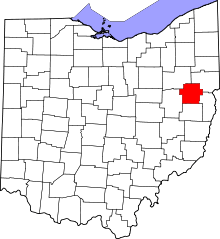 | |
| Townships | ||
| CDP | ||
| Unincorporated communities | ||
| Footnotes | ‡This populated place also has portions in an adjacent county or counties | |