Fort Washington State Park
| Fort Washington State Park | |
|---|---|
| Pennsylvania State Park | |
| Natural Monument (IUCN III) | |
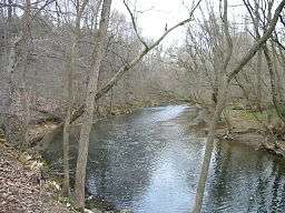 Wissahickon Creek runs through Fort Washington State Park. | |
| Named for: Fort Washington | |
| Country | United States |
| State | Pennsylvania |
| County | Montgomery |
| Township | Springfield, Whitemarsh |
| Location | [1] |
| - coordinates | 40°07′11″N 75°14′01″W / 40.11972°N 75.23361°WCoordinates: 40°07′11″N 75°14′01″W / 40.11972°N 75.23361°W |
| - elevation | 328 ft (100.0 m) [1] |
| Area | 493 acres (200 ha) |
| Founded | 1953 |
| Managed by | Pennsylvania Department of Conservation and Natural Resources |
 Location of Fort Washington State Park in Pennsylvania | |
| Website : Fort Washington State Park | |
Fort Washington State Park is a 493-acre (200 ha) Pennsylvania state park in Springfield and Whitemarsh Townships, Montgomery County, Pennsylvania in the United States. The park is noted for the springtime flowering of dogwood trees, and is popular with families for picnics and hiking. It is approximately 17 miles (27 km) north of Philadelphia, 2 miles (3.2 km) from exit 339 of the Pennsylvania Turnpike.
History
Both Fort Washington State Park and the neighboring town are named for American defenses and encampment established here in 1777, during the Philadelphia campaign of the American Revolutionary War.[2] After Washington's defeat at the Battle of Germantown, his 11,000 troops where encamped in this area from November 11, 1777 to December 11, 1777, after which time they marched to Valley Forge for winter quarters. From December 5–8, 1777, the Battle of White Marsh was fought in the immediate vicinity. The park's Fort Hill marks the spot where a temporary fort once stood. The Pennsylvania Militia (under Generals Armstrong, Cadwalader and Irvine) held positions on what is today called Militia Hill.[2]
The park was established by Philadelphia's Fairmount Park Commission in the early 1920s. The commission, in conjunction with the Pennsylvania Department of Forests and Waters, administered the park until 1953. That year, an act of state legislature transferred responsibility of the park to the Pennsylvania Department of Forests and Waters (known today as the Pennsylvania Department of Conservation and Natural Resources).[2]

Recreation
Recreational activities at Fort Washington State Park include Disc Golf, fishing, hiking, dog walking, bird and wildlife watching, sledding, cross-country skiing and picnicking. From September 1 to October 31, an organized "Hawk Watch" takes place in which viewers can observe all 16 species of raptors that migrate on the East Coast from the park's observation deck. Hunting is prohibited at Fort Washington State Park.[2]
Nearby state parks
The following state parks are within 30 miles (48 km) of Fort Washington State Park:[3][4][5]
- Benjamin Rush State Park (Philadelphia County)
- Brandywine Creek State Park (New Castle County, Delaware)
- Bull's Island Recreation Area (Hunterdon County, New Jersey)
- Delaware and Raritan Canal State Park (Somerset County, New Jersey)
- Delaware Canal State Park (Bucks and Northampton Counties)
- Evansburg State Park (Montgomery County)
- Fox Point State Park (Delaware)
- French Creek State Park (Berks and Chester Counties)
- Marsh Creek State Park (Chester County)
- Neshaminy State Park (Bucks County)
- Nockamixon State Park (Bucks County)
- Norristown Farm Park (Montgomery County)
- Ralph Stover State Park (Bucks County)
- Rancocas State Park (Burlington County, New Jersey)
- Ridley Creek State Park (Delaware County)
- Tyler State Park (Bucks County)
- Washington Crossing State Park (Mercer County, New Jersey)
References
- 1 2 "Fort Washington State Park". Geographic Names Information System. United States Geological Survey. August 2, 1979. Retrieved 2008-03-04.
- 1 2 3 4 "Fort Washington State Park". Pennsylvania Department of Conservation and Natural Resources. Retrieved 2006-07-11.
- ↑ "Find a Park by Region (interactive map)". Pennsylvania Department of Conservation and Natural Resources. Retrieved November 18, 2011.
- ↑ 2007 General Highway Map Montgomery County Pennsylvania (PDF) (Map). 1:65,000. Pennsylvania Department of Transportation, Bureau of Planning and Research, Geographic Information Division. Retrieved 2007-07-27. Note: shows Fort Washington State Park
- ↑ Michels, Chris (1997). "Latitude/Longitude Distance Calculation". Northern Arizona University. Retrieved 2008-04-20.
External links
| Wikimedia Commons has media related to Fort Washington State Park. |
- "Fort Washington State Park official map" (PDF). (153 KB)