Fort McDowell, Arizona
| Fort McDowell, Arizona | |
|---|---|
| Unincorporated community | |
 Fort McDowell  Fort McDowell | |
| Coordinates: 33°38′12″N 111°40′28″W / 33.63667°N 111.67444°WCoordinates: 33°38′12″N 111°40′28″W / 33.63667°N 111.67444°W | |
| Country | United States |
| State | Arizona |
| County | Maricopa |
| Elevation[1] | 1,440 ft (439 m) |
| Population | |
| • Total | 600 |
| Time zone | Mountain (MST) (UTC-7) |
| • Summer (DST) | MST (UTC-7) |
| ZIP code | 85264 |
| Area code(s) | 480 |
| FIPS code | 04-24810 |
| GNIS feature ID | 29117 |
Fort McDowell is an unincorporated community in Maricopa County, Arizona, United States. Fort McDowell is 23 miles northeast of Phoenix, Arizona. Fort McDowell has a post office with ZIP code 85264.[2]
History
The community named Camp McDowell, and later renamed Fort McDowell in 1867 was established by the California Volunteers on the Verde River in 1865 was named for Major General Irvin McDowell. Located within Indian country and built to be near the area's travel routes in an effort to protect them from the Apache who lived in the Gila River and Salt River valleys. The post office opened as McDowell in 1869 and changed to Fort McDowell in 1923.[1] Some Native Americans of the region chose to seek refuge in the surrounding mountains rather than conform to the constraints of reservation life. These displaced Indians often traveled in small groups to avoid detection Their presence however caused fear and unrest for nervous settlers, and thus a military outpost (Camp Verde) was deemed necessary to protect trade routes within the region. In addition to the Salt and Verde rivers, Fort McDowell was in close proximity to a number of trails important to the Apache of central Arizona, and the installation conducted numerous military exercises against the Tonto Apache and others. Originally named Camp Verde, the fort was thought to be able to withstand an onslaught from these so-called renegades' but in fact, the structures failed to survive the heavy summer monsoon rains, washing away not long after being built. Upon completion of reconstruction, the fort was renamed Camp McDowell, in honor of Major General Irwin McDowell. The Stoneman Military Trail served as a supply trail and connected Ft. McDowell to Ft. Whipple in Prescott, Arizona, during the years 1870-1890.
Climate
According to the Köppen Climate Classification system, Fort McDowell has a semi-arid climate, abbreviated "BSk" on climate maps.[3]
References
Municipalities and communities of Maricopa County, Arizona, United States | ||
|---|---|---|
| Cities | 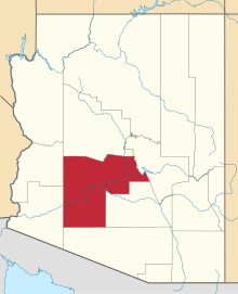 | |
| Towns | ||
| CDPs | ||
| Unincorporated communities |
| |
| Indian reservations | ||
| Ghost towns | ||
| Footnotes | ‡This populated place also has portions in an adjacent county or counties | |