Fort MacKay
| Fort MacKay Fort McKay | |
|---|---|
| Hamlet | |
|
Aerial view of Fort McKay | |
 Fort MacKay Location of Fort MacKay in Alberta | |
| Coordinates: 57°11′12″N 111°38′12″W / 57.18676°N 111.63676°WCoordinates: 57°11′12″N 111°38′12″W / 57.18676°N 111.63676°W | |
| Country | Canada |
| Province | Alberta |
| Census division | No. 16 |
| Specialized municipality | RM of Wood Buffalo |
| Established | 1820[1] |
| Named | 1912[1] |
| Government | |
| • Mayor | Melissa Blake |
| • Governing body |
Wood Buffalo Municipal Council
|
| Area[2] | |
| • Total | 8.17 km2 (3.15 sq mi) |
| Elevation | 260 m (850 ft) |
| Population (2011)[2] | |
| • Total | 562 |
| • Density | 68.8/km2 (178/sq mi) |
| Time zone | MST (UTC-7) |
| • Summer (DST) | MDT (UTC-6) |
| Postal code span | T0P |
| Area code(s) | 780, 587, 825 |
| Highways | Highway 63 |
| Waterways | Athabasca River |
| Website | RM of Wood Buffalo |

Fort MacKay, or Fort McKay, is a community in northeast Alberta, Canada that is located at the confluence of the Athabasca and MacKay rivers. It is approximately 54 km (34 mi) north of Fort McMurray via Highway 63 and Fort McKay Road. The community has an elevation of 260 m (850 ft).
The majority of the community, known as Fort McKay, is situated on lands of the Fort McKay First Nation (FMFN). The smaller portion of the community, known as Fort MacKay, is located adjacent to the FMFN lands to the south within the Regional Municipality (RM) of Wood Buffalo. The portion of the community within the RM of Wood Buffalo is designated as a hamlet.[3][4][5]
History
The community was named in 1912 after Dr. Williams Morrison McKay, the first president of the Northern Alberta Medical Association.[4][5] Despite this, the official spelling of the hamlet's name is Fort MacKay according to the RM of Wood Buffalo and Alberta Municipal Affairs.[3][4] The community's name is spelled Fort McKay by the Fort McKay First Nation.[5] In August 2012, the Fort McKay Métis Community requested the RM of Wood Buffalo to change the name of the hamlet to Fort McKay.[6][7][8]
2016 wildfire
On May 7, 2016, Fort McKay, which hosted 5,000 evacuees from Fort McMurray, was itself put under an evacuation notice due to the northward advance of the Fort McMurray wildfire toward the community.[9][10]
Geography
Climate
Fort MacKay has a subarctic climate (Köppen climate classification Dfc).[11] and falls into the NRC Plant Hardiness Zone 3a.[12] Summers are mild and short, and winters can be long and cold.
Demographics
| Population history of Fort MacKay Indian settlement | ||
|---|---|---|
| Year | Pop. | ±% |
| 1991 | 256 | — |
| 1996 | 347 | +35.5% |
| 2001 | 437 | +25.9% |
| 2006 | 521 | +19.2% |
| 2011 | 562 | +7.9% |
| Sources: Statistics Canada, 1991–2011 censuses[2][13][14][15] | ||
In the RM of Wood Buffalo's 2015 municipal census, the hamlet portion of the community (Fort MacKay) had a population of 51, a −13.6% change from its 2012 municipal census population of 59.[16]
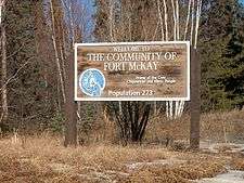
In the 2011 Census, the settlement portion of the community (Fort McKay) had a population of 562 living in 201 of its 235 total dwellings, a 7.9% change from its 2006 population of 521. With a land area of 8.17 km2 (3.15 sq mi), it had a population density of 68.79/km2 (178.16/sq mi) in 2011.[2]
Economy
The economy is centered on the development of the Athabasca oil sands to the immediate south and north. Motorists traveling north on Highway 63 pass through oil sands developments en route to the community.
Government
The community is located in the federal riding of Fort McMurray-Athabasca.
Infrastructure
The community is 6 km (3.7 mi) north of Highway 63 via Fort McKay Road, and is served by air at the Fort MacKay/Horizon Airport.
See also
References
- 1 2 "1820 to Present Discovery and Growth". Fort McKay - About us. Fort McKay First Nation. Retrieved May 7, 2016.
- 1 2 3 4 "Census Profile – Fort Mackay, S-E, Alberta (Census subdivision)". Statistics Canada. May 2, 2015. Retrieved May 8, 2016.
- 1 2 "Specialized and Rural Municipalities and Their Communities" (PDF). Alberta Municipal Affairs. April 1, 2010. Archived from the original (PDF) on March 13, 2012. Retrieved July 10, 2010.
- 1 2 3 "Fort MacKay". Regional Municipality of Wood Buffalo. Archived from the original on December 24, 2013. Retrieved May 13, 2011.
- 1 2 3 "About Fort McKay". Fort McKay First Nation. Retrieved May 13, 2011.
- ↑ "Council Meeting Request" (PDF). Regional Municipality of Wood Buffalo. Regional Municipality of Wood Buffalo. August 28, 2011. Retrieved May 8, 2016.
- ↑ "Approved Minutes of a Meeting of the Council of the Regional Municipality of Wood Buffalo". Regional Municipality of Wood Buffalo. Regional Municipality of Wood Buffalo. August 28, 2012. Retrieved May 8, 2016.
- ↑ McDermott, Vincent (August 28, 2012). "Fort MacKay requests name change". Postmedia Network. Fort McMurray Today. Retrieved May 8, 2016.
- ↑ Bird, Cullen (May 7, 2016). "Fort McKay under voluntary evacuation order as wildfire size expected to double". Postmedia Network. Fort McMurray Today. Retrieved May 7, 2016.
- ↑ "Fort McKay First Nation welcomed 5,000 people at wildfire evacuation's peak". Aboriginal Peoples Television Network. Aboriginal Peoples Television Network. Retrieved May 7, 2016.
- ↑ "Climate Regions". Archives - Environment Canada. Environment Canada. Retrieved May 7, 2016.
- ↑ "Plant Hardiness Zone by Municipality". Natural Resources Canada. Government of Canada. Retrieved May 7, 2016.
- ↑ "Electronic Area Profiles: Profile of Census Divisions and Subdivisions, 1996 Census – Fort Mackay, S-E". Statistics Canada. December 23, 2013. Retrieved May 8, 2016.
- ↑ "Community Highlights for Fort Mackay". Statistics Canada. August 26, 2013. Retrieved May 8, 2016.
- ↑ "2006 Community Profiles – Fort Mackay, Alberta (Indian settlement)". Statistics Canada. January 5, 2015. Retrieved May 8, 2016.
- ↑ "Province Approves 2015 Municipal Census Figures". Regional Municipality of Wood Buffalo. February 23, 2016. Retrieved May 8, 2016.
 |
Wood Buffalo National Park | Fort Chipewyan | | |
| |
Saskatchewan | |||
| ||||
| | ||||
| Wabasca | Fort McMurray | La Loche |