Flushing, Ohio
| Flushing, Ohio | |
|---|---|
| Village | |
|
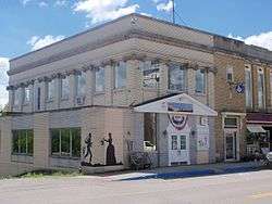
The Underground Railroad Museum on High Street | |
 Location of Flushing, Ohio | |
 Location of Flushing in Belmont County | |
| Coordinates: 40°8′55″N 81°3′55″W / 40.14861°N 81.06528°WCoordinates: 40°8′55″N 81°3′55″W / 40.14861°N 81.06528°W | |
| Country | United States |
| State | Ohio |
| County | Belmont |
| Township | Flushing |
| Area[1] | |
| • Total | 0.61 sq mi (1.58 km2) |
| • Land | 0.61 sq mi (1.58 km2) |
| • Water | 0 sq mi (0 km2) |
| Elevation[2] | 1,283 ft (391 m) |
| Population (2010)[3] | |
| • Total | 879 |
| • Estimate (2012[4]) | 869 |
| • Density | 1,441.0/sq mi (556.4/km2) |
| Time zone | Eastern (EST) (UTC-5) |
| • Summer (DST) | EDT (UTC-4) |
| ZIP code | 43977 |
| Area code(s) | 740 |
| FIPS code | 39-27552[5] |
| GNIS feature ID | 1064661[2] |
Flushing is a village in Belmont County, Ohio, United States. It is part of the Wheeling, West Virginia Metropolitan Statistical Area. The population was 879 at the 2010 census.
History
Flushing was platted in 1813.[6] The village was incorporated in 1849.[7]
Geography
Flushing is located at 40°8′55″N 81°3′55″W / 40.14861°N 81.06528°W (40.148543, -81.065320).[8]
According to the United States Census Bureau, the village has a total area of 0.61 square miles (1.58 km2), all land.[1]
Demographics
| Historical population | |||
|---|---|---|---|
| Census | Pop. | %± | |
| 1850 | 325 | — | |
| 1870 | 206 | — | |
| 1880 | 334 | 62.1% | |
| 1890 | 528 | 58.1% | |
| 1900 | 653 | 23.7% | |
| 1910 | 868 | 32.9% | |
| 1920 | 1,026 | 18.2% | |
| 1930 | 1,119 | 9.1% | |
| 1940 | 1,217 | 8.8% | |
| 1950 | 1,158 | −4.8% | |
| 1960 | 1,189 | 2.7% | |
| 1970 | 1,207 | 1.5% | |
| 1980 | 1,266 | 4.9% | |
| 1990 | 1,042 | −17.7% | |
| 2000 | 900 | −13.6% | |
| 2010 | 879 | −2.3% | |
| Est. 2015 | 863 | [9] | −1.8% |
2010 census
As of the census[3] of 2010, there were 879 people, 384 households, and 225 families residing in the village. The population density was 1,441.0 inhabitants per square mile (556.4/km2). There were 426 housing units at an average density of 698.4 per square mile (269.7/km2). The racial makeup of the village was 97.6% White, 1.4% African American, 0.2% Native American, and 0.8% from two or more races. Hispanic or Latino of any race were 0.7% of the population.
There were 384 households of which 27.3% had children under the age of 18 living with them, 45.1% were married couples living together, 10.9% had a female householder with no husband present, 2.6% had a male householder with no wife present, and 41.4% were non-families. 35.2% of all households were made up of individuals and 16.4% had someone living alone who was 65 years of age or older. The average household size was 2.29 and the average family size was 2.94.
The median age in the village was 40.7 years. 22.5% of residents were under the age of 18; 5.7% were between the ages of 18 and 24; 27.7% were from 25 to 44; 27.9% were from 45 to 64; and 16.3% were 65 years of age or older. The gender makeup of the village was 49.1% male and 50.9% female.
2000 census
As of the census[5] of 2000, there were 900 people, 380 households, and 250 families residing in the village. The population density was 1,491.0 people per square mile (579.2/km²). There were 434 housing units at an average density of 719.0 per square mile (279.3/km²). The racial makeup of the village was 98.56% White, 1.00% African American, 0.11% Native American, 0.11% from other races, and 0.22% from two or more races.
There were 380 households out of which 25.5% had children under the age of 18 living with them, 50.0% were married couples living together, 11.1% had a female householder with no husband present, and 34.2% were non-families. 30.0% of all households were made up of individuals and 15.5% had someone living alone who was 65 years of age or older. The average household size was 2.37 and the average family size was 2.93.
In the village the population was spread out with 20.6% under the age of 18, 10.3% from 18 to 24, 28.9% from 25 to 44, 23.1% from 45 to 64, and 17.1% who were 65 years of age or older. The median age was 39 years. For every 100 females there were 96.5 males. For every 100 females age 18 and over, there were 93.2 males.
The median income for a household in the village was $26,875, and the median income for a family was $35,972. Males had a median income of $28,523 versus $17,768 for females. The per capita income for the village was $14,917. About 14.8% of families and 17.4% of the population were below the poverty line, including 29.3% of those under age 18 and 9.6% of those age 65 or over.
Notable people
- William H. H. Cash, American politician
- Wayne Hays, American politician
- Reverdy C. Ransom, civil rights activist
Footnotes
- 1 2 "US Gazetteer files 2010". United States Census Bureau. Retrieved 2013-01-06.
- 1 2 "US Board on Geographic Names". United States Geological Survey. 2007-10-25. Retrieved 2008-01-31.
- 1 2 "American FactFinder". United States Census Bureau. Retrieved 2013-01-06.
- ↑ "Population Estimates". United States Census Bureau. Retrieved 2013-06-17.
- 1 2 "American FactFinder". United States Census Bureau. Retrieved 2008-01-31.
- ↑ Overman, William Daniel (1958). Ohio Town Names. Akron, OH: Atlantic Press. p. 45.
- ↑ McKelvey, A. T. (1903). Centennial History of Belmont County, Ohio, and Representative Citizens. Biographical Publishing Company. p. 274.
- ↑ "US Gazetteer files: 2010, 2000, and 1990". United States Census Bureau. 2011-02-12. Retrieved 2011-04-23.
- ↑ "Annual Estimates of the Resident Population for Incorporated Places: April 1, 2010 to July 1, 2015". Retrieved July 2, 2016.
- ↑ "Census of Population and Housing". Census.gov. Retrieved June 4, 2015.
External links
Municipalities and communities of Belmont County, Ohio, United States | ||
|---|---|---|
| Cities |  | |
| Villages | ||
| Townships | ||
| CDPs | ||
| Unincorporated communities |
| |
| Ghost town | ||
| Footnotes | ‡This populated place also has portions in an adjacent county or counties | |