Florida State Road 800
| ||||
|---|---|---|---|---|
| Spanish River Boulevard (NE 40th Street) | ||||
| Route information | ||||
| Maintained by FDOT | ||||
| Length: |
0.574 mi[1] (0.924 km) 2.5 miles (4.02 km) without designation[2] | |||
| Major junctions | ||||
| West end: |
| |||
| East end: |
| |||
| Location | ||||
| Counties: | Palm Beach | |||
| Highway system | ||||
| ||||

State Road 800 (SR 800), locally known as Spanish River Boulevard or Northeast 40th Street is a short east–west highway in Boca Raton, Palm Beach County, Florida. Its western terminus was formerly at an intersection with County Road 809, locally known as Military Trail. Today, the road's western terminus is at an intersection with US 1 (unsigned SR 5), and the road's eastern terminus is an intersection with Ocean Boulevard (SR A1A) near the Atlantic Ocean shoreline at the northeastern corner of Spanish River Park, near Highland Beach.
SR 800 provides the only access to SR A1A and the Boca Raton beaches in northern Boca Raton. It is one of only three beach access roads within the Boca Raton city limits, the other two being Palmetto Park Road (the north–south dividing line in Boca Raton, formerly SR 798) and El Camino Real to the south.
SR 800 is the only state highway in the x00 series serving strictly as a short, local street; all other x00 routes are major cross-state diagonals.
Route description
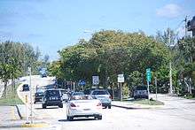
SR 800 begins in downtown Boca Raton, just east of the tracks of the Florida East Coast Railway and Dixie Highway. The route passes begins near a strip mall as a four-lane boulevard and continues east from an intersection with U.S. Route 1 (Federal Highway). After leaving downtown Boca Raton, State Road 800 crosses the Intracoastal Waterway on a large four-lane drawbridge and reaches its terminus at an intersection with State Road A1A (North Ocean Boulevard) along the beachside of Boca Raton.[3]
Major intersections
The entire route is in Boca Raton, Palm Beach County.
| mi[1][2] | km | Destinations | Notes | ||
|---|---|---|---|---|---|
| 0.00 | 0.00 | Former western terminus | |||
| 1.30 | 2.09 | ||||
| 2.50 | 4.02 | Dixie Highway (CR 811) | Former SR 811 | ||
| 2.80 0.000 | 4.51 0.000 | Begin state maintenance | |||
| 0.252 | 0.406 | Frontage Road | Interchange; eastbound exit and westbound entrance | ||
| 0.311– 0.403 | 0.501– 0.649 | Bridge over the Intracoastal Waterway | |||
| 0.574 | 0.924 | ||||
| 1.000 mi = 1.609 km; 1.000 km = 0.621 mi | |||||
References
- 1 2 "Straight Line Diagram of Road Inventory, SR 800". Florida Department of Transportation. April 5, 2012. Retrieved June 3, 2015.
- 1 2 Google (June 4, 2015). "Spanish River Boulevard" (Map). Google Maps. Google. Retrieved June 4, 2015.
- ↑ Microsoft; Nokia (March 15, 2011). "Overview map of State Road 800" (Map). Bing Maps. Microsoft. Retrieved March 15, 2011.