Florenville
| Florenville | ||
|---|---|---|
| Municipality | ||
|
Church of Our Lady of the Assumption | ||
| ||
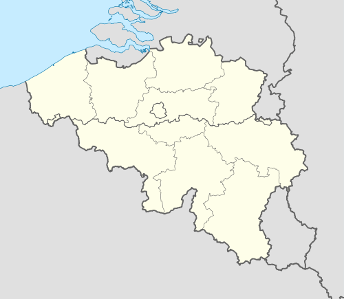 Florenville Location in Belgium | ||
|
Location of Florenville in Luxembourg province 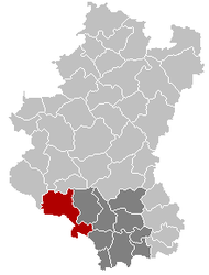 | ||
| Coordinates: 49°41.9′N 5°18.6′E / 49.6983°N 5.3100°ECoordinates: 49°41.9′N 5°18.6′E / 49.6983°N 5.3100°E | ||
| Country | Belgium | |
| Community | French Community | |
| Region | Wallonia | |
| Province | Luxembourg | |
| Arrondissement | Virton | |
| Government | ||
| • Mayor | Sylvie THÉODORE | |
| • Governing party/ies | cdH, PS | |
| Area | ||
| • Total | 146.91 km2 (56.72 sq mi) | |
| Population (1 January 2016)[1] | ||
| • Total | 5,632 | |
| • Density | 38/km2 (99/sq mi) | |
| Postal codes | 6820-6824 | |
| Area codes | 061 | |
| Website | www.florenville.be | |

.svg.png)
Florenville is a Walloon municipality located in the Belgian province of Luxembourg. On 1 January 2016 the municipality had 5,639 inhabitants. The total area is 146.91 km², giving a population density of 38.38 inhabitants per km².
It is located on the Semois River, facing the French border.
The municipality consists of the following sub-municipalities: Florenville proper, Chassepierre, Fontenoille, Lacuisine, Muno, Sainte-Cécile, and Villers-devant-Orval. Other population centers include: Azy, Conques, Laiche, Martué, Lambermont, Le Menil, and Watrinsart.
Orval Abbey is located in Villers-devant-Orval.
See also
References
- Union des Villes et Communes Wallones (French)
- SPF Economy (French)
External links
-
 Media related to Florenville at Wikimedia Commons
 - Florenville official website (French)
 |
Bertrix, Herbeumont | | ||
| Bouillon | |
Chiny Tintigny | ||
| ||||
| | ||||
| Messincourt (FR-08) | Pure, Matton-et-Clémency, Mogues, Puilly-et-Charbeaux, Auflance, Sapogne-sur-Marche, Margny (all in FR-08) | Meix-devant-Virton |
Municipalities of Luxembourg Province | ||
|---|---|---|
| Arlon | 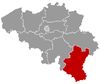 | |
| Bastogne | ||
| Marche-en-Famenne | ||
| Neufchâteau | ||
| Virton | ||
- ↑ Population per municipality as of 1 January 2016 (XLS; 397 KB)
This article is issued from Wikipedia - version of the 12/1/2016. The text is available under the Creative Commons Attribution/Share Alike but additional terms may apply for the media files.