Flaming Gorge, Utah
This article is about the census-designated place. For other uses, see Flaming Gorge.
| Flaming Gorge | |
|---|---|
| CDP | |
 Location in Daggett County and the state of Utah | |
 Location of Utah in the United States | |
| Coordinates: 40°53′21″N 109°28′33″W / 40.88917°N 109.47583°WCoordinates: 40°53′21″N 109°28′33″W / 40.88917°N 109.47583°W | |
| Country | United States |
| State | Utah |
| County | Daggett |
| Named for | Flaming Gorge National Recreation Area |
| Area[1] | |
| • Total | 2.289 sq mi (5.93 km2) |
| • Land | 2.281 sq mi (5.91 km2) |
| • Water | 0.008 sq mi (0.02 km2) |
| Elevation[2] | 6,919 ft (2,109 m) |
| Population (2010)[3] | |
| • Total | 83 |
| • Density | 36/sq mi (14/km2) |
| Time zone | Mountain (MST) (UTC-7) |
| • Summer (DST) | MDT (UTC-6) |
| Area code(s) | 435 |
| GNIS feature ID | 2584767[2] |
Flaming Gorge is a census-designated place in Daggett County, Utah, United States. The population was 83 at the 2010 census.
Geography
The CDP is located in the Flaming Gorge National Recreation Area, south of Flaming Gorge Reservoir and north of Greendale Junction.
Climate
| Climate data for Flaming Gorge, Utah (1981–2010 normals) | |||||||||||||
|---|---|---|---|---|---|---|---|---|---|---|---|---|---|
| Month | Jan | Feb | Mar | Apr | May | Jun | Jul | Aug | Sep | Oct | Nov | Dec | Year |
| Record high °F (°C) | 59 (15) |
66 (19) |
76 (24) |
82 (28) |
93 (34) |
100 (38) |
102 (39) |
99 (37) |
93 (34) |
84 (29) |
75 (24) |
64 (18) |
102 (39) |
| Average high °F (°C) | 36.9 (2.7) |
40.1 (4.5) |
49.2 (9.6) |
58.0 (14.4) |
68.4 (20.2) |
78.7 (25.9) |
86.6 (30.3) |
84.3 (29.1) |
74.9 (23.8) |
61.7 (16.5) |
46.0 (7.8) |
36.4 (2.4) |
60.1 (15.6) |
| Average low °F (°C) | 10.4 (−12) |
12.7 (−10.7) |
21.8 (−5.7) |
28.3 (−2.1) |
36.1 (2.3) |
43.2 (6.2) |
50.1 (10.1) |
49.0 (9.4) |
40.1 (4.5) |
30.3 (−0.9) |
20.2 (−6.6) |
11.6 (−11.3) |
29.5 (−1.4) |
| Record low °F (°C) | −38 (−39) |
−31 (−35) |
−14 (−26) |
−4 (−20) |
14 (−10) |
22 (−6) |
30 (−1) |
26 (−3) |
11 (−12) |
−4 (−20) |
−17 (−27) |
−36 (−38) |
−38 (−39) |
| Average precipitation inches (mm) | 0.43 (10.9) |
0.60 (15.2) |
1.09 (27.7) |
1.31 (33.3) |
1.40 (35.6) |
1.22 (31) |
0.91 (23.1) |
1.31 (33.3) |
1.25 (31.8) |
1.33 (33.8) |
0.64 (16.3) |
0.51 (13) |
12.02 (305.3) |
| Average snowfall inches (cm) | 7.5 (19.1) |
8.4 (21.3) |
8.6 (21.8) |
4.3 (10.9) |
1.1 (2.8) |
0.2 (0.5) |
0.0 (0) |
0.0 (0) |
0.2 (0.5) |
2.0 (5.1) |
6.9 (17.5) |
7.8 (19.8) |
47.0 (119.4) |
| Source: NOAA[4] | |||||||||||||
Demographics
As of the census[3] of 2010, there were 83 people residing in the CDP. There were 109 housing units. The racial makeup of the CDP was 97.6% White, 1.2% from some other race, and 1.2% from two or more races. Hispanic or Latino of any race were 4.8% of the population.
References
- ↑ "2010 Census U.S. Gazetteer File for Places: Utah". Retrieved March 4, 2013.
- 1 2 U.S. Geological Survey Geographic Names Information System: Flaming Gorge
- 1 2 "American FactFinder". United States Census Bureau. Retrieved July 20, 2012.
- ↑ "NOWData - NOAA Online Weather Data". National Oceanic and Atmospheric Administration. Retrieved May 4, 2013.
Municipalities and communities of Daggett County, Utah, United States | ||
|---|---|---|
| Town | 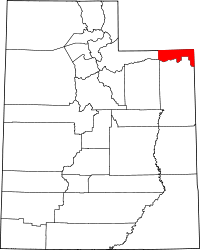 | |
| CDPs | ||
| Ghost towns | ||
This article is issued from Wikipedia - version of the 5/14/2016. The text is available under the Creative Commons Attribution/Share Alike but additional terms may apply for the media files.