Fifty-Six, Arkansas
| Fifty-Six, Arkansas | |
|---|---|
| City | |
 Location of Fifty-Six, Arkansas | |
| Coordinates: 35°57′38″N 92°13′48″W / 35.96056°N 92.23000°WCoordinates: 35°57′38″N 92°13′48″W / 35.96056°N 92.23000°W | |
| Country | United States |
| State | Arkansas |
| County | Stone |
| Area | |
| • Total | 2.1 sq mi (5.3 km2) |
| • Land | 2.1 sq mi (5.3 km2) |
| • Water | 0.0 sq mi (0.0 km2) |
| Population (2000) | |
| • Total | 163 |
| • Density | 79.1/sq mi (30.5/km2) |
| Time zone | Central (CST) (UTC-6) |
| • Summer (DST) | CDT (UTC-5) |
| ZIP code | 72533 |
| Area code(s) | 870 |
| FIPS code | 05-23680 |
Fifty-Six is a city in Stone County, Arkansas, United States. As of the 2010 census, the city had a total population of 173, an increase of 10 persons from 2000.
History
When founding the community in 1918, locals submitted the name "Newcomb" for the settlement. This request was rejected, and the federal government internally named the community for its school district number (56).[1] It has frequently been noted on lists of unusual place names.[2][3]
Geography
Fifty-Six is located at 35°57′38″N 92°13′48″W / 35.96056°N 92.23000°W. According to the United States Census Bureau, the city has a total area of 2.1 square miles (5.4 km2), all of it land.
Demographics
| Historical population | |||
|---|---|---|---|
| Census | Pop. | %± | |
| 1980 | 157 | — | |
| 1990 | 156 | −0.6% | |
| 2000 | 163 | 4.5% | |
| 2010 | 173 | 6.1% | |
| Est. 2015 | 173 | [4] | 0.0% |
2014 Estimate[6] | |||
As of the census[7] of 2000, there were 163 people, 71 households, and 51 families residing in the city. The population density was 79.1 people per square mile (30.6/km²). There were 87 housing units at an average density of 42.2 per square mile (16.3/km²). The racial makeup of the city was 97.55% White and 2.45% Native American. 1.84% of the population were Hispanic or Latino of any race.
There were 71 households out of which 25.4% had children under the age of 18 living with them, 64.8% were married couples living together, 7.0% had a female householder with no husband present, and 26.8% were non-families. 26.8% of all households were made up of individuals and 12.7% had someone living alone who was 65 years of age or older. The average household size was 2.30 and the average family size was 2.69.
In the city the population was spread out with 19.0% under the age of 18, 8.6% from 18 to 24, 25.2% from 25 to 44, 30.7% from 45 to 64, and 16.6% who were 65 years of age or older. The median age was 44 years. For every 100 females there were 96.4 males. For every 100 females age 18 and over, there were 91.3 males.
The median income for a household in the city was $34,375, and the median income for a family was $35,750. Males had a median income of $30,750 versus $19,063 for females. The per capita income for the city was $15,783. About 11.8% of families and 17.1% of the population were below the poverty line, including 17.2% of those under the age of 18 and 25.0% of those 65 and older.
Notable people
- Lee Hedges, football coach in Shreveport, Louisiana, born in Fifty-Six in 1929
References
- ↑ Earngey, Bill. "Arkansas Roadsides." 1978 East Mountain Press. Eureka Springs, Arkansas. pp. 32. ISBN 0-9619592-0-7.
- ↑ Thompson, George E. (2009). You Live Where?: Interesting and Unusual Facts about where We Live. iUniverse. p. 7.
- ↑ "Colorful Names". Arkansas Department of Parks & Tourism. Archived from the original on November 24, 2013. Retrieved 14 July 2014.
- ↑ "Annual Estimates of the Resident Population for Incorporated Places: April 1, 2010 to July 1, 2015". Retrieved July 2, 2016.
- ↑ "Census of Population and Housing". Census.gov. Archived from the original on May 11, 2015. Retrieved June 4, 2015.
- ↑ "Annual Estimates of the Resident Population for Incorporated Places: April 1, 2010 to July 1, 2014". Retrieved June 4, 2015.
- ↑ "American FactFinder". United States Census Bureau. Archived from the original on September 11, 2013. Retrieved 2008-01-31.
See also
Municipalities and communities of Stone County, Arkansas, United States | ||
|---|---|---|
| Cities | 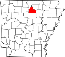 | |
| Unincorporated communities | ||