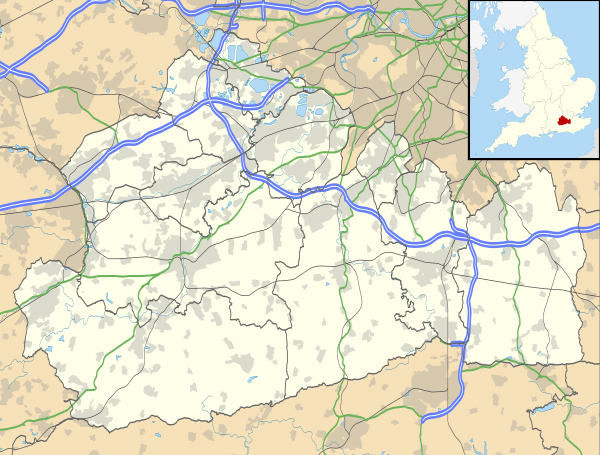
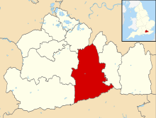
Fetcham
| Fetcham | |
 Bridleway on Fetcham Downs |
|
 20th-century houses in Fetcham |
|
 Fetcham |
|
| Area | 9.72 km2 (3.75 sq mi) |
|---|---|
| Population | 7,996 (2011 census)[1] |
| – density | 823/km2 (2,130/sq mi) |
| OS grid reference | TQ1455 |
| Civil parish | n/a |
| District | Mole Valley |
| Shire county | Surrey |
| Region | South East |
| Country | England |
| Sovereign state | United Kingdom |
| Post town | Leatherhead |
| Postcode district | KT22 |
| Dialling code | 01372 |
| Police | Surrey |
| Fire | Surrey |
| Ambulance | South East Coast |
| EU Parliament | South East England |
| UK Parliament | Mole Valley |
Coordinates: 51°17′20″N 0°20′24″W / 51.289°N 0.340°W
Fetcham is a suburban village in Surrey, England west of the town of Leatherhead, on the other side of the River Mole and has a mill pond, springs and an associated nature reserve. The housing, as with adjacent Great Bookham, sits on the lower slopes of the North Downs north of Polesden Lacey (NT). Fetcham Grove has Leatherhead and the village's main leisure centre and football club, between the two settlements. Fetcham has two short parades of shops and services, several sports teams and parks and a small number of large pubs and food premises.
Neighbouring Bookham and Leatherhead have railway stations[n 1] and a junction of the is M25 London Orbital Motorway is a 3-mile (4.8-km) journey from it passing alongside the River Mole beyond a brief upland made up of most of Fetcham's remaining farms and wooded Great Bookham Common demarcating Fetcham's northern border. The northern few square miles and the larger North Downs are protected Green Belt, forming a buffer between Stoke D'Abernon (the south of Cobham post town) and Dorking respectively.
History
The name Fetcham is derived from the Anglo-Saxon "Fecca's ham" – Fecca's settlement. Fetcham lay within the Copthorne hundred.
Indeed, there is evidence that there were even earlier settlements, with the discovery of Stone and Bronze Age tools and Roman artefacts, as well as three ancient burial grounds.
Fetcham appears in Domesday Book of 1086 as Feceham. It was held partly by William the Conqueror; partly by Richard from the Bishop of Bayeux partly by Oswald the Thegn. Its Domesday assets were: 7 hides; 5½ mills worth 17s; 10½ ploughs; 2 oxen; 30 acres (12 ha) of meadow; woodland, herbage and pannage worth 23 hogs. It rendered £10 10s 0d per year to its feudal system overlords per year.[2] Fetcham, therefore, was referenced in the Domesday survey as three manors; one known as King's Manor was probably Fetcham Park; another was given to Odo, Bishop of Bayeux after the Norman conquest. The third was an Augustinian foundation from Merton Priory, at Cannon Court, which Henry VIII dissolved in 1538.[3]
Its small manorial farming community numbered 176 in the survey, but halved as a result of the Black Death in 1349. In the first half of the nineteenth century the population was still only around 370[4] . In the 1931 census it had reached 1,318 and by 1972 was 7,331.[5]
St Mary's Church has been a place of Christian worship for over 1000 years. Built during Anglo-Saxon and early Norman periods, it is probably on the site of an even earlier timber church. There are many hints of its past in its structure. These include the south-west quoin of the nave, and a single splay window high on the south wall with traces of Roman brick as well as arches that are presumed to pre-date 1066.
Topography
The village of Fetcham is slightly larger than the English non-city parish average; extending from the River Mole at the village's east side, it is bounded by the neighbouring villages of Great Bookham and Little Bookham on its west.
Amenities and landmarks
Although at the eastern extreme, the historic B2122 Guildford Road/Waterlow Road which has mixed use splits north and east with two bridges to Leatherhead, Fetcham is centred on its own road The Street, with wide-ranging convenience shops, some small restaurants/take-aways, community halls, large public houses as well as nearby churches.

front elevation
The Fetcham Conservation Area includes the impressive 18th-century mansion of Fetcham Park House. The Well House, The Dower House and Ballands Hall[6] are three of a cluster of old buildings in that area. Others are sparingly strewn throughout Fetcham including at Grade II*: Le Pelerin[7] and Thorncroft Manor.[8]
The Mill Pond springs are a large number of chalk springs, still used to supply potable tap water . These springs continued to supply water during the droughts of 1976 and 2006.
There are four Christian congregations in the village:
- Cannon Court Evangelical Church, in Cannonside
- Church of the Holy Spirit (RC), in Bell Lane
- Christ Church Fetcham, which meets in Oakfield Junior School
- St Mary's Church Grade II* listed medieval,[9] off The Ridgeway
To its south are the Fetcham and Leatherhead Downs, which are a part of the North Downs.
Education
There are two village schools:
- Fetcham Infants School for ages 4–7 with an attached pre-school for ages 2–4
- Oakfield Junior School for ages 7–11
Culture, sport and social life
Fetcham's sole pub, The Bell was built in brick in the 1930s on the site of an earlier pub, opposite Fetcham Infants School. It changed ownership several times in the late 20th century until it was bought by the Youngs brewery chain in 2004, when it had a major refit, followed by another in late 2007. The Bell is mentioned in The Good Food Guide and holds a pub quiz on Mondays.[10]
The large Village Hall in The Street is home to several organisations, including Fetcham Village Women's Institute. It was also the venue for several early performances by the influential band John's Children, which included sometime frontman Marc Bolan.[11]
There is also a small reading room that can be hired for private functions, on Cobham Road just north of the railway.
There was a social club, called the Fetcham Sports and Social Club, but this closed in 2001 after the membership dwindled. The building is now used as offices.
1st Fetcham Scout Group, headquartered in Cock Lane, has two Cub Scout packs and two Scout Troops, as well as Beavers and Explorers.
Fetcham FC football club, formerly known as Fetcham Park United, is an adult amateur Charter Standard football club affiliated with the Surrey FA. Its two teams play in Division 1 and Division 5 of the Leatherhead & District Sunday Football League. The home ground was formerly the Cock Lane Recreation Ground in Fetcham but the teams now play home games at Priest Hill Playing Fields, in Epsom.
Transport
All parts of the large village are within 1.5 miles (2.4 km) of a railway station giving easy access to London. The M25 motorway's nearest access is J9, just after the one-way square in Leatherhead town centre (enclosing public gardens) or from the south of the village via the Leatherhead bypass and A246. Guildford, Cobham, Epsom and Leatherhead can be reached by the A-road network that has a choice of routes through and around the village.
Roads
The main village thoroughfare is the A245 Cobham Road and is partly bounded by and contains partly in the south the east-west, part-dualled A246.
Rail
The New Guildford Line skirts the north of most of the houses in Fetcham. The nearest stations are Leatherhead, Cobham & Stoke D'Abernon and Bookham.
Emergency services
Fetcham is served by the following emergency services:
- Surrey Police
- South East Coast Ambulance Service as of 1 July 2006. The Surrey, Sussex, and Kent Ambulance services have merged, and no longer exist separately.
- Surrey Fire & Rescue Service, Leatherhead Fire Station is in Fetcham, off Guildford Road, close to the River Mole boundary with Leatherhead.
- Fetcham (Leatherhead) fire station has 28 personnel and one fire engine (water tender ladder). It also has special vehicles, one that is capable of transporting a large quantity of water or foam to an incident (water carrier), and a fire victim support vehicle crewed by the Red Cross.
- Appliances:
- 1 x water tender ladder
- 1 x water carrier
Demography and housing
| Ward | Detached | Semi-detached | Terraced | Flats and apartments | Caravans/temporary/mobile homes/houseboats | Shared between households[1] |
|---|---|---|---|---|---|---|
| Fetcham East | 852 | 440 | 57 | 159 | 0 | 0 |
| Fetcham West | 807 | 615 | 120 | 61 | 1 | 0 |
The average level of accommodation in the region composed of detached houses was 28%, the average that was apartments was 22.6%.
| Ward | Population | Households | % Owned outright | % Owned with a loan | hectares[1] |
|---|---|---|---|---|---|
| Fetcham East | 3,836 | 1508 | 50 | 36 | 429 |
| Fetcham West | 4160 | 1604 | 46 | 46 | 543 |
The proportion of households who owned their home outright compares to the regional average of 35.1%. The proportion who owned their home with a loan compares to the regional average of 32.5%. The remaining % is made up of rented dwellings (plus a negligible % of households living rent-free).
 |
Stoke D'Abernon Cobham |
Oxshott | North Leatherhead or Leatherhead Common | |
| Effingham Junction | |
Leatherhead | ||
| ||||
| | ||||
| Bookham | Westhumble | Leatherhead Downs & Givons Grove Mickleham |
See also
![]() Surrey portal
Surrey portal
Notes and references
- Notes
- ↑ Bookham railway station is served by half-hourly Effingham Junction services, part of an original route from London to Portsmouth via Guildford, by which London is less than 1 hour away, Leatherhead's typical scheduled time is c. 40 minutes to Central London.
- References
- 1 2 3 Key Statistics; Quick Statistics: Population Density United Kingdom Census 2011 Office for National Statistics Retrieved 20 December 2013
- ↑ Surrey Domesday Book
- ↑ British History – A History of Parliament Trust/University of Portsmouth project
- ↑ http://www.british-history.ac.uk/report.asp?compid=50962#s1
- ↑ http://archiver.rootsweb.com/th/read/ENG-SURREY/1999-04/0924853766
- ↑ Historic England. "Details from listed building database (1188828)". National Heritage List for England. Ballands Hall
- ↑ Historic England. "Details from listed building database (1028662)". National Heritage List for England. Le Pelerin
- ↑ Historic England. "Details from listed building database (1389370)". National Heritage List for England. Thorncroft Manor
- ↑ Historic England. "Details from listed building database (1378187)". National Heritage List for England. St Mary's Church
- ↑ The Bell, Fetcham
- ↑ John's Children official site
External links
| Wikimedia Commons has media related to Fetcham. |
- Fetcham Community Information
- Fetcham history (British History Online) (5,500ww)
- 'Fetcham – Fincham', A Topographical Dictionary of England (1848), pp. 232–35
- 1st Fetcham Scout Group
- Vicar of St Mary’s church in Fetcham between 1836 – 1839
|
|  | ||||||||||||||||||||||||||||||
|---|---|---|---|---|---|---|---|---|---|---|---|---|---|---|---|---|---|---|---|---|---|---|---|---|---|---|---|---|---|---|---|---|
| Parks | ||||||||||||||||||||||||||||||||
| Places of worship | ||||||||||||||||||||||||||||||||
| Education | ||||||||||||||||||||||||||||||||
| Transport |
| |||||||||||||||||||||||||||||||
Buildings and structures | ||||||||||||||||||||||||||||||||
| Sport |
| |||||||||||||||||||||||||||||||
Places listed are articles notable as settlements, arranged by post town The two principal towns are emboldened | ||||||||||||||||||||||||||||||||