Fern Bay, New South Wales
| Fern Bay New South Wales | |||||||||||||
|---|---|---|---|---|---|---|---|---|---|---|---|---|---|
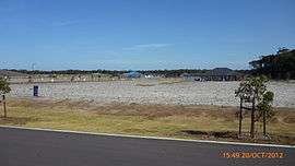 New housing subdivision works at Fern Bay | |||||||||||||
|
Fern Bay | |||||||||||||
| Coordinates | 32°52′26″S 151°47′42″E / 32.87389°S 151.79500°ECoordinates: 32°52′26″S 151°47′42″E / 32.87389°S 151.79500°E | ||||||||||||
| Population | 1,625 (2011 census)[1] | ||||||||||||
| • Density | 191.2/km2 (495/sq mi) [lower-alpha 1] | ||||||||||||
| Postcode(s) | 2295 | ||||||||||||
| Area | 8.5 km2 (3.3 sq mi)[lower-alpha 2] | ||||||||||||
| Time zone | AEST (UTC+10) | ||||||||||||
| • Summer (DST) | AEDT (UTC+11) | ||||||||||||
| Location |
| ||||||||||||
| LGA(s) | Port Stephens Council[2] | ||||||||||||
| Region | Hunter | ||||||||||||
| County | Gloucester[3] | ||||||||||||
| Parish | Stockton[3] | ||||||||||||
| State electorate(s) | Newcastle | ||||||||||||
| Federal Division(s) | Newcastle | ||||||||||||
| |||||||||||||
| |||||||||||||
Fern Bay is the southern-most suburb of the Port Stephens local government area in the Hunter Region of New South Wales, Australia.[2][3] It is located just north of Stockton, which is the only suburb of Newcastle that lies north of the Hunter River and to the east of the north arm of the Hunter River at the entrance to Fullerton Cove, a large body of water. To the east is the Tasman Sea.[5] Despite the suburb only being 6 kilometres (3.7 mi) in a direct line from Newcastle, the need to cross the Hunter River results in Fern Bay being 16 km (9.9 mi) by road from the centre of the city.
The area is undergoing a residential expansion program with a large development being built between Nelson Bay Road and Stockton Beach on land formerly used as a military weapons range.[6][7]
Notes
References
- ↑ Australian Bureau of Statistics (31 October 2012). "Fern Bay (State Suburb)". 2011 Census QuickStats. Retrieved 13 October 2012.
- 1 2 "Suburb Search – Local Council Boundaries – Hunter (HT) – Port Stephens". New South Wales Division of Local Government. Archived from the original on 21 June 2014. Retrieved 8 June 2008.
- 1 2 3 "Fern Bay". Geographical Names Register (GNR) of NSW. Geographical Names Board of New South Wales. Retrieved 26 May 2008.
- 1 2 3 "Newcastle Nobbys Signal Station AWS". Climate statistics for Australian locations. Bureau of Meteorology. Retrieved 2 June 2008.
- ↑ "Fern Bay". Land and Property Management Authority - Spatial Information eXchange. New South Wales Land and Property Information. Retrieved 26 May 2008.
- ↑ "Fern Bay development before Govt". ABC News. 26 May 2005. Retrieved 26 May 2008.
- ↑ "Stockton Bight National Park Proposal". Parliament of New South Wales. 28 November 2000. Retrieved 26 May 2008.
External links
- Fern Bay at Australian Explorer
-
 Media related to Fern Bay, New South Wales at Wikimedia Commons