Ferlach
| Ferlach | ||
|---|---|---|
 | ||
| ||
 Ferlach Location within Austria | ||
| Coordinates: 46°32′N 14°18′E / 46.533°N 14.300°ECoordinates: 46°32′N 14°18′E / 46.533°N 14.300°E | ||
| Country | Austria | |
| State | Carinthia | |
| District | Klagenfurt-Land | |
| Government | ||
| • Mayor | Ingo Appé (SPÖ) | |
| Area | ||
| • Total | 117.25 km2 (45.27 sq mi) | |
| Elevation | 466 m (1,529 ft) | |
| Population (1 January 2016)[1] | ||
| • Total | 7,118 | |
| • Density | 61/km2 (160/sq mi) | |
| Time zone | CET (UTC+1) | |
| • Summer (DST) | CEST (UTC+2) | |
| Postal code | 9170 | |
| Area code | 04227 | |
| Website | www.ferlach.at | |

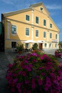
Ferlach (Slovene: Borovlje) in the district of Klagenfurt-Land in Carinthia is the southernmost town in Austria. It is known for its centuries-old gunsmith tradition, part of the Austrian intangible cultural heritage since 2010.
Geography
It is situated in the Rosental/Rož Valley of the Drava River, about 17 kilometres (11 mi) south of the Carinthian state capital Klagenfurt. In the south, the crest of the Karawanks mountain range forms the border with Slovenia. The municipal area comprises the cadastral communities of Ferlach (Borovlje), Kappel an der Drau (Kapla ob Dravi), Kirschentheuer (Kožentavra), Unterloibl (Podljublj), Waidisch (Bajdiše), Unterferlach (Medborovnica), Glainach (Glinje), Seidolach (Ždovlje), and Windisch Bleiberg (Slovenji Plajberg).
The town centre lies at the junction of the Rosental Straße (B85) highway with Loiblpass Straße (B91), part of the European route E652, running from Klagenfurt to Tržič in Slovenia via Loibl Pass. The Ferlach Railway line from Weizelsdorf went out of service in 1951, but on summer weekends and special occasions a heritage railway service, the Rosentaler Dampfzug runs as far as Wiezelsdorf, operated by the preservation group Nostalgiebahnen in Kärnten.
History
Ferlach was first mentioned as Vörelach in a 1246 deed, named after the surrounding pine (Föhre, bor in Slovene) forests. The mountainous area is the site of large iron ore deposits, ironworks and forging is documented since the 15th century.
The relocation of the capital of the Duchy of Carinthia to nearby Klagenfurt under the rule of King Ferdinand I about 1529 decisively promoted the development of Ferlach as a centre of firearm manufacturing. Under Empress Maria Theresa, its gunsmiths became the main armorers of the Habsburg Monarchy. Ferlach firearms were also used by the Spanish, French and Turkish armies.
The present-day municipality was established as Oberferlach in 1850. Ferlach received town privileges in 1930 and today is a centre for the production of hunting rifles. The history of the town is depicted in its coat of arms: it features a pine tree with a cone, two crossed silver nails, and a rifle.
Population
According to the 2001 census 8.3% of the population are Carinthian Slovenes.
| Village | Number of people 1991 | Percent of Slovenes 1991 | Percent of Slovenes 1951 |
|---|---|---|---|
| Bodental/Poden | 115 | 53.9% | 83.3% |
| Loibltal/Brodi | 70 | 51.4% | 68.2% |
| Strugarjach/Strugarje | 18 | 61.6% | 94.1% |
| W.Bleiberg/Slovenji Plajberk | 124 | 66.9% | 87.3% |
| Waidisch/Bajdiše | 93 | 37.6% | 44.5% |
| Glainach/Glinje | 114 | 12.3% | 84.7% |
| Kappel a.D./Kapla ob Dravi | 262 | 6.5% | 30.3% |
| Tratten/Trata | 82 | 15.9% | 41.4% |
| Unterglainach/Vesca | 32 | 37.5% | 100% |
| Laak/Loka | 41 | 14.6% | 100% |
| Seidolach/Ždovlje | 87 | 18.4% | 74.5% |
| Dörfl/Kajže | 18 | 55.6% | 79.4% |
| Singerberg/Žingarica | 9 | 11.1% | 100% |
| Rauth/Rute | 11 | 9.1% | 100% |
| Görtschach/Goriče | 230 | 8.8% | 13.7% |
| Reßnig/Resnica | 212 | 7.1% | 44.8% |
| Kirschentheuer/Kožentavra | 252 | 7.9% | 45.6% |
| Otroutza/Otrovca | 71 | 5.6% | 41.0% |
| Strau/Struga | 222 | 5.0% | 28.5% |
| Unterloibl/Podljubelj | 240 | 8.3% | 22.1% |
Climate
| Climate data for Ferlach | |||||||||||||
|---|---|---|---|---|---|---|---|---|---|---|---|---|---|
| Month | Jan | Feb | Mar | Apr | May | Jun | Jul | Aug | Sep | Oct | Nov | Dec | Year |
| Record high °C (°F) | 13.8 (56.8) |
21.8 (71.2) |
24.8 (76.6) |
27.0 (80.6) |
31.4 (88.5) |
32.8 (91) |
36.5 (97.7) |
36.0 (96.8) |
31.0 (87.8) |
26.2 (79.2) |
18.8 (65.8) |
17.8 (64) |
36.5 (97.7) |
| Average high °C (°F) | 0.9 (33.6) |
5.0 (41) |
10.8 (51.4) |
15.3 (59.5) |
20.6 (69.1) |
23.7 (74.7) |
25.9 (78.6) |
25.6 (78.1) |
20.9 (69.6) |
14.6 (58.3) |
6.3 (43.3) |
1.3 (34.3) |
14.2 (57.6) |
| Daily mean °C (°F) | −4.0 (24.8) |
−1.4 (29.5) |
3.5 (38.3) |
8.2 (46.8) |
13.5 (56.3) |
16.7 (62.1) |
18.6 (65.5) |
18.1 (64.6) |
13.7 (56.7) |
8.2 (46.8) |
1.7 (35.1) |
−2.7 (27.1) |
7.8 (46) |
| Average low °C (°F) | −7.1 (19.2) |
−5.4 (22.3) |
−1.4 (29.5) |
2.5 (36.5) |
7.2 (45) |
10.7 (51.3) |
12.5 (54.5) |
12.3 (54.1) |
8.6 (47.5) |
4.3 (39.7) |
−1.1 (30) |
−5.2 (22.6) |
3.16 (37.68) |
| Record low °C (°F) | −24.3 (−11.7) |
−24.1 (−11.4) |
−16.7 (1.9) |
−6.0 (21.2) |
−2.6 (27.3) |
2.0 (35.6) |
3.7 (38.7) |
3.5 (38.3) |
−1.4 (29.5) |
−10.6 (12.9) |
−15.0 (5) |
−19.6 (−3.3) |
−24.3 (−11.7) |
| Average rainfall mm (inches) | 51.9 (2.043) |
50.4 (1.984) |
70.3 (2.768) |
99.1 (3.902) |
104.0 (4.094) |
134.0 (5.276) |
137.0 (5.394) |
120.1 (4.728) |
122.6 (4.827) |
118.0 (4.646) |
114.7 (4.516) |
80.0 (3.15) |
1,202.1 (47.327) |
| Average snowfall cm (inches) | 28.9 (11.38) |
33.7 (13.27) |
19.1 (7.52) |
10.8 (4.25) |
0.2 (0.08) |
0.0 (0) |
0.0 (0) |
0.0 (0) |
0.0 (0) |
0.8 (0.31) |
13.8 (5.43) |
29.2 (11.5) |
136.5 (53.74) |
| Average rainy days (≥ 1.0mm) | 5.8 | 5.1 | 7.5 | 9.3 | 11.4 | 12.0 | 11.4 | 9.8 | 8.5 | 8.3 | 7.8 | 6.8 | 103.7 |
| Average snowy days (≥ 1.0cm) | 26.1 | 21.4 | 12.9 | 1.8 | 0.2 | 0.0 | 0.0 | 0.0 | 0.0 | 0.2 | 5.9 | 19.8 | 88.3 |
| Mean monthly sunshine hours | 78.8 | 123.0 | 158.3 | 175.2 | 212.5 | 217.5 | 241.2 | 233.0 | 180.5 | 125.6 | 66.0 | 57.4 | 1,869 |
| Source: | |||||||||||||
Politics
Seats in the municipal assembly (Gemeinderat) as of 2015 local elections:
- Social Democratic Party of Austria (SPÖ): 15
- Austrian People's Party (ÖVP): 5
- Enotna lista/Volilna skupnost: 3
- Freedom Party of Austria (FPÖ): 2
- The Greens – The Green Alternative: 2
Notable people
- Odo Josef Struger (1931–1998), engineer
- Wolfgang Petritsch (born 1947), diplomat, honorary citizen
References
External links
| Wikimedia Commons has media related to Ferlach. |