Farrow, County Westmeath
| Farrow | |
|---|---|
| Townland | |
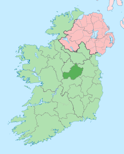
 Farrow Location of Farrow within County Westmeath in the Republic of Ireland | |
| Coordinates: 53°36′14″N 7°27′37″W / 53.60389°N 7.46028°WCoordinates: 53°36′14″N 7°27′37″W / 53.60389°N 7.46028°W | |
| Country |
|
| Province | Leinster |
| County | County Westmeath |
| Irish grid reference | N358617 |
Farrow is a townland in County Westmeath, Ireland. It is located about 11.65 kilometres (7 mi) north–west of Mullingar. This place name is not to be confused with Farra which is in the neighbouring townland of Rathbennett or Barr of Farrow which is a townland in County Leitrim.
Farrow is one of 15 townlands of the civil parish of Leny in the barony of Corkaree in the Province of Leinster. The townland covers 365 acres (1.48 km2). The neighbouring townlands are: Ballyvade and Cullenhugh to the north, Rathaniska and Rathbennett to the east and Grange, Piercefield and Piercefield (or Templeoran) to the south.[1][2] The south–west boundary of the townland borders the shore of Lough Iron.
In the 1911 census of Ireland there were 2 houses[3] and 6 inhabitants[4] in the townland.
References
- ↑ Farrow Townland, Co. Westmeath Townlands.ie Retrieved on 5 June 2015.
- ↑ Farrow Townland, Co. Westmeath IreAtlas Townland Data Base Retrieved on 5 June 2015.
- ↑ Houses in Farrow. Census of Ireland 1911. Retrieved on 5 June 2015.
- ↑ Inhabitants in Farrow. Census of Ireland 1911. Retrieved on 5 June 2015.