Fairbanks North Star Borough, Alaska
| Fairbanks North Star Borough, Alaska | ||
|---|---|---|
| ||
 Location in the U.S. state of Alaska | ||
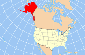 Alaska's location in the U.S. | ||
| Incorporated | January 1, 1964[1] | |
| Seat | Fairbanks | |
| Largest city | Fairbanks | |
| Area | ||
| • Total | 7,444 sq mi (19,280 km2) | |
| • Land | 7,338 sq mi (19,005 km2) | |
| • Water | 105 sq mi (272 km2), 1.4% | |
| Population (est.) | ||
| • (2015) | 99,631 | |
| • Density | 13/sq mi (5/km²) | |
| Congressional district | At-large | |
| Time zone | Alaska: UTC-9/-8 | |
| Website |
www | |
.jpg)
The Fairbanks North Star Borough is a borough located in the state of Alaska. As of the 2010 census, the population was 97,581.[2] The borough seat is Fairbanks.[3] The borough's land area is slightly smaller than that of the state of New Jersey.
Fairbanks North Star Borough comprises the Fairbanks, AK Metropolitan Statistical Area.
The borough is home to the University of Alaska Fairbanks and Eielson Air Force Base.
Geography
The borough has a total area of 7,444 square miles (19,280 km2), of which 7,338 square miles (19,010 km2) is land and 105 square miles (270 km2) (1.4%) is water.[4]
Adjacent boroughs and census areas
- Yukon-Koyukuk Census Area, Alaska – north
- Southeast Fairbanks Census Area, Alaska – southeast
- Denali Borough, Alaska – southwest
Government

The assembly is the borough's governing body, or legislative branch. The assembly consists of nine members who are elected at-large (borough-wide), serving three-year terms. The borough operates under a "strong mayor" system. The mayor, along with his chief of staff, perform many of the job duties normally associated with a city manager.
- Mayor
- Karl Kassel (term ends October 2018)
- Assembly members
October 2016 – October 2017; the year term expires is in parenthesis next to name
- Seat A – Van Lawrence (2018)
- Seat B – Shaun Tacke (2019)
- Seat C – Andrew Gray (2019)
- Seat D – Christopher Quist (2017)
- Seat E – Guy Sattley (2017)
- Seat F – Kathryn Dodge (2018)
- Seat G – Lance Roberts (2018)
- Seat H – John Davies (2017)
- Seat I – Matt Cooper (2019)
The borough operates a public library system; the main library is the Noel Wien Public Library.
Demographics
| Historical population | |||
|---|---|---|---|
| Census | Pop. | %± | |
| 1960 | 43,412 | — | |
| 1970 | 45,864 | 5.6% | |
| 1980 | 53,983 | 17.7% | |
| 1990 | 77,720 | 44.0% | |
| 2000 | 82,840 | 6.6% | |
| 2010 | 97,581 | 17.8% | |
| Est. 2015 | 99,631 | [5] | 2.1% |
| U.S. Decennial Census[6] 1790–1960[7] 1900–1990[8] 1990–2000[9] 2010–2015[2] | |||
As of the 2000 census,[10] 82,840 people, 29,777 households, and 20,516 families were residing in the borough. The population density was 11 people per square mile (4/km²). There were 33,291 housing units at an average density of 4 per square mile (2/km²). The racial makeup of the borough was 77.79% White, 5.6% Black or African American, 6.90% Native American, 2.08% Asian, 0.30% Pacific Islander, 1.71% from other races, and 5.39% from two or more races. 4.15% of the population were Hispanic or Latino of any race.
There were 29,777 households out of which 41.30% had children under the age of 18 living with them, 54.70% were married couples living together, 9.30% had a female householder with no husband present, and 31.10% were non-families. 23.60% of all households were made up of individuals and 3.60% had someone living alone who was 65 years of age or older. The average household size was 2.68 and the average family size was 3.20.
In the borough the population was spread out with 30.10% under the age of 18, 12.20% from 18 to 24, 33.30% from 25 to 44, 19.80% from 45 to 64, and 4.60% who were 65 years of age or older. The median age was 30 years. For every 100 females there were 109.10 males. For every 100 females age 18 and over, there were 110.90 males.
Communities
Cities
Census-designated places
Unincorporated communities
Sister cities
See also
- List of airports in Fairbanks North Star Borough
- National Register of Historic Places listings in Fairbanks North Star Borough, Alaska
References
- ↑ 1996 Alaska Municipal Officials Directory. Juneau: Alaska Municipal League/Alaska Department of Community and Regional Affairs. January 1996. p. 5.
- 1 2 "State & County QuickFacts". United States Census Bureau. Retrieved May 18, 2014.
- ↑ "Find a County". National Association of Counties. Retrieved 2011-06-07.
- ↑ "US Gazetteer files: 2010, 2000, and 1990". United States Census Bureau. 2011-02-12. Retrieved 2011-04-23.
- ↑ "County Totals Dataset: Population, Population Change and Estimated Components of Population Change: April 1, 2010 to July 1, 2015". Retrieved July 2, 2016.
- ↑ "U.S. Decennial Census". United States Census Bureau. Retrieved May 18, 2014.
- ↑ "Historical Census Browser". University of Virginia Library. Retrieved May 18, 2014.
- ↑ "Population of Counties by Decennial Census: 1900 to 1990". United States Census Bureau. Retrieved May 18, 2014.
- ↑ "Census 2000 PHC-T-4. Ranking Tables for Counties: 1990 and 2000" (PDF). United States Census Bureau. Retrieved May 18, 2014.
- ↑ "American FactFinder". United States Census Bureau. Retrieved 2011-05-14.
- ↑ Archived March 3, 2012, at the Wayback Machine.
- ↑ Archived February 5, 2012, at the Wayback Machine.
External links
 |
Unorganized Borough | Yukon-Koyukuk Census Area | | |
| Unorganized Borough | |
|||
| ||||
| | ||||
| Denali Borough | Southeast Fairbanks Census Area |
Municipalities and communities of Fairbanks North Star Borough, Alaska, United States | ||
|---|---|---|
| Cities | | |
| CDPs | ||
| Unincorporated communities | ||
| Ghost town | ||
Juneau (capital) | ||
| Topics |
|  |
| Society |
| |
| Regions | ||
| Largest cities | ||
| Boroughs | ||
| Census Areas | ||
Coordinates: 64°50′N 146°25′W / 64.833°N 146.417°W