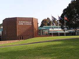
Eurobodalla Shire
| Eurobodalla Shire New South Wales | |||||||||||||
|---|---|---|---|---|---|---|---|---|---|---|---|---|---|
 Location in New South Wales | |||||||||||||
| Population | 37,882 (2015 Est)[1] | ||||||||||||
| • Density | 11.05011/km2 (28.6197/sq mi) | ||||||||||||
| Established | 1913 | ||||||||||||
| Area | 3,428.2 km2 (1,323.6 sq mi) | ||||||||||||
| Mayor | Liz Innes | ||||||||||||
| Council seat | Moruya[2] | ||||||||||||
| Region | South Coast | ||||||||||||
| State electorate(s) | Bega | ||||||||||||
| Federal Division(s) | Eden-Monaro | ||||||||||||
|
| |||||||||||||
| Website | Eurobodalla Shire | ||||||||||||
| |||||||||||||
Eurobodalla Shire is a local government area located in the South Coast region of New South Wales, Australia. The Shire is located in a largely mountainous coastal region and situated adjacent to the Tasman Sea, the Princes Highway and the Kings Highway.
The Mayor of Eurobodalla Shire Council is Cr. Liz Innes, an unaligned politician.[3]
Towns and localities
The shire chambers are located in the town of Moruya in the central part of the Shire. Other major towns within the shire include Batemans Bay and Narooma. Smaller towns and hamlets include Durras, Nelligen, Mogo, Malua Bay, Tomakin, Broulee, Mossy Point, Rosedale, Bodalla, Potato Point, Nerrigundah, Mystery Bay, Central Tilba, Wallaga Lake Koori Village and Congo.
History
The area which is now Eurobodalla Shire was originally the home of the South Coast Bugelli-Manji and Yuin Aboriginal peoples. The Council signed a Commitment to Indigenous Australians and a Local Agreement with the Aboriginal Community.[4]
The Eurobodalla Shire Council was formed in 1913 with the responsibility for administering local government functions along 110 kilometres (68 mi) of the NSW coast between Durras and Wallaga Lake. The Council administers only about 30% of the area of the Shire as the remaining 70% is non-rateable crown land held as national park and state forest: 40% of the shire is national park, 30% is state forest, 20% is productive farmland and 10% is urban settlement.[5]
The Shire is unusual in that nearly half of ratepayers are non-residents. Just over 17% of ratepayers are residents of Canberra. Although the permanent population is around 34,100, the visiting population (who stay more than 3 nights) is 3.1 million per year.[5]
Economy
The main growth industries in the area are construction, government services, real estate, retail, retirement, aged care, tourism, while dairy farming, forestry, sawmilling and commercial fishing are traditional industries in decline. Eurobodalla Shire is serviced by two highways - the Princes Highway between Sydney and Melbourne (part of Highway One around Australia), and the Kings Highway (National Route 52) linking Batemans Bay to Canberra. Moruya Airport, just east of the township of Moruya, is serviced by regular scheduled commuter flights to Sydney and Melbourne. There are no railways or major seaports in Eurobodalla Shire.
Census 2011 statistics
Demographics
In the 2011 census, the Local Government Area of Eurobodalla recorded a population of 35,741 people.[6] The area of 3,422 square kilometre gives a population density 9.8 people per square kilometre.
Age distribution
- Median age: 50, compared to the national median on 37.
- Children aged under 15 years: 16.5%.
- People aged 65 years and over: 25.8%.
Nation of birth
- Australia - 80.0%, compared to the national average of 69.8%
- England - 5.3%
- New Zealand - 1.2%
- Germany - 0.9%
- Scotland - 0.7%
- Netherlands - 0.6%
- Aboriginal or Torres Strait Islanders: 4.2%
Languages spoken at home
- English only - 91.2%
- German - 0.6%
- Italian - 0.4%
- Croatian - 0.4%
- Greek - 0.3%
- Dutch - 0.2%
Religion
- Anglican - 27.9%
- Catholic - 23.0%
- No Religion - 22.6%
- Uniting Church - 4.3%
- Presbyterian and Reformed - 3.8%
Housing
- Median weekly rent: $220
- Median monthly home loan repayments: $1,430
- Median weekly individual income: $424
- Median weekly household income: $784
- Mean household size: 2.3
Household motor vehicle ownership
- Vehicles per dwelling - 1.6
- No vehicle - 6.2%
- One vehicle - 43.5%
- Two vehicles - 34.2%
- Three or more vehicles - 12.5%
Housing tenure
- Owned outright - 46.3%
- Owned with a mortgage - 23.8%
- Rented - 25.8%
Structure of inhabited dwellings
- Separate houses - 84.3%
- Semi-detached, row or terrace houses, townhouses etc. - 7.2%
- Flats, units or apartments - 6.2%
- Other dwellings - 2.2%
Employment
- Worked full-time - 47.3%
- Worked part-time - 38.4%
- Away from work - 6.8%
- Unemployed - 7.5%
Council
Current composition and election method
Eurobodalla Shire Council is composed of nine Councillors, including the Mayor, for a fixed four-year term of office. The Mayor is directly elected while the eight other Councillors are elected proportionally as one entire ward. The most recent election was held on 10 September 2016, and the makeup of the Council, including the Mayor, is as follows:[7][8]
| Party | Councillors | |
|---|---|---|
| Independents | 8 | |
| Australian Greens | 1 | |
| Total | 9 | |
The current Council, elected in 2016, in order of election, is:[8]
| Councillor | Party | Notes | |
|---|---|---|---|
| Liz Innes | Unaligned | Mayor[7] | |
| Jack Tait | Unaligned | ||
| Lindsay Brown | Independent | ||
| Phil Constable | Unaligned | ||
| Maureen Nathan | Unaligned | ||
| Anthony Mayne | Independent | ||
| Rob Pollock | Independent | ||
| Patrick McGinlay | Greens | ||
| James Thomson | Independent | ||
References
- ↑ "3218.0 – Regional Population Growth, Australia, 2014–15". Australian Bureau of Statistics. Retrieved 29 September 2016.
- ↑ "Eurobodalla Shire Council". Department of Local Government. Retrieved 15 November 2006.
- ↑ http://vtr.elections.nsw.gov.au/eurobodalla-shire-council/mayoral
- ↑ Shain, Kathryn (2005). "Eurobodalla Shire Council". Agreements, Treaties and Negotiated Settlements Project - Agreements Database. University of Melbourne. Archived from the original on 20 May 2006. Retrieved 22 May 2006.
- 1 2 "Rosedale Association Newsletter" (PDF). Rosedale Association. December 2004. Retrieved 15 November 2006.
- ↑ Australian Bureau of Statistics (31 October 2012). "Eurobodalla (Local Government Area)". 2011 Census QuickStats. Retrieved 22 January 2015.
- 1 2 "Eurobodalla Shire Council - Mayoral Election". Local Government Election 2016. New South Wales Electoral Commission. 20 September 2016. Retrieved 6 November 2016.
- 1 2 "Eurobodalla Shire Council: Summary of First Preference and Group Votes for each Candidate". Local Government Election 2016. New South Wales Electoral Commission. 20 September 2016. Retrieved 6 November 2016.
External links
| Cities | |
|---|---|
| Townships |
|
| Local government areas | |
| National parks |
|
| Rivers and other waterbodies | |
Coordinates: 35°55′S 150°06′E / 35.917°S 150.100°E