Etah
| Etah एटा | |
|---|---|
| city | |
|
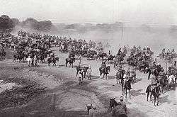
Grand Trunk Road,at Etah, during British Raj | |
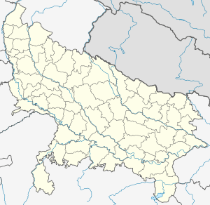 Etah Location in Uttar Pradesh, India | |
| Coordinates: 27°38′N 78°40′E / 27.63°N 78.67°ECoordinates: 27°38′N 78°40′E / 27.63°N 78.67°E | |
| Country |
|
| State | Uttar Pradesh |
| District | Etah |
| Founded by | King Dil Sukh Rai Bahadur |
| Government | |
| • Etah (Lok Sabha constituency )MP | Mr.Rajveer Singh (BJP) |
| • Municipal council Chairman | Mr.Rakesh Gandhi (neutral) |
| Population (2011) | |
| • Total | 131,023 |
| • Rank | 272nd in India |
| Languages | |
| • Official | Hindi |
| Time zone | IST (UTC+5:30) |
| Vehicle registration | UP 82 |
| Website | http://etah.nic.in/ |
Etah is a municipality town which is also the district headquarters of Etah district of Uttar Pradesh state, India. The driving distance from New Delhi to Etah is 207 km and it takes approximately 4 hours by public transport to reach there.[1] Etah is dominated by Yadavs.[2][3]
Geography
Etah is located at 27°38′N 78°40′E / 27.63°N 78.67°E.[4] It has an average elevation of 170 metres (557 feet). Eesan river flows through there (though very polluted now and almost dried up behind the village Gajipur Pahore.
History
It is the midpoint on the Kanpur-Delhi Highway. Historically, it is also known for being a centre of the Revolt of 1857. In ancient times, Etah was called "Aintha" which means 'to respond aggressively' because of the people of the Yadav community, who are very aggressive. It was when the king of Awagarh went hunting in the forest along with his 2 dogs. The dogs saw a fox and started barking and chasing it. The fox kept on running away trying to protect itself from the king's dogs but when it reached Etah, the fox responded very aggressively to the king's dogs. The King was surprised by the behavioral change in the fox. So, he thought that this place must have something which made the fleeing fox change attitude. Therefore, the place was called Aintha, which later was mispronounced as Etah Famous Village Nayabans Pac Road Etah. Another story found in Vidya Bharti's book states the old name of Etah as 'Einta' due to a person lost here. In search of water, he dig into the land and his shoe struck a brick (eint) which leads to the name Einta and later this word changed to Etah. Etah also is very famous for its Yagyashala which is located in the Gurukul Vidyalaya. The Yagyashala is considered to be world's second largest Yagyashala. There is a historical fort which was built by the king of Awagarh. Awagarh is a place which is 24 km from Etah. Etah also has a historical mandir named as Kailash Mandir dedicated to Lord Shiva. Amir Khusro was born in Patiyali, Etah and is considered as one of the best poets of Urdu. Also, it is said that the famous Hindi poet Tulsidas, who also wrote Ram Charit Manas, was born in Soron which is also said to have a connection with Hindu Mythology as the Varah Avtar (third avtar of Lord Vishnu) is said to be incarnated here.
Major data
It is of Uttar Pradesh, one of the 34 economically distressed districts and is receiving funds from the Backward Regions Grant Fund Program. Etah District is part of the Aligarh Division. The majority population are Yadavs and Rajputs.
Agriculture
The primary occupation of the people of the district is agriculture. The area is situated between Ganga and Yamuna (Doaab) which is highly fertile (Alluvial soil). The farmers are harvesting three crops in a year. The water for irrigation is available the year round. Major agricultural products are rice, wheat, barley, jowar, bajra, maize; the soil is suitable for the cultivation of tobacco.


Dress
The people of Etah dress in a variety of traditional and Western styles.[212] Traditional styles of dress include colourful draped garments – such as sari for women and dhoti or lungi for men – and tailored clothes such as salwar kameez for women and kurta-pyjama for men.[212] Men often sport head-gear like topi or pagri.[212] Sherwani is a more formal male dress and is frequently worn along with chooridar on festive occasions. European-style trousers and shirts are also common among the men.[212]
Population density
The initial provisional data released by census India 2011, shows that density of Etah district for 2011 is 717 people per km2. In 2001, Etah district density was at 636 people per km2. Etah district administers 2,456 square kilometers of areas.
Cultural

Etah is a developing city. It is the district headquarters since the British times. National Highway 91 (India)(NH 91) GT Road passes through city Etah. The Padav maidan (open field ) is the field used for the army during army movements. Every year this field is use for Ram-Lila at Dussehra in month September and October and for exhibitions in month from December to February. Only these are the two events in a year when public of district Etah can enjoy the events like Kavisammelan, Dance competition and Fair.
Demographics
As per provisional data of 2011 census, Etah urban agglomeration had a population of 131,023, out of which males were 69,446 and females were 61,577. The literacy rate was 85.62 per cent.[5]
As of 2001 India census,[6] Etah has a population of 107,098. Males constitute 53% of the population and females 47%. Etah has an average literacy rate of 68%, higher than the national average of 59.5%: male literacy is 73%, and female literacy is 63%. In Etah, 14% of the population is under 6 years of age.
Developments
The opening of railway line by the first president Mr. Rajendra Prasad.....Here is only one small railway line from ETAH to Tundla and further railway connectivity to Kasganj and Aligarh is on high demand by people of Etah. Railway Ministry has approved the survey for direct trains to New Delhi, Agra and Aligarh. A Thermal Power Project of 4000 MW has proposed, will situated at Nandpur Belamai near sakit and approximately 20 km from Etah, Ministry of Environment has cleared the project, Land acquisition work is over and construction of the same shall start in the year 2015, will boost up the power supply in UP.
Religious places
Sufi Sant Hazrat Abdul Ghafoor Shah Safvi's Dargaah situated in Holi Gate is a dargah of chishti silsila
Bada Jain Mandir, Kailash Mandir, Hanumangarhi, Kaali Mandir, Janta Durga Mandir, Vijaynagar, Varshney Mandir, Raghu Nath Mandir, Pathwari Mandir. Patiali is the birthplace of Amir Khusro.
The Kailash Mandir at Etah was built by King Dil Sukh Rai Bahadur and is 148 years old.
Noah Kera village was famous for marriage of Lord Sri Krishna with Rukmini.
Etah is also known for world famous Gurukul. It is said to be providing education using traditional methods. Gurukuls are ancient residential schools.
Baba Ramdev's Guru's birthplace.
Famous bhooteshwar is a place for Hindu bodies cremation .
Food
Etah food consists of the food prepared in the state of Uttar Pradesh, India. It consists of the famous Mughlai near in Agra cuisines and comprises vegetarian and non-vegetarian foods. Dum biryani, kababs, and kormas are some of the famous dishes made in this region.
-

Some assorted halva including sooji, chana, and gajar halva
-

Paratha served with tea.
-

puri with accompaniments
-

Chicken Dum Biryani
-

Navratan Korma
-

Chicken Curry with Chapati.
-

Raita Raita
-
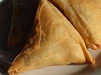
= Samosa
Education

Schools in the town include Assisi Convent School, Jawahar Navodaya Vidyalaya, St. Paul's Sr. Sec. School, Gyan Bharti Inter College, Tulip Public School, Sarswati Vidya Mandir, Sri Ram Bal Bharati Higher Secondary School, Dr. Lokman Das Public School, Apex Public School, S.B Public School, Christian Agricultural Inter College, G.I.C Inter College, [J.L.N. PUBLIC SCHOOL BHAGIPUR ETAH], Gandhi Smark inter College, Arya Vidyalay, Printis Girls College, G.G.I.C. Inter College and Maharani Lakshmi Bai Inter College are the most famous schools in Etah. Ganjdundwara PG College and Dr. Z.H. Degree College and Jawaharlal Nehru Degree College Etah are colleges in the district for Science students.
Places to visit
There is bird sanctuary about 10.0 km from this village called Patna Pakshi Vihar maintained by Govt of Uttar Pradesh.
Hangouts
Mehta Park and Thandi Sadak, Ghanta Ghar and Hathi Gate, Pipal Adda ,are famous hangout places for people here. Mehta Park is famous for its Indian dish Samaosa but more for the cheela and forest area near railway station. This railway station is almost barren so it is also a good place to visit and spend evenings. This is barren in the sense that there are just one train which comes in at 8:30 am & 3:00 pm and leaves after 15 minutes and halts at tundla junction and stays there.
References
- ↑ Distance between Etah, Uttar Pradesh and New Delhi, Delhi 128 Miles / 207 km. Distancebetweencities.co.in. Retrieved on 2014-01-02.
- ↑ Fifth phase of UP polls to seal Yadavs' fate. Hindustan Times (2012-02-22). Retrieved on 2014-01-02.
- ↑ https://books.google.co.in/books?id=8V4IAAAAQAAJ&pg=PA237&dq=Jats+Gujars+and+Ahirs&hl=en&sa=X&ei=H0m3VPf_JI2zuASO84LgBw&ved=0CCQQ6AEwAjhk#v=onepage&q=Ahirs&f=false
- ↑ Falling Rain Genomics, Inc – Etah. Fallingrain.com. Retrieved on 2014-01-02.
- ↑ "Urban Agglomerations/Cities having population 1 lakh and above" (PDF). Provisional Population Totals, Census of India 2011. Retrieved 2012-07-07.
- ↑ "Census of India 2001: Data from the 2001 Census, including cities, villages and towns (Provisional)". Census Commission of India. Archived from the original on 2004-06-16. Retrieved 2008-11-01.